This website works best with a newer web browser such as Chrome, Firefox, Safari or Microsoft Edge. Internet Explorer is not supported by this website.

Archive: Thu Jun 2018

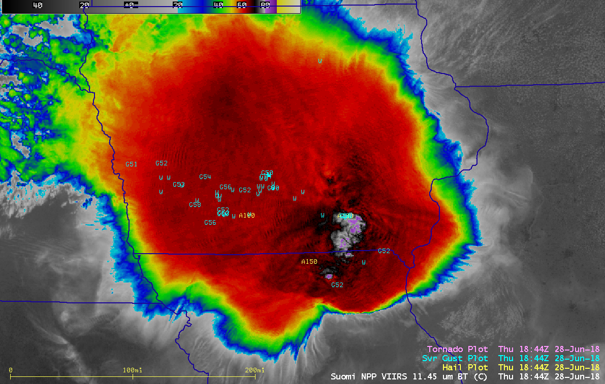
Severe thunderstorms in Montana and South Dakota

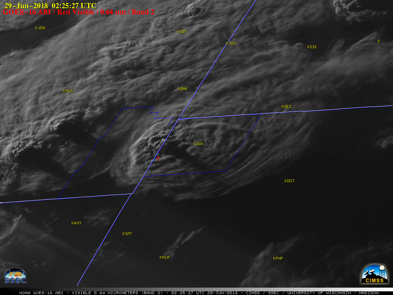
1-minute Mesoscale Domain Sector GOES-16 (GOES-East) “Red” Visible (0.64 µm) images (above) showed thunderstorms which produced large hail and tornadoes in far southeastern Montana and far northwestern South Dakota (SPC storm reports | NWS Billings | NWS Rapid City) on 28 June 2018. The pulsing nature of the parent storm’s overshooting tops was very apparent in the animation.The corresponding GOES-16... Read More

River valley fog in the Upper Midwest

Comparisons of NOAA-20 and Suomi NPP VIIRS Day/Night Band (0.7 µm) and “Fog Product” Infrared Brightness Temperature Difference images (above) showed the nighttime formation of river valley fog in parts of the Mississippi River and its tributaries in Minnesota, Wisconsin and Iowa on 28 June 2018.  Due to ample illumination... Read More