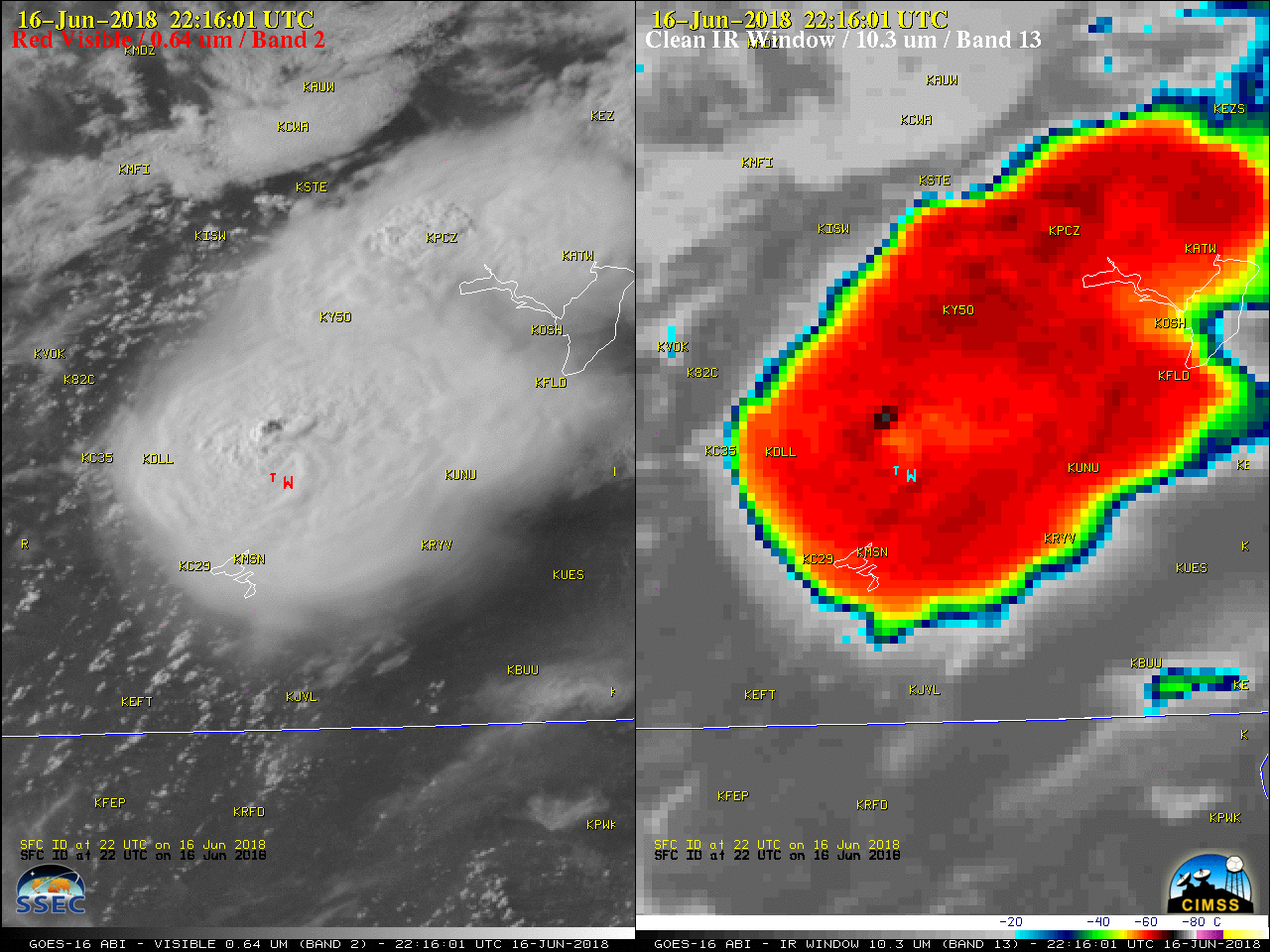
Severe weather in southern Wisconsin

1-minute Mesoscale Domain Sector GOES-16 (GOES-East) “Red” Visible (0.64 µm) and “Clean” Infrared Window (10.3 µm) images (above) showed the development of thunderstorms over southern Wisconsin during the afternoon and evening hours on 16 June 2018. There were reports of hail, damaging winds and 1 brief tornado (SPC storm reports | NWS MKX summary). The pulsing of short-lived overshooting tops... Read More


