Severe thunderstorms in Montana and South Dakota
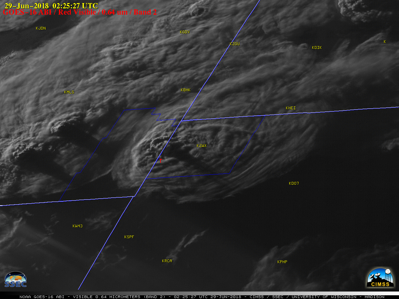
GOES-16 “Red” Visible (0.64 µm) images, with SPC storm reports plotted in red; Carter County, Montana and Harding County, South Dakota are outlined in blue [click to play MP4 animation]
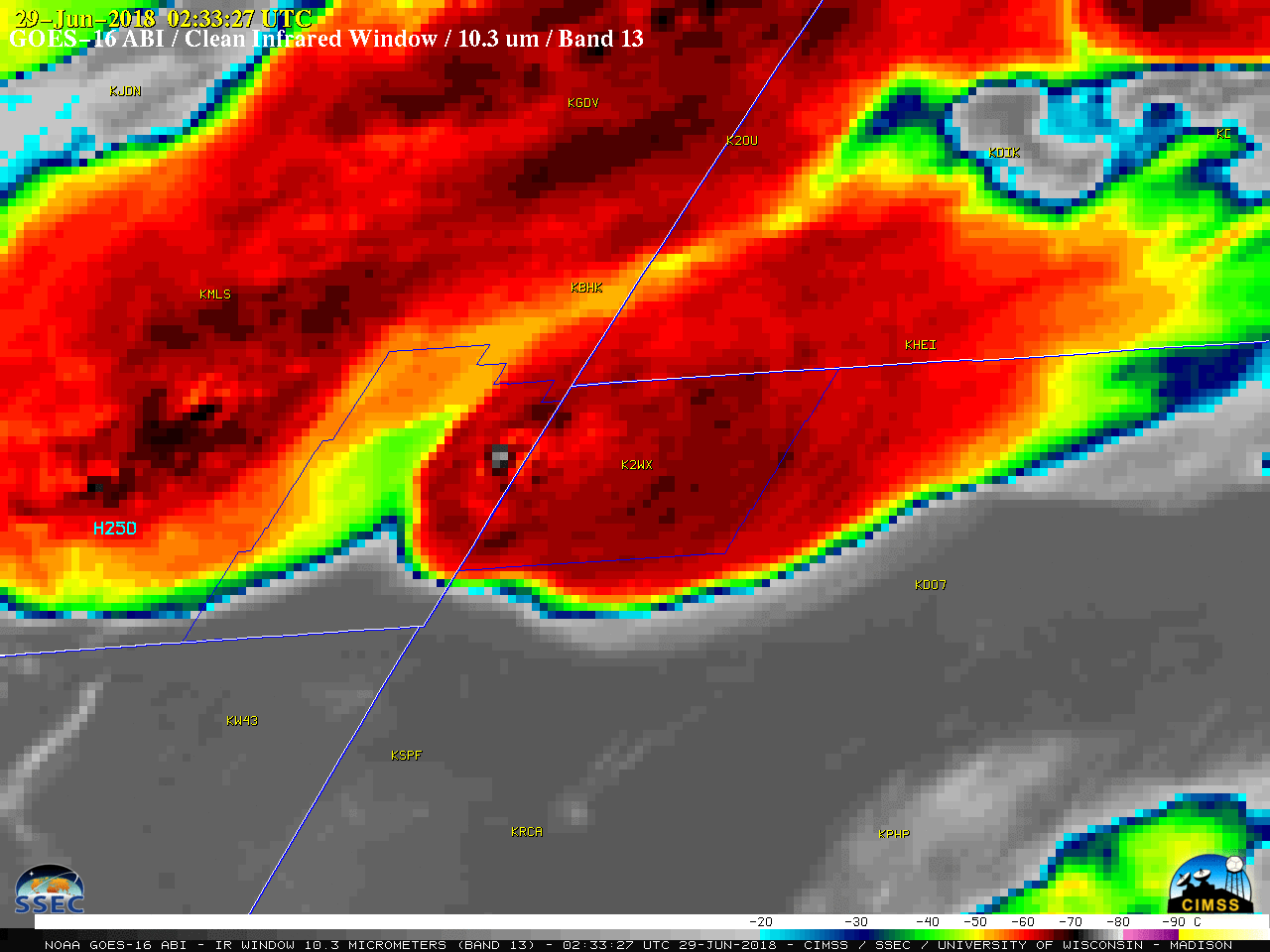
The corresponding GOES-16 “Clean” Infrared Window (10.3 µm) images (below) revealed cloud-top infrared brightness temperatures in the -70 to -75ºC range (black to light gray enhancement) associated with some of the overshooting tops (for example, at 0233 UTC).
![GOES-16 "Clean" Infrared Window (10.3 µm) images, with SPC storm reports plotted in red; Carter County, Montana and Harding County, South Dakota are outlined in blue [click to play MP4 animation]](https://cimss.ssec.wisc.edu/satellite-blog/wp-content/uploads/sites/5/2018/06/G16_IR_MT_SD_SVR_28JUN2018_960x1280_B13_2018180_022527_0001PANEL_00206.GIF)
GOES-16 “Clean” Infrared Window (10.3 µm) images, with SPC storm reports plotted in red; Carter County, Montana and Harding County, South Dakota are outlined in blue [click to play MP4 animation]
![Plot of rawinsonde data from Rapid City SD [click to enlarge]](https://cimss.ssec.wisc.edu/satellite-blog/wp-content/uploads/sites/5/2018/06/180629_00UTC_KRAP_RAOB.GIF)
Plot of rawinsonde data from Rapid City SD [click to enlarge]