River valley fog in the Upper Midwest
NOAA-20 VIIRS Day/Night Band (0.7 µm) and “Fog Product” Infrared Brightness Temperature Difference (11.0 – 3.7 µm) images, with plots of Ceiling and Visibility [click to enlarge]
![Suomi NPP VIIRS Day/Night Band (0.7 µm) and "Fog Product" Infrared Brightness Temperature Difference (11.0 - 3.7 µm) images, with plots of Ceiling and Visibility [click to enlarge]](https://cimss.ssec.wisc.edu/satellite-blog/wp-content/uploads/sites/5/2018/06/180628_0815utc_suomi_npp_viirs_DayNightBand_Fog_CeilingVisibility_river_valley_fog_anim.gif)
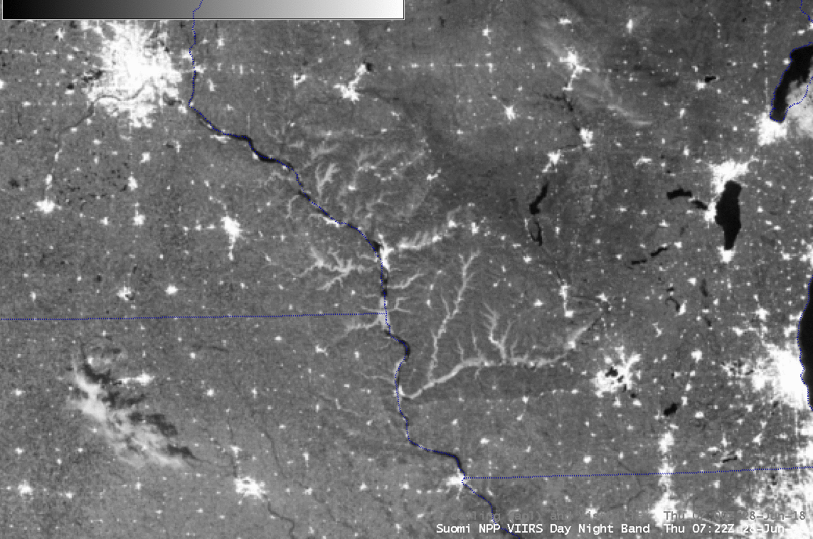
Suomi NPP VIIRS Day/Night Band (0.7 µm) and “Fog Product” Infrared Brightness Temperature Difference (11.0 – 3.7 µm) images, with plots of Ceiling and Visibility [click to enlarge]
A toggle between NOAA-20 and Suomi NPP VIIRS Day/Night Band images acquired by the SSEC Direct Broadcast ground station (below) revealed increased fog formation over portions of the Mississippi River between Rochester MN and Madison WI during the 52 minutes separating the two images.
![NOAA-20 and Suomi NPP VIIRS Day/Night Band (0.7 µm) images [click to enlarge]](https://cimss.ssec.wisc.edu/satellite-blog/wp-content/uploads/sites/5/2018/06/180628_noaa20_suomi_npp_viirs_DayNightBand_river_valley_fog_anim.gif)
NOAA-20 and Suomi NPP VIIRS Day/Night Band (0.7 µm) images [click to enlarge]

GOES-16 “Red” Visible (0.64 µm) images, with hourly plots of surface weather type [click to play animation | MP4]
![GOES-16 Natural Color RGB images [click to play MP4 animation]](https://cimss.ssec.wisc.edu/satellite-blog/wp-content/uploads/sites/5/2018/06/180628_1202utc_goes16_natural_color.jpeg)
GOES-16 Natural Color RGB images [click to play MP4 animation]