Severe thunderstorms in Kansas and Oklahoma
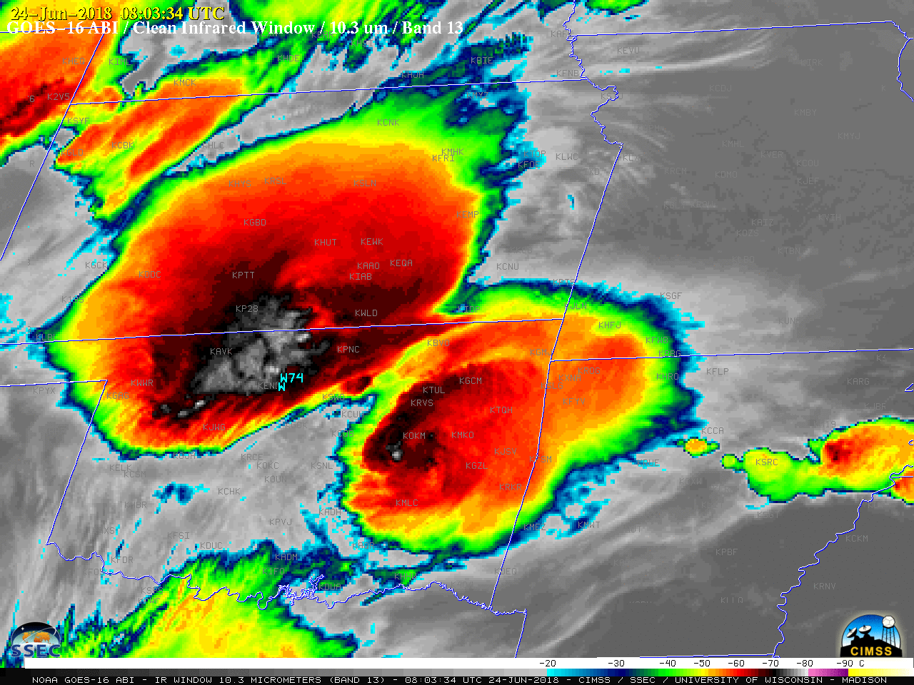
GOES-16 (GOES-East) “Clean” Infrared Window (10.3 µm) images (above) showed the development of a number of Mesoscale Convective System (MCS) features across the southern Plains (with a focus on Kansas and Oklahoma) after sunset on 23 June 2018. A Mesoscale Domain Sector was positioned over that region, providing images at 1-minute intervals; SPC storm reports are plotted... Read More