Waves over the Upper Midwest / Great Lakes
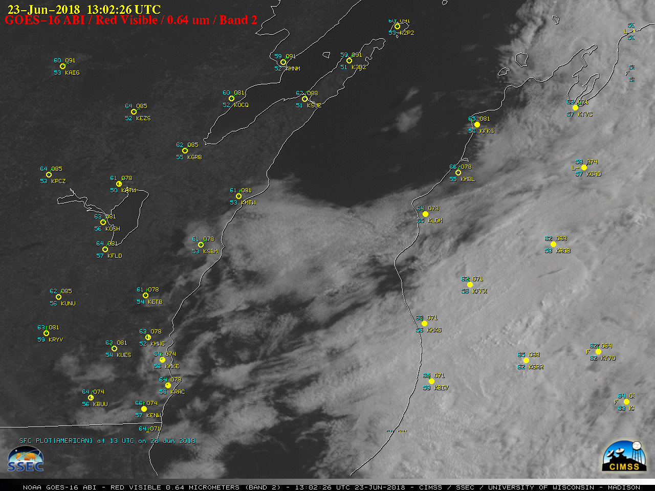
GOES-16 “Red” Visible (0.64 µm) images, with hourly plots of surface reports [click to play animation]
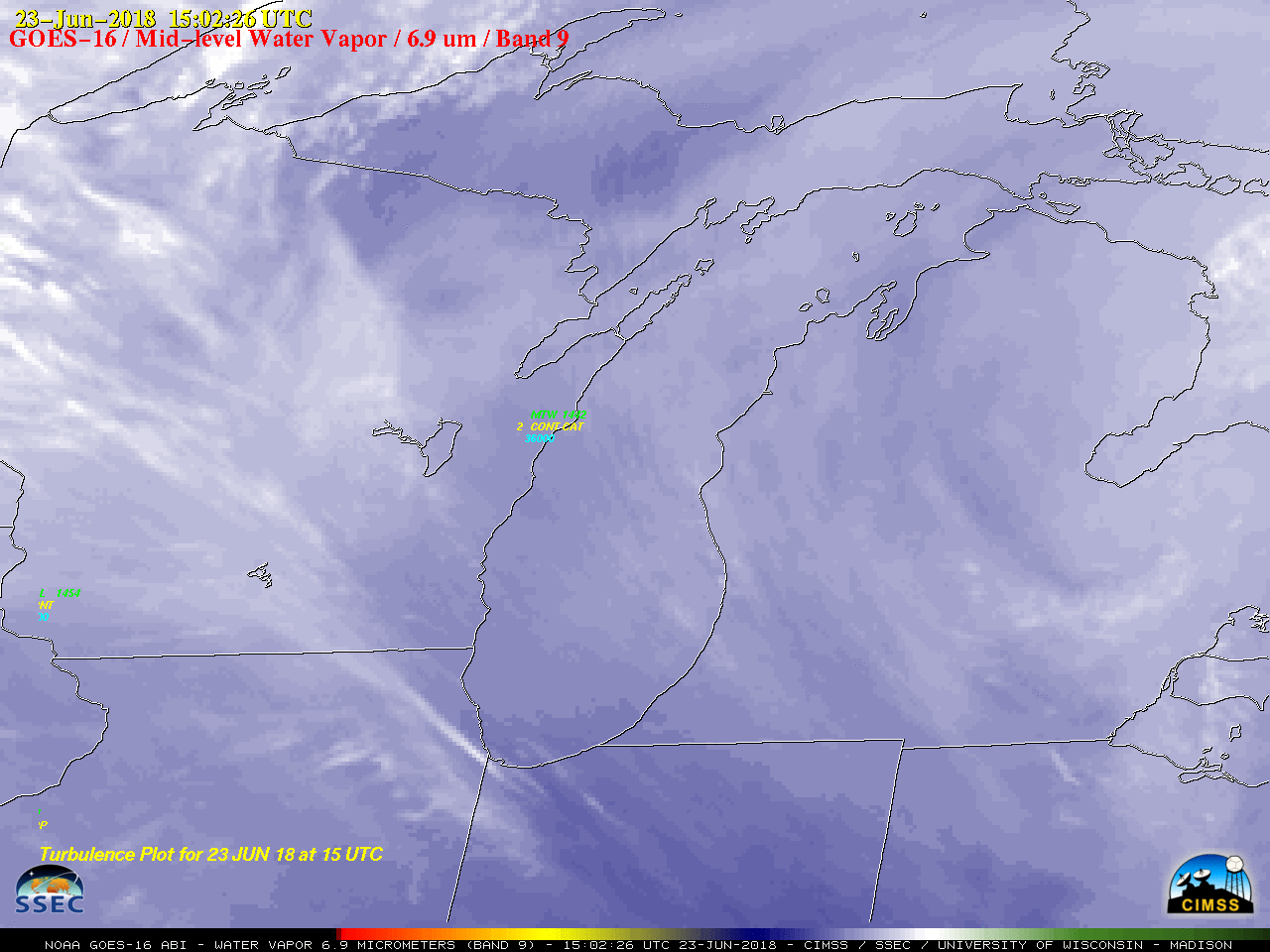
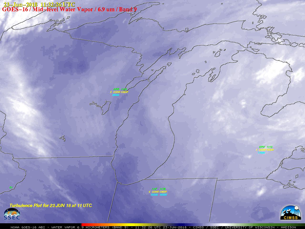
In an effort to determine the vertical extent of these waves, a look at GOES-16 Low-level Water Vapor (7.3 µm), Mid-level Water Vapor (6.9 µm) and Upper-level Water Vapor (6.2 µm) images from the UW-Madison AOS site (below) showed a signature of waves propagating northeastward across the region during the 0802-2102 UTC time period.
![GOES-16 Low-level Water Vapor (7.3 µm) images [click to play MP4 animation]](https://cimss.ssec.wisc.edu/satellite-blog/wp-content/uploads/sites/5/2018/06/goes16_wv10_201806231302_wi.jpg)
GOES-16 Low-level Water Vapor (7.3 µm) images [click to play MP4 animation]
![GOES-16 Mid-level Water Vapor (6.9 µm) images [click to play MP4 animation]](https://cimss.ssec.wisc.edu/satellite-blog/wp-content/uploads/sites/5/2018/06/goes16_wv9_201806231302_wi.jpg)
GOES-16 Mid-level Water Vapor (6.9 µm) images [click to play MP4 animation]
![GOES-16 Upper-level Water Vapor (6.2 µm) images [click to play MP4 animation]](https://cimss.ssec.wisc.edu/satellite-blog/wp-content/uploads/sites/5/2018/06/goes16_wv8_201806231302_wi.jpg)
GOES-16 Upper-level Water Vapor (6.2 µm) images [click to play MP4 animation]
![GOES-16 Low-level (7.3 µm) images, with hourly pilot reports of turbulence [click to play animation]](https://cimss.ssec.wisc.edu/satellite-blog/wp-content/uploads/sites/5/2018/06/180623_goes16_water_vapor_band_10_Lake_Michigan_waves_anim.gif)
GOES-16 Low-level Water Vapor (7.3 µm) images, with hourly pilot reports of turbulence [click to play animation]
![GOES-16 Mid-level (6.9 µm) images, with hourly pilot reports of turbulence [click to play animation]](https://cimss.ssec.wisc.edu/satellite-blog/wp-content/uploads/sites/5/2018/06/180623_goes16_water_vapor_band_9_Lake_Michigan_waves_anim.gif)
GOES-16 Mid-level Water Vapor (6.9 µm) images, with hourly pilot reports of turbulence [click to play animation]
![GOES-16 Upper-level (6.2 µm) images, with hourly pilot reports of turbulence [click to play animation]](https://cimss.ssec.wisc.edu/satellite-blog/wp-content/uploads/sites/5/2018/06/180623_goes16_water_vapor_band_8_Lake_Michigan_waves_anim.gif)
GOES-16 Upper-level Water Vapor (6.2 µm) images, with hourly pilot reports of turbulence [click to play animation]
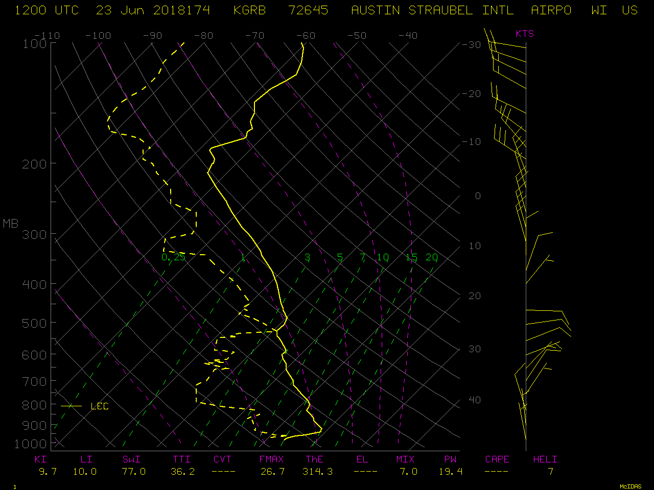
![GOES-16 Water Vapor weighting functions, calculated using 12 UTC rawinsonde data from Green Bay, Wisconsin [click to enlarge]](https://cimss.ssec.wisc.edu/satellite-blog/wp-content/uploads/sites/5/2018/06/180623_12utc_kgrb_water_vapor_weighting_functions.jpeg)
GOES-16 Water Vapor weighting functions, calculated using 12 UTC rawinsonde data from Green Bay, Wisconsin [click to enlarge]
![Aqua MODIS Water Vapor (6.7 µm) and Infrared Window (11.0 µm) images, with plots of pilot reports [click to enlarge]](https://cimss.ssec.wisc.edu/satellite-blog/wp-content/uploads/sites/5/2018/06/180623_0801utc_aqua_modis_water_vapor_infrared_waves_anim.gif)
Aqua MODIS Water Vapor (6.7 µm) and Infrared Window (11.0 µm) images, with plots of pilot reports [click to enlarge]