Severe thunderstorms in Kansas and Oklahoma
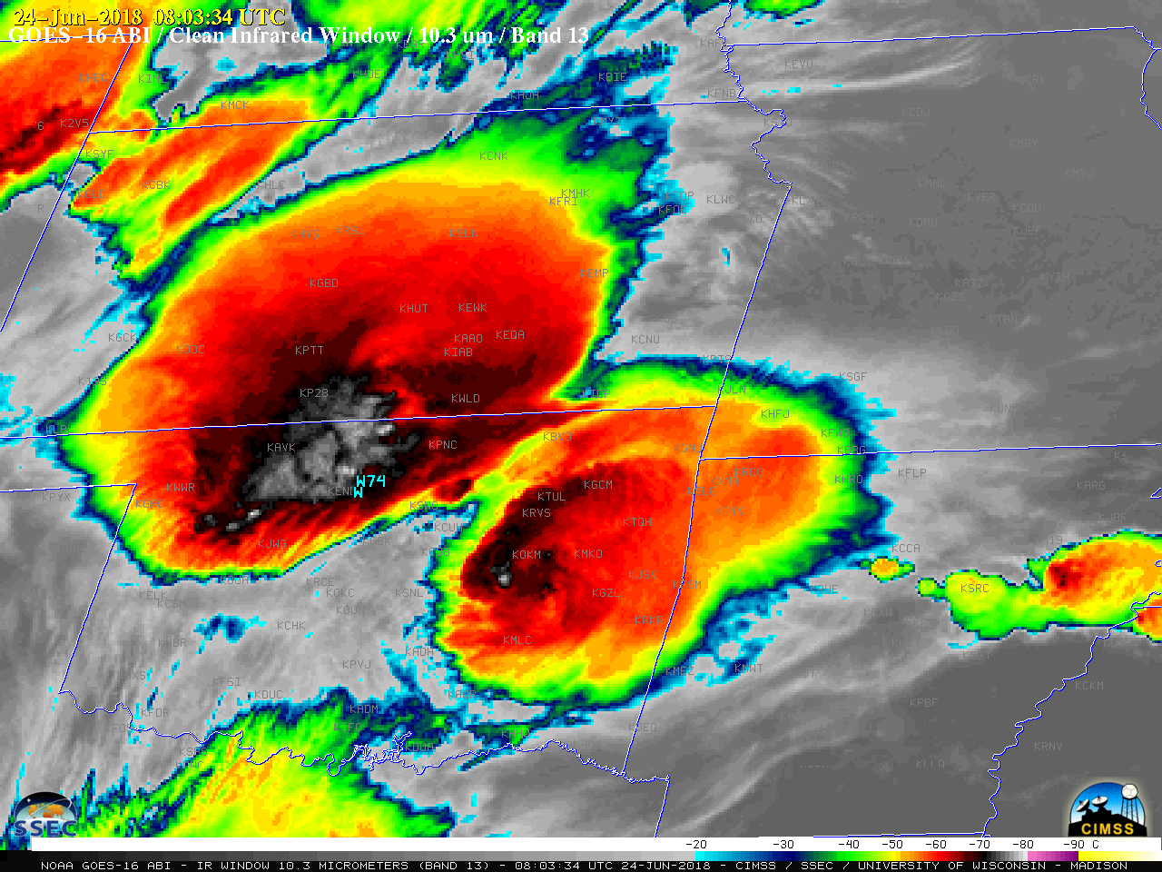
GOES-16 “Clean” Infrared Window (10.3 µm) images, with SPC storm reports plotted in cyan [click to play MP4 animation]
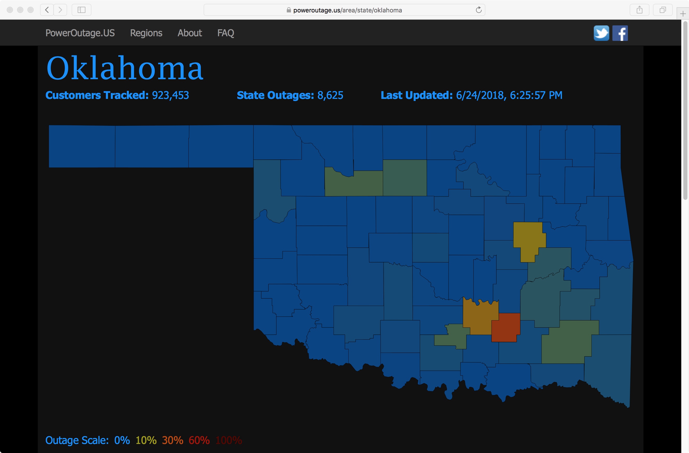
A toggle between Suomi NPP VIIRS Day/Night Band (0.7 µm) and Infrared Window (11.45 µm) images at 0748 UTC or 2:48 am CDT (below) showed two MCS features — one with its core in north-central Oklahoma and another over eastern Oklahoma. Features exhibited by the northern storm included numerous bright lightning streaks on the Day/Night Band image, with one cluster located over an area of damaging wind reports. The minimum cloud-top infrared brightness temperature associated with this storm was -86ºC (violet enhancement). Over Kansas, packets of gravity waves could be seen on both images, propagating radially outward from the storm core along the cloud top. The combination of lightning and damaging winds (which downed power poles) led to power outages that lasted into the next evening (map | provider listing) across parts of Oklahoma.
With the MCS over eastern Oklahoma, a large cluster of bright lightning streaks was co-located with the overshooting top (which had a minimum cloud-top infrared brightness temperature of -80ºC) — and a distinct above-anvil cirrus plume could be seen flowing east-southeastward from the overshooting top.
![Suomi NPP VIIRS Day/Night Band (0.7 µm) and Infrared Window (11.45 µm) images, with SPC storm reports of damaging winds plotted in cyan [click to enlarge]](https://cimss.ssec.wisc.edu/satellite-blog/wp-content/uploads/sites/5/2018/06/180624_0748utc_suomi_npp_viirs_DayNightBand_InfraredWindow_KS_OK_anim.gif)
Suomi NPP VIIRS Day/Night Band (0.7 µm) and Infrared Window (11.45 µm) images, with SPC storm reports of damaging winds plotted in cyan [click to enlarge]
![NOAA-20 VIIRS Day/Night Band (0.7 µm) and Infrared Window (11.45 µm) images [click to enlarge]](https://cimss.ssec.wisc.edu/satellite-blog/wp-content/uploads/sites/5/2018/06/180624_0836utc_noaa20_viirs_DayNightBand_InfraredWindow_KS_OK_anim.gif)
NOAA-20 VIIRS Day/Night Band (0.7 µm) and Infrared Window (11.45 µm) images [click to enlarge]