This website works best with a newer web browser such as Chrome, Firefox, Safari or Microsoft Edge. Internet Explorer is not supported by this website.

Archive: Jun 2018

Convection and Flooding over northern Wisconsin

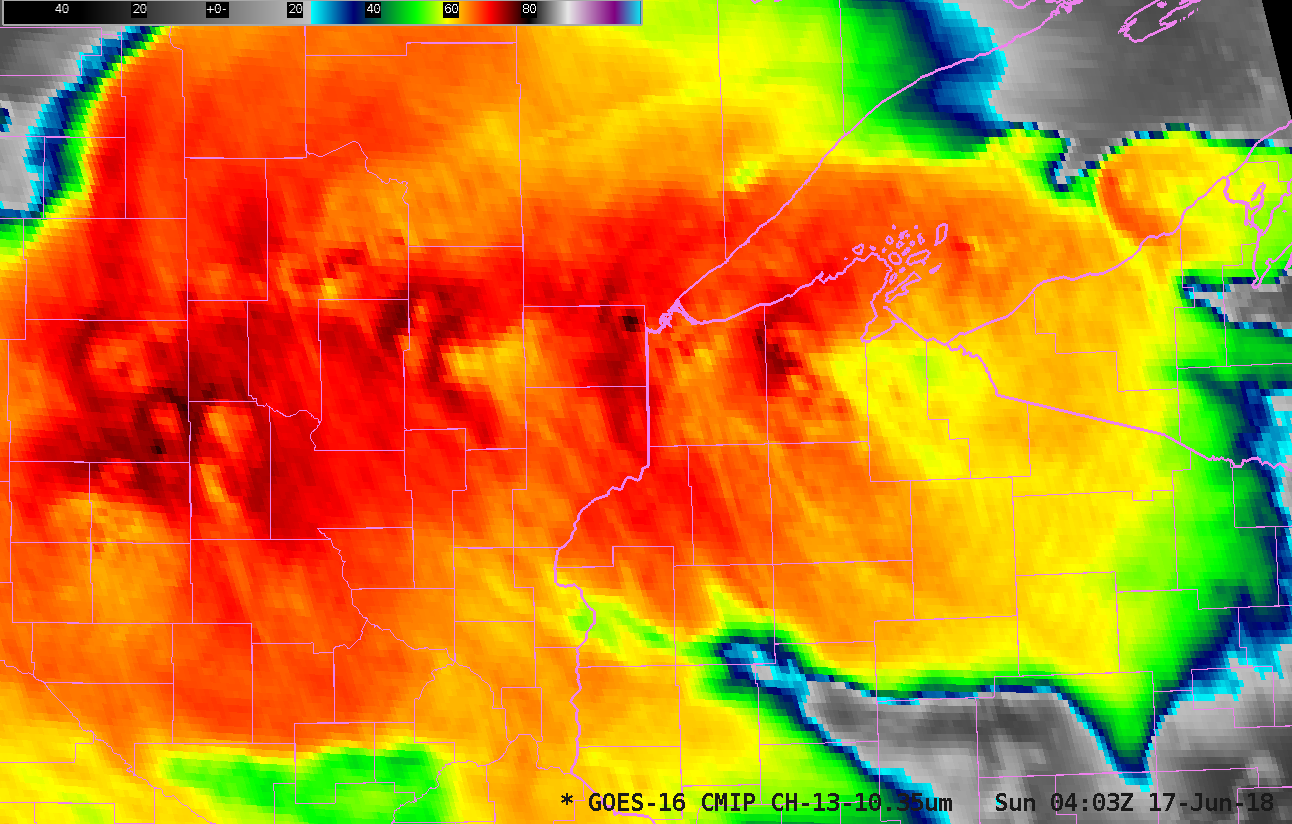
Persistent convection over northern Wisconsin, Minnesota and upper Michigan late Saturday (16 June)/early Sunday (17 June) caused significant flooding.  The animation above shows GOES-16 ABI “Clean Window” Infrared Imagery from 0200-0600 UTC on 17 June.  Note the persistence of the cold overshooting tops over western Bayfield County in northwestern Wisconsin! A... Read More

Transverse banding around a decaying MCS

A comparison of Aqua MODIS Visible (0.65 µm), Near-Infrared “Cirrus” (1.37 µm), Water Vapor (6.7 µm) and Infrared Window (11.0 µm) images (above) showed widespread transverse banding along the northern and eastern periphery of a decaying Mesoscale Convective System (MCS) that was moving from Iowa into Illinois and Missouri on... Read More