Category: Satellite winds
Cyclone Habana in the South Indian Ocean
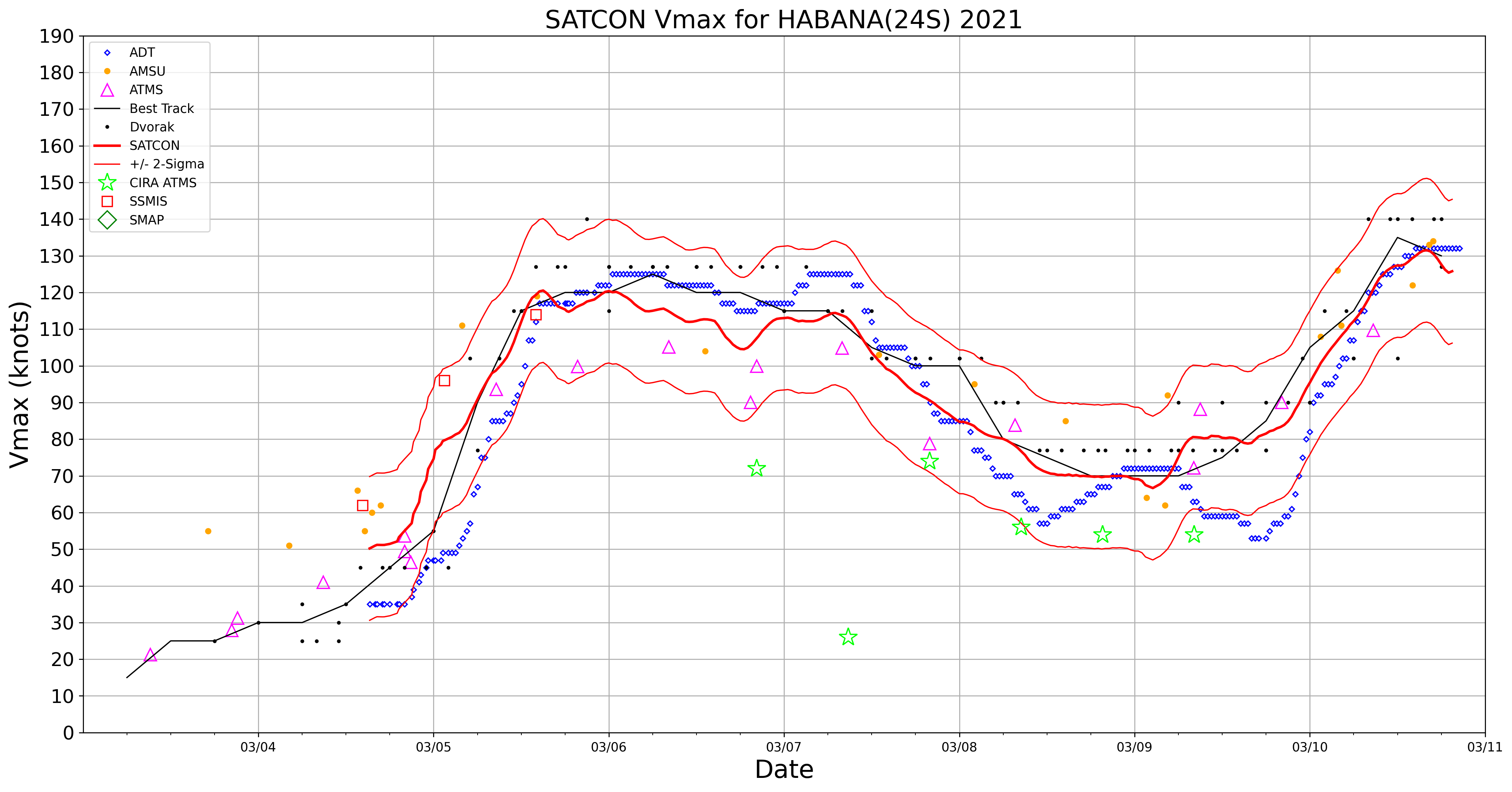
US Space Force EWS-G1 Infrared Window (10.7 µm) images (above) displayed the well-defined eye and eyewall structure of Cyclone Habana in the South Indian Ocean on 10 March 2021. This was the second period of Category 4 intensity (ADT | SATCON) during the life cycle of Habana.Meteosat-8 Infrared images with... Read More
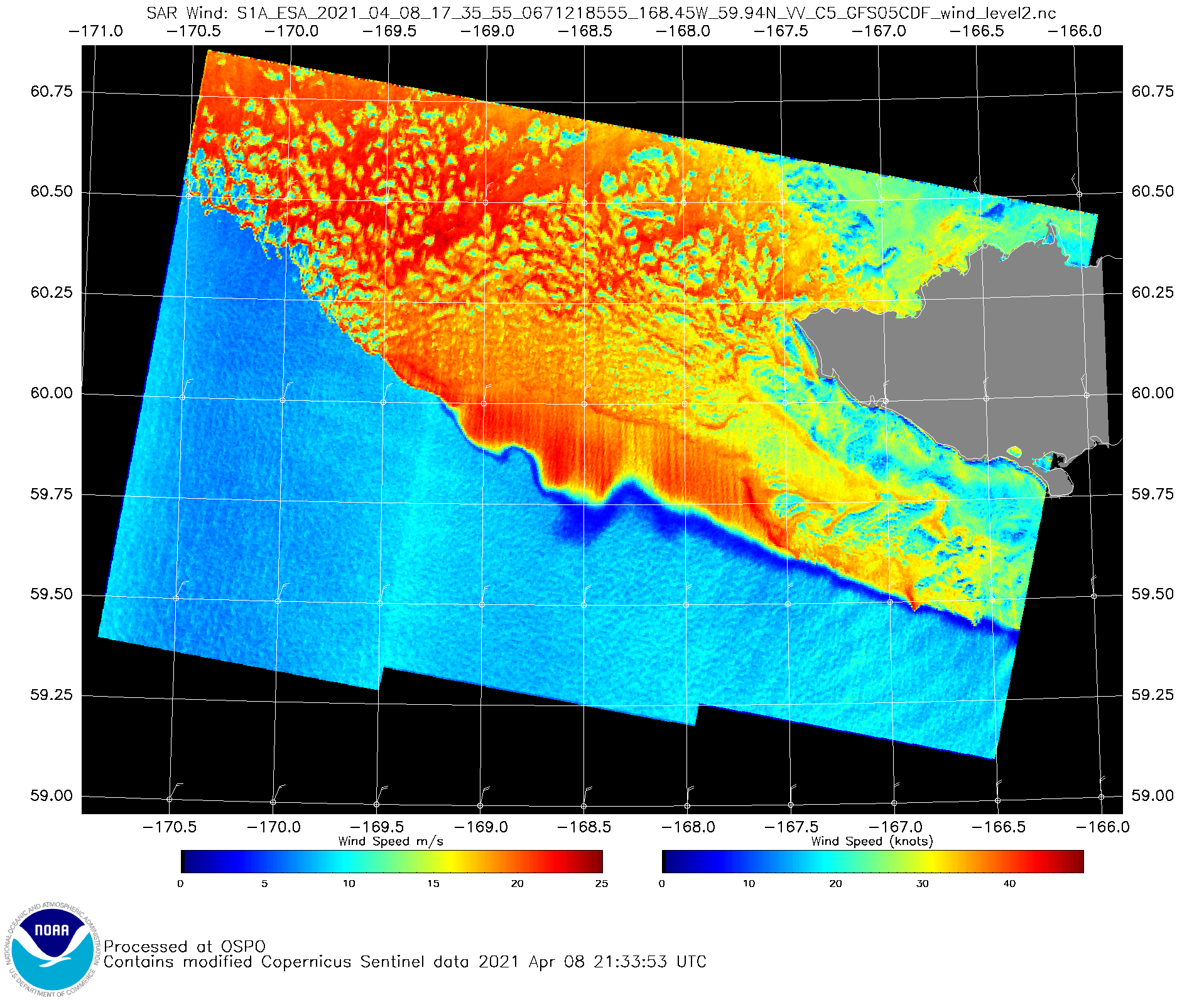
Re-suspended ash from the Katmai volcano in Alaska
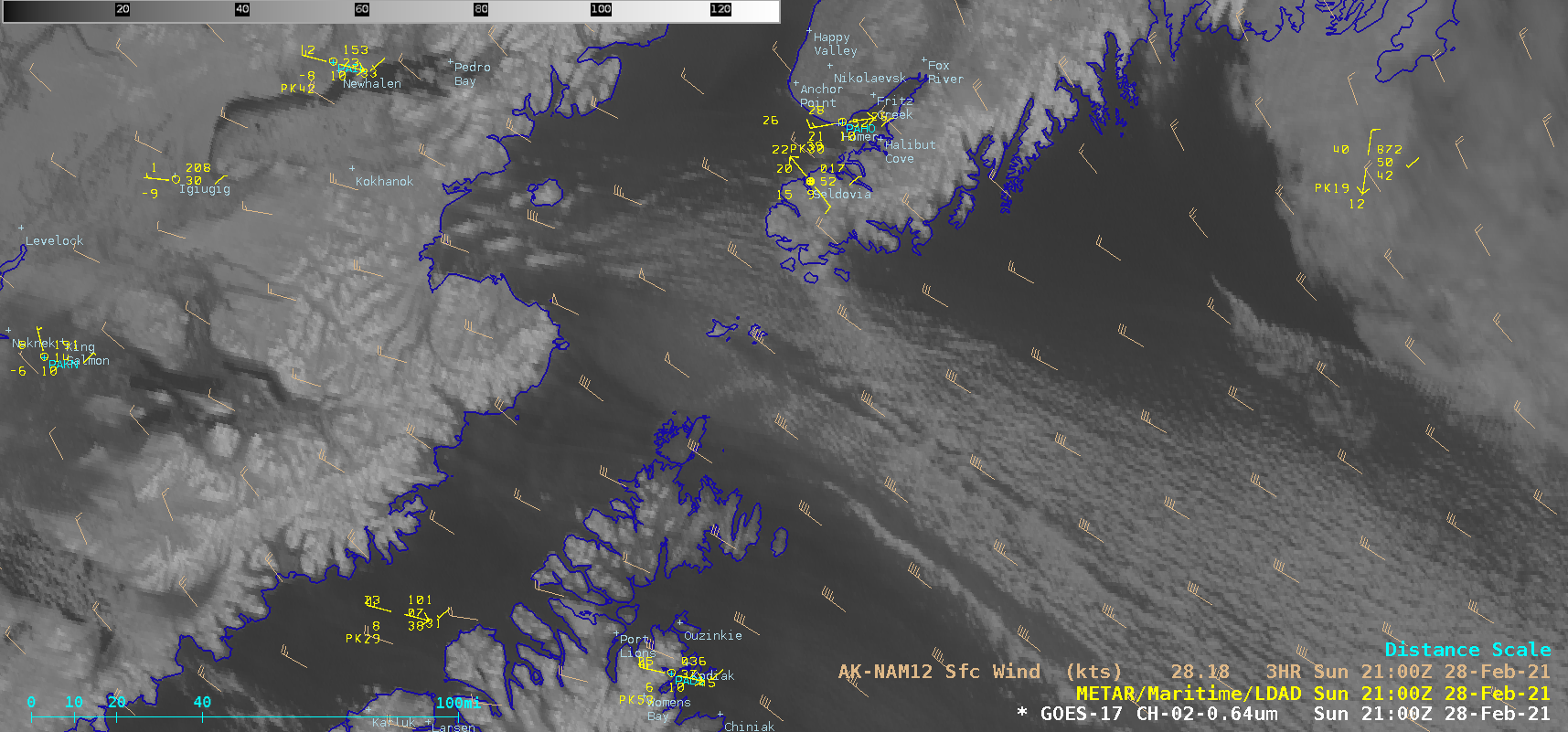
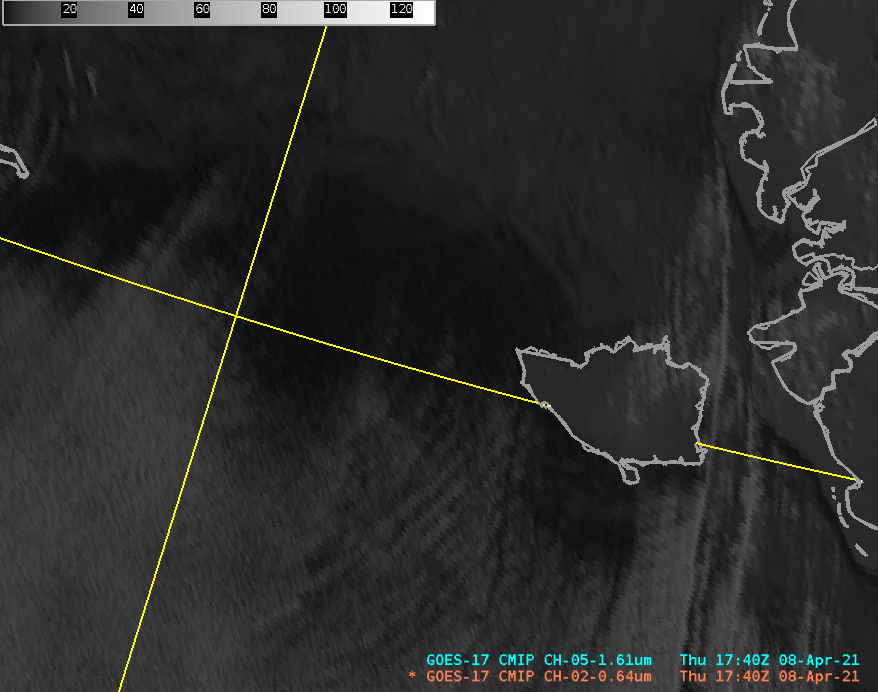
1-minute Mesoscale Domain Sector GOES-17 (GOES-West) “Red” Visible (0.64 µm) images (above) showed the hazy signature of a plume of re-suspended ash from the 1912 Katmai volcanic eruption. Strong surface winds gusting to 50-55 knots — caused by a strong pressure gradient along the western periphery of a Storm Force low in the Gulf of Alaska (surface analyses)... Read More
Using 1-minute GOES-17 imagery to monitor tropical convection near American Samoa
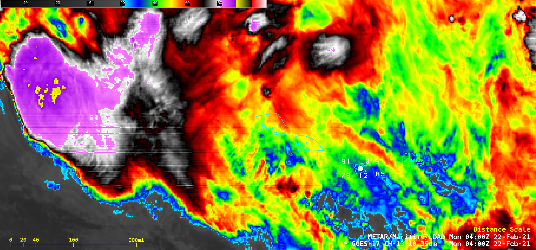
1-minute Mesoscale Domain Sector GOES-17 (GOES-West) “Clean” Infrared Window (10.35 µm) images (above) showed thunderstorms associated with the South Pacific Convergence Zone (SPCZ) on 21 February 2021. The 3 METAR stations plotted on the imagery are, from left to right, Hihifo Airport, Wallis and Fotuna (NLWW), Apia, Samoa (NSFA) and Pago Pago, American Samoa (NSTU).In spite... Read More
