Contrails over Wisconsin, and a mesovortex moving across Indiana

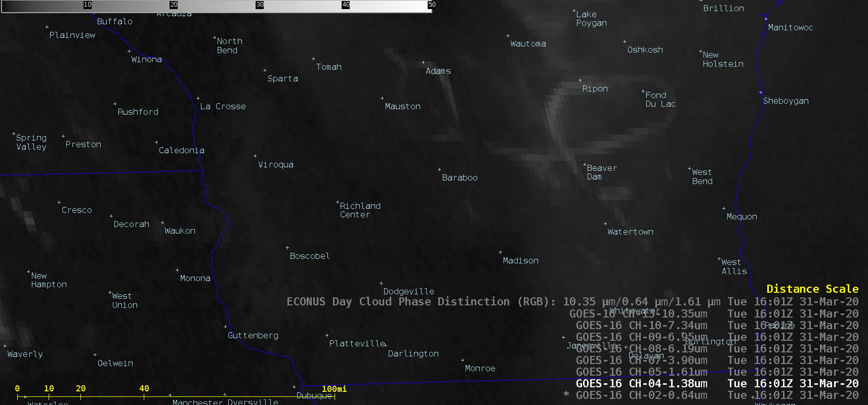
GOES-16 “Red” Visible (0.64 µm), Near-Infrared “Cirrus” (1.37 µm), Near-Infrared “Snow/Ice” (1.61 µm), Upper-level Water Vapor (6.2 µm), Mid-level Water Vapor (6.9 µm), Low-level Water Vapor (7.3 µm), “Clean” Infrared Window (10.35 µm) and Day Cloud Phase Distinction RGB images [click to play animation | MP4]
A toggle between GOES-16 Visible and Cirrus images at 1601 UTC (below) indicated that the darker signature seen in Visible imagery was actually the shadow from the high-altitude contrails being cast upon the top of the low-level stratus clouds.
Another feature of interest was revealed by 1-minute Mesoscale Domain Sector GOES-16 Visible images — a mesovortex that was moving southwestward from southwest Michigan across northwestern Indiana (below). However, the small-scale circulation of the vortex was not captured by 1-minute GOES-16 Derived Motion Winds.![GOES-16 "Red" Visible (0.64 µm) images with plots of Derived Motion Winds (yellow) [click to enlarge]](https://cimss.ssec.wisc.edu/satellite-blog/images/2020/03/vort-20200331_170555.png)
GOES-16 “Red” Visible (0.64 µm) images, with Derived Motion Winds plotted in yellow [click to play animation | MP4]


![GOES-16 "Red" Visible (0.64 µm), and Near-Infrared "Cirrus" (1.37 µm) images [click to enlarge]](https://cimss.ssec.wisc.edu/satellite-blog/images/2020/03/200331_1601utc_goes16_visible_cirrus_WI_contrails_anim.gif)