Ice motion on the Great Lakes
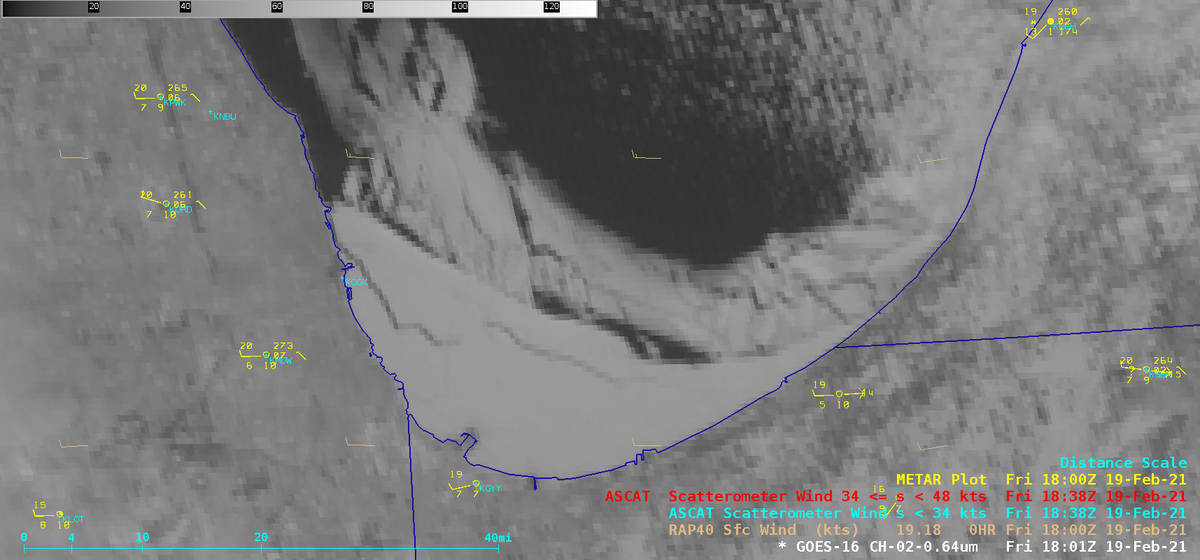
1-minute Mesoscale Domain Sector GOES-16 (GOES-East) “Red” Visible (0.64 µm) images (above) revealed the fracturing of land-fast ice in the far southern portion of Lake Michigan on 19 February 2021. Although the westerly wind speeds were not particularly strong — generally 15-20 knots over water, including Metop ASCAT winds early in the day — these winds... Read More