Sun glint and light winds to the west of Invest 95L in the tropical Atlantic
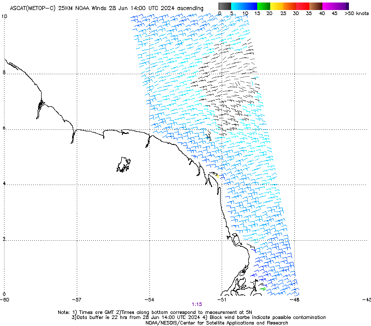
CSPP Geosphere imagery above (direct link) shows an area of sun glint over the tropical Atlantic. Embedded within the brighter areas of sun glint is a dark path centered near 7oN, 52oW over the ocean to the northeast of French Guiana. Long-time readers of this blog will no doubt recognize this feature... Read More
