Satellite comparisons of Beryl near Jamaica to Gilbert, Ivan, and Dean near (or over!) Jamaica
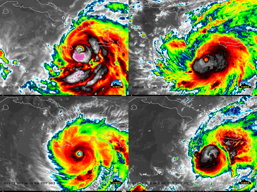
GOES-16 clean window infrared imagery, above, shows the evolution (at half-hourly intervals; in reality, 1-minute data was available of its passage, along with lightning) of Hurricane Beryl‘s cloud field as it moved just south of the island of Jamaica. The time-step above was degraded to allow a comparison to Hurricanes Gilbert, see this too, (with... Read More
