This website works best with a newer web browser such as Chrome, Firefox, Safari or Microsoft Edge. Internet Explorer is not supported by this website.

Category: Satellite winds

Hurricane Douglas moves just north of Hawai’i

1-minute Mesoscale Domain Sector GOES-17 (GOES-West) “Red” Visible (0.64 µm) and “Clean” Infrared Window (10.35 µm) images (above) showed  Category 1 Hurricane Douglas as it moved just north of Hawai’i during the day on 26 July 2020 (the boundary of the Mesoscale Sector was abruptly shifted westward at 1658 UTC). The coldest cloud-top infrared brightness temperatures were around -80ºC.The apparent storm... Read More

Tropical Storm Cristobal makes landfall along the coast of Louisiana

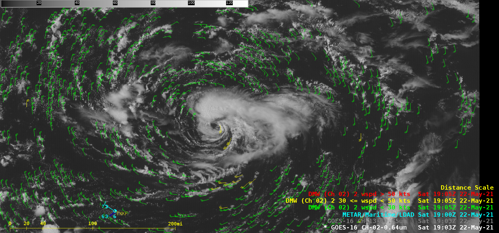
1-minute Mesoscale Domain Sector GOES-16 “Red” Visible (0.64 µm) images (above) revealed low-level vortices that were pivoting around the analyzed center of Tropical Storm Cristobal as it approached the coast of Louisiana on 07 June 2020, making landfall at 2200 UTC. Wind gusts were as high as 57 mph in Louisiana and 64 mph in Mississippi.GOES-16 Visible images with overlays... Read More