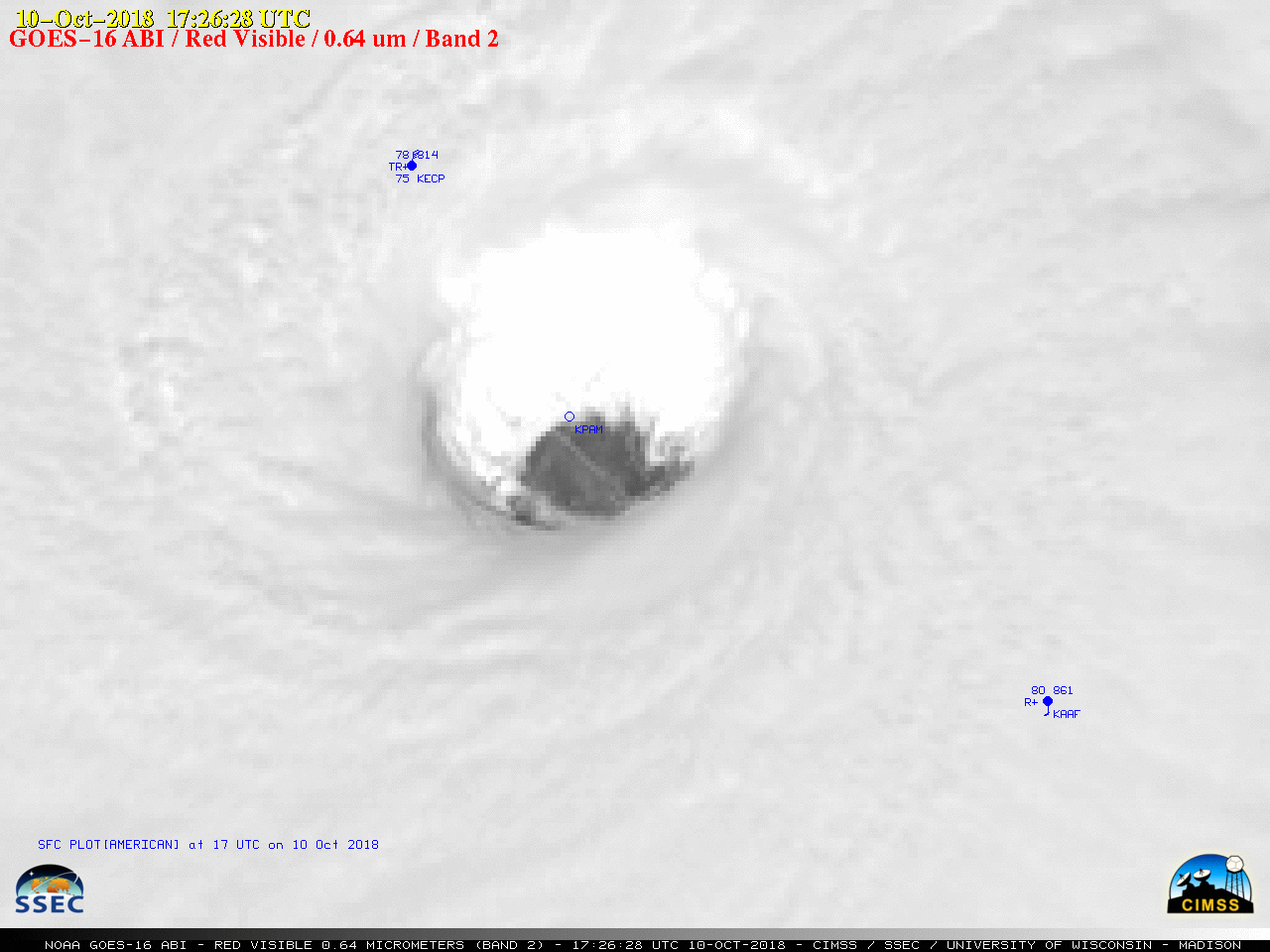
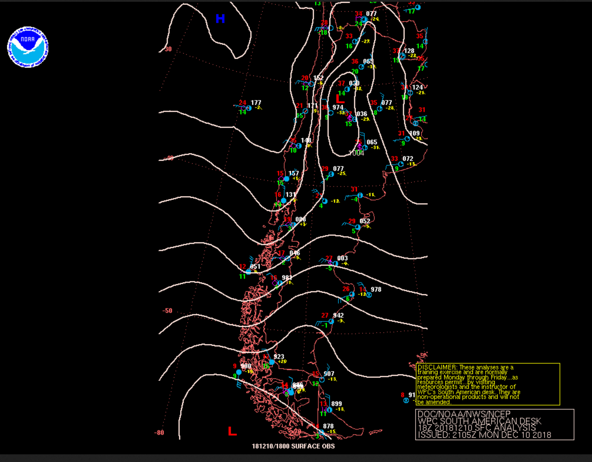
Severe thunderstorms in Argentina
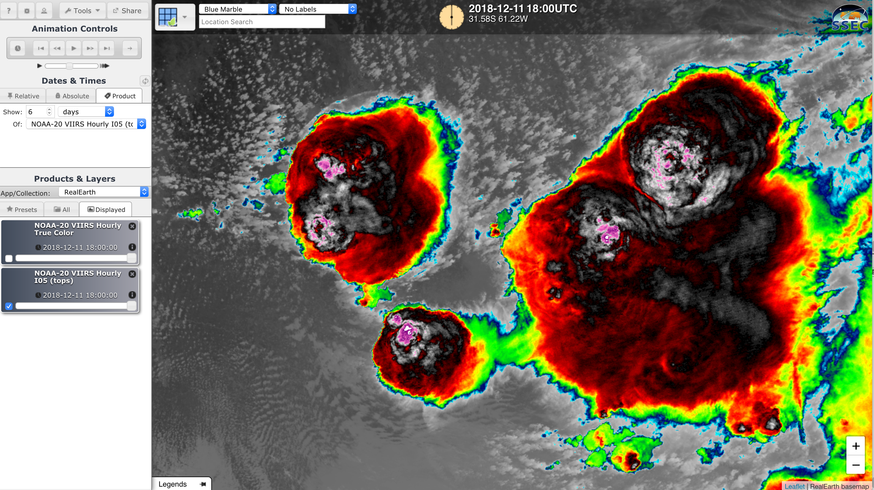
A comparison of GOES-16 (GOES-East) “Red” Visible (0.64 µm) and “Clean” Infrared Window (10.3 µm) images (above) showed the development of thunderstorms well ahead of a cold front (surface analyses) that was moving northward across central Argentina on 10 December 2018. A Mesoscale Domain Sector had been positioned over that region in support of the RELAMPAGO-CACTI... Read More
