Heavy rainfall in Arizona from the remnants of Rosa
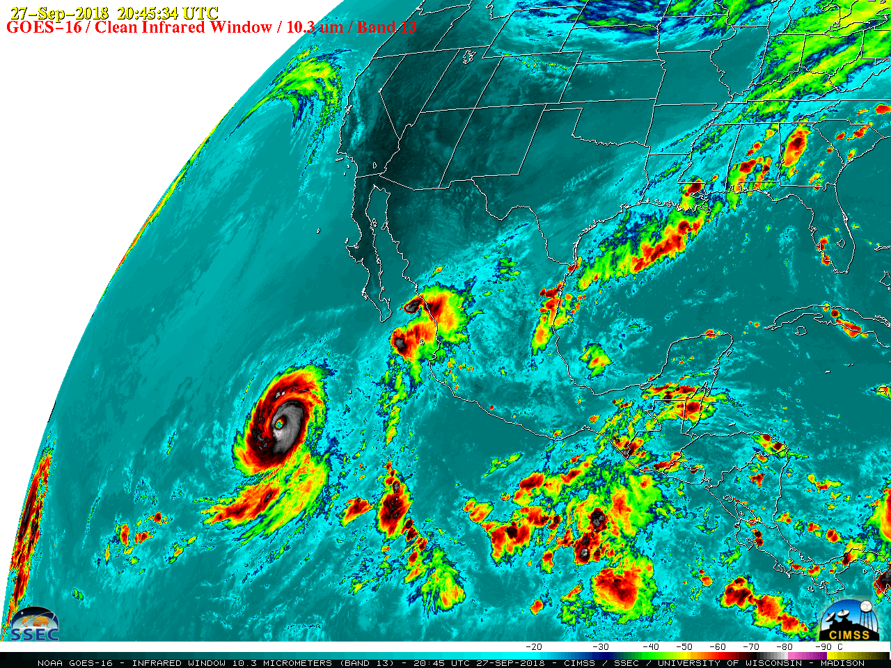
GOES-16 “Clean” Infrared Window (10.3 µm) images, 25 September – 02 October [click to play MP4 animation]
A closer look at Rosa during that same time period is shown below. The image interval is 15 minutes, except for 5-minute imagery during a test of Mode 4 scanning strategy on 01 October (from 0000-1550 UTC).
![GOES-16 "Clean" Infrared Window (10.3 µm) images, 25 September - 02 October [click to play MP4 animation]](https://cimss.ssec.wisc.edu/satellite-blog/wp-content/uploads/sites/5/2018/10/G16_IR_ROSA_ZOOM_25SEP_02OCT2018_960x1280_B13_2018270_204534_0001PANEL_00216.GIF)
GOES-16 “Clean” Infrared Window (10.3 µm) images, 25 September – 02 October [click to play MP4 animation]
![MIMIC Total Precipitable Water product, 25 September - 02 October [click to play MP4 animation | MP4]](https://cimss.ssec.wisc.edu/satellite-blog/wp-content/uploads/sites/5/2018/10/180925_181002_mimic_tpw_Rosa_anim.gif)
MIMIC Total Precipitable Water product, 25 September – 02 October [click to play MP4 animation | MP4]
![Plots of rawinsonde data from Tucson, Arizona 30 September - 02 October [click to enlarge]](https://cimss.ssec.wisc.edu/satellite-blog/wp-content/uploads/sites/5/2018/10/180930_181002_ktwc_raobs_anim.gif)
Plots of rawinsonde data from Tucson, Arizona 30 September – 02 October [click to enlarge]
Here's a look at the rainfall totals over the past 48 hours across the southern half of Arizona. Impressive totals across western Pima county and far southern Maricopa county. #azwx pic.twitter.com/hi7A54DHhM
— NWS Tucson (@NWSTucson) October 2, 2018