Severe thunderstorms in Argentina
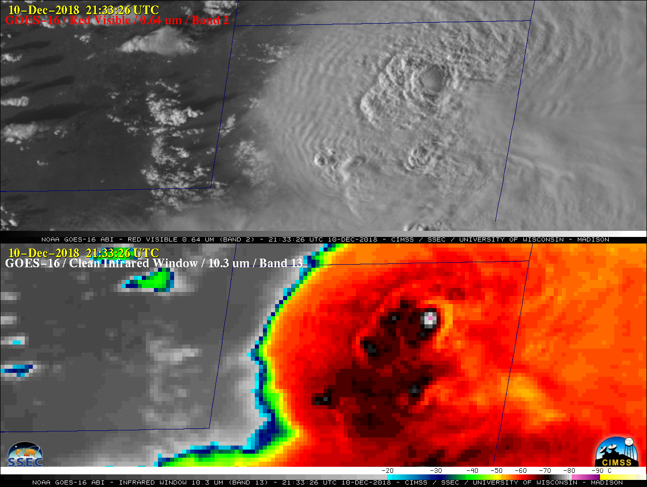
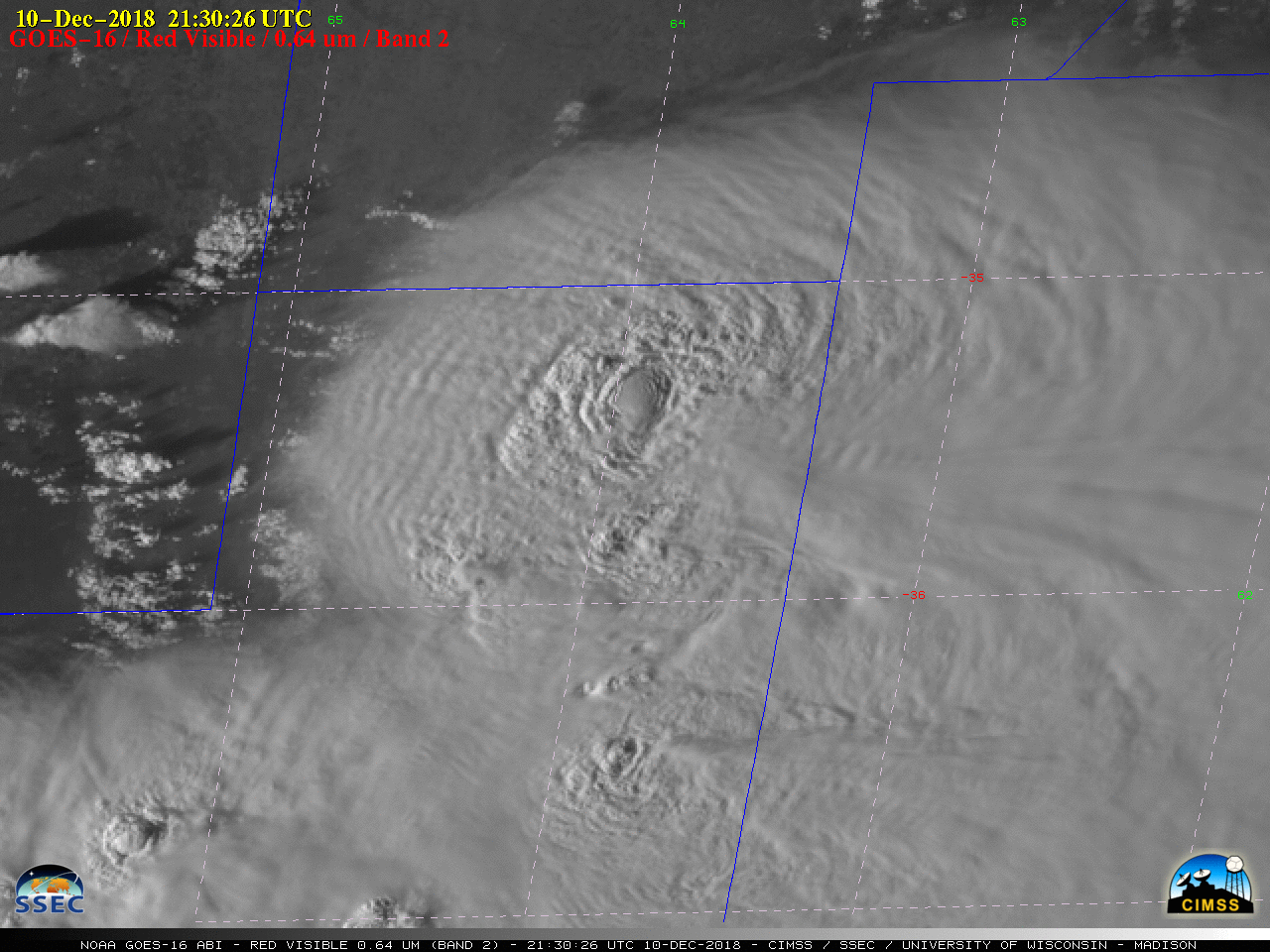
GOES-16 “Red” Visible (0.64 µm, top) and “Clean” Infrared Window (10.3 µm, bottom) images [click to play MP4 animation]
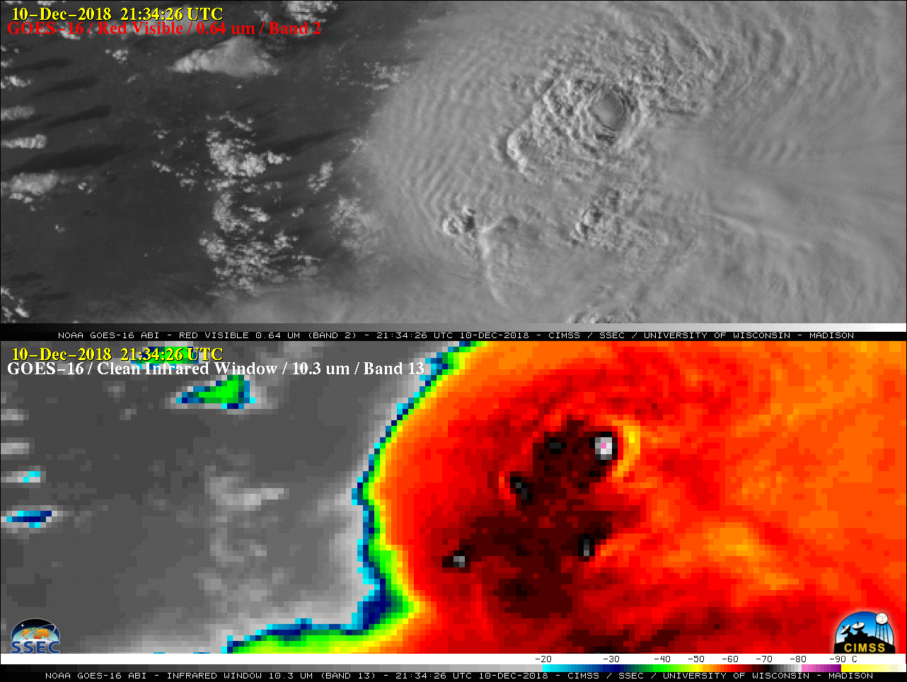
Plots of GOES-16 GLM Groups on the Visible and Infrared images (below) showed a good deal of lightning activity with this convection — especially in the leading anvil region east of the storm core. However, it is interesting to point out that there was a general lack of satellite-detected lightning directly over the large and persistent overshooting top. The GLM Groups were plotted with the default parallax correction removed, so the optical emissions of the lightning aligned with cloud-top features as seen on the ABI imagery.
![GOES-16 "Red" Visible (0.64 µm, top) with GLM Groups and "Clean" Infrared Window (10.3 µm, bottom) images [click to play MP4 animation]](https://cimss.ssec.wisc.edu/satellite-blog/wp-content/uploads/sites/5/2018/12/G16_VIS_GLM_IR_ARGENTINA_10DEC2018_2018344_213326_GOES-16_0002PANELS.GIF)
GOES-16 “Red” Visible (0.64 µm, top) with GLM Groups and “Clean” Infrared Window (10.3 µm, bottom) images [click to play MP4 animation]
![GOES-16 "Red" Visible (0.64 µm, top) and Near-Infrared "Snow/Ice" (1.61 µm, bottom) images [click to play MP4 animation]](https://cimss.ssec.wisc.edu/satellite-blog/wp-content/uploads/sites/5/2018/12/G16_VIS_NIR_ARGENTINA_10DEC2018_2018344_213326_GOES-16_0002PANELS.GIF)
GOES-16 “Red” Visible (0.64 µm, top) and Near-Infrared “Snow/Ice” (1.61 µm, bottom) images [click to play MP4 animation]
![Plot of severe weather reports [click to enlarge]](https://cimss.ssec.wisc.edu/satellite-blog/wp-content/uploads/sites/5/2018/12/181210_public_severe_weather_reports_Argentina.png)
Plot of severe weather reports [click to enlarge]
GOES-16 “Red” Visible (0.64 µm) images [click to play MP4 animation]
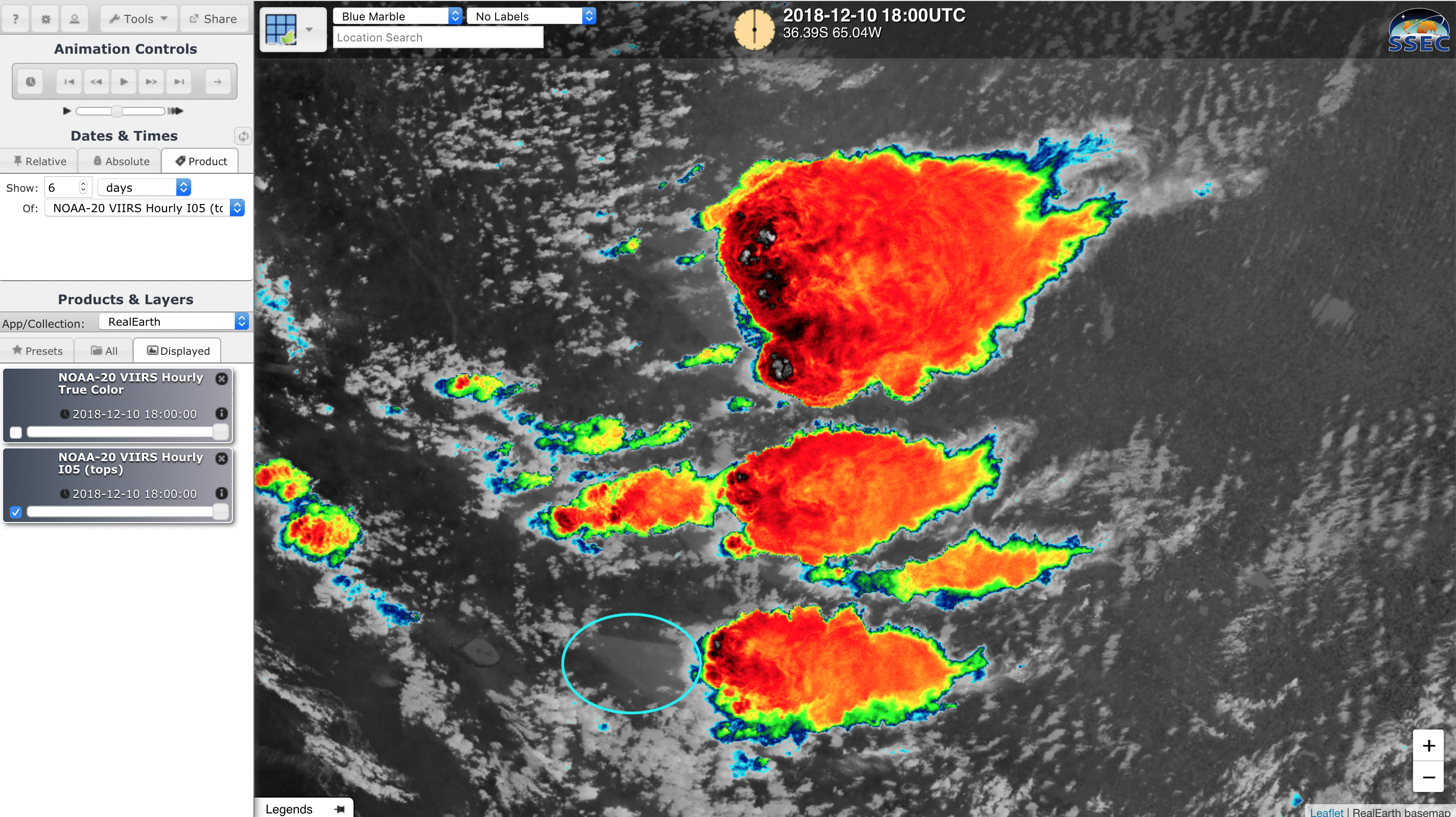
A zoom-in of NOAA-20 VIIRS True Color Red-Green-Blue (RGB) imagery at 1835 UTC viewed using RealEarth (below) showed the 3 discrete thunderstorms in the vicinity of Santa Rosa.
![NOAA-20 VIIRS True Color RGB image at 1835 UTC [click to enlarge]](https://cimss.ssec.wisc.edu/satellite-blog/wp-content/uploads/sites/5/2018/12/181210_1835utc_noaa20_truecolor_zoom_Argentina_anim.gif)
NOAA-20 VIIRS True Color RGB image at 1835 UTC [click to enlarge]
![NOAA-20 VIIRS True Color RGB and Infrared Window (11.45 µm) images at 1835 UTC [click to enlarge]](https://cimss.ssec.wisc.edu/satellite-blog/wp-content/uploads/sites/5/2018/12/181210_1835utc_noaa20_truecolor_infrared_zoom_Argentina_anim.gif)
NOAA-20 VIIRS True Color RGB and Infrared Window (11.45 µm) images at 1835 UTC [click to enlarge]
![NOAA-20 VIIRS Infrared Window (11.45 µm) images at 1835 UTC on 10 December and 0555UTC on 11 December [click to enlarge]](https://cimss.ssec.wisc.edu/satellite-blog/wp-content/uploads/sites/5/2018/12/181210_1835utc_181211_0555utc_noaa20_viirs_infrared_Argentina_anim.gif)
NOAA-20 VIIRS Infrared Window (11.45 µm) images at 1835 UTC on 10 December and 0555 UTC on 11 December [click to enlarge]
LA PAMPA | Granizo destructivo en Ingeniero Luiggi esta tarde. Tormentas fuertes y severas (presencia de superceldas) en la región central. Zona que tendrá nuevas tormentas, incluso más hacia el Este, finalizando el Lunes y en parte del Martes. Imagen (Foro Gustfront). pic.twitter.com/KdkFNcfZSC
— Meteorología de la República Argentina (@MetRAnoticias) December 10, 2018
#Granizo dañino reportado cerca de General Pico, específicamente en Ingeniero Luiggi, norte de La Pampa. Fuente: Portal InfoPico. pic.twitter.com/0sstdUjSwj
— Christian Garavaglia (@ChGaravaglia) December 11, 2018
URGENTE | Dañina granizada de tamaños grandes en General Villegas, Buenos Aires. Tiempo severo que viene registrándose desde más temprano en el centro del país. Noche de Lunes y Martes complicado. AVISO A CORTO PLAZO DEL SMN PARA EL EXTREMO SUR DE STA FE Y NOROESTE DE BS AS. pic.twitter.com/tMMNDUjgrq
— Meteorología de la República Argentina (@MetRAnoticias) December 11, 2018
Así estan las calles rosarinas por la gran cantidad de lluvia caída ?? INUNDADAS#Tormenta #Rosario pic.twitter.com/7KvqKQZCeQ
— Conclusión (@ConclusionRos) December 11, 2018
===== 11 December Update =====
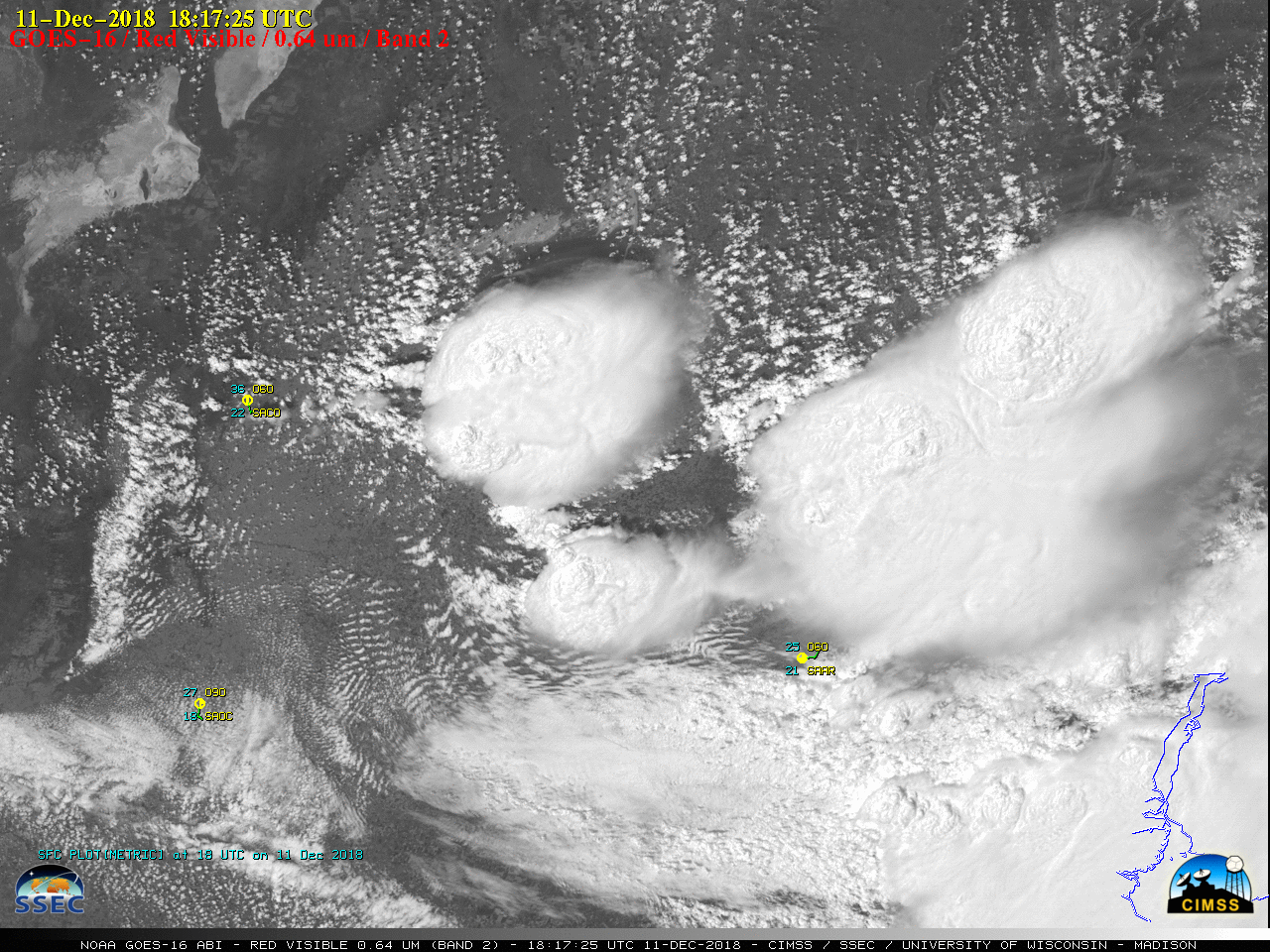
GOES-16 “Red” Visible (0.64 µm) images [click to play MP4 animation]
![GOES-16 "Red" Visible (0.64 µm) images, with GLM Groups plotted in red [click to play MP4 animation]](https://cimss.ssec.wisc.edu/satellite-blog/wp-content/uploads/sites/5/2018/12/G16_VIS_GLM_ARGENTINA_11DEC2018_2018345_181725_GOES-16_0001PANEL.GIF)
GOES-16 “Red” Visible (0.64 µm) images, with GLM Groups plotted in red [click to play MP4 animation]
![GOES-16 "Clean" Infrared Window (10.3 µm) images [click to play MP4 animation]](https://cimss.ssec.wisc.edu/satellite-blog/wp-content/uploads/sites/5/2018/12/G16_IR_ARGENTINA_11DEC2018_2018345_181725_GOES-16_0001PANEL.GIF)
GOES-16 “Clean” Infrared Window (10.3 µm) images [click to play MP4 animation]
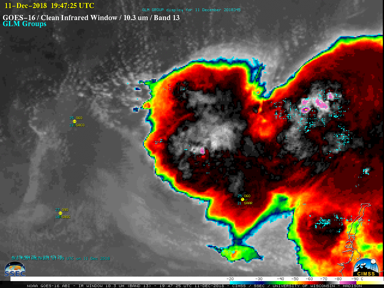
![GOES-16 "Clean" Infrared Window (10.3 µm) images, with GLM Groups plotted cyan [click to play MP4 animation]](https://cimss.ssec.wisc.edu/satellite-blog/wp-content/uploads/sites/5/2018/12/G16_IR_GLM_ARGENTINA_11DEC2018_2018345_181725_GOES-16_0001PANEL.GIF)
GOES-16 “Clean” Infrared Window (10.3 µm) images, with GLM Groups plotted cyan [click to play MP4 animation]
![NOAA-20 VIIRS True Color RGB image at 1817 UTC [click to enlarge]](https://cimss.ssec.wisc.edu/satellite-blog/wp-content/uploads/sites/5/2018/12/181211_1817utc_noaa20_viirs_truecolor_Argentina_anim.gif)
NOAA-20 VIIRS True Color RGB image at 1817 UTC [click to enlarge]
![NOAA-20 VIIRS True Color RGB and Infrared Window (11.45 µm) images at 1817 UTC [click to enlarge]](https://cimss.ssec.wisc.edu/satellite-blog/wp-content/uploads/sites/5/2018/12/181211_1817utc_noaa20_viirs_truecolor_infrared_Argentina_anim.gif)
NOAA-20 VIIRS True Color RGB and Infrared Window (11.45 µm) images at 1817 UTC [click to enlarge]
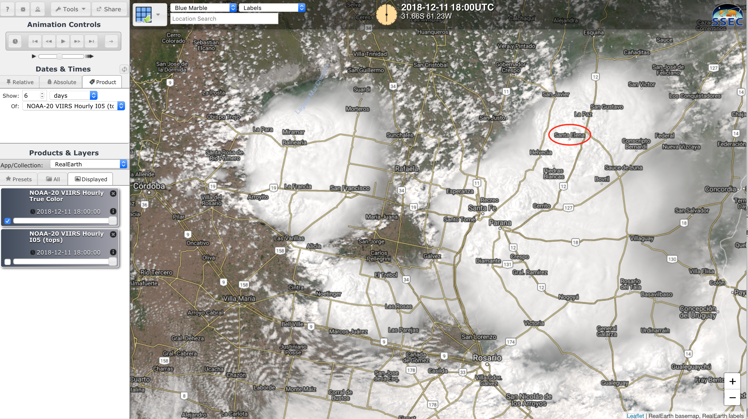
ENTRE RÍOS – TORNADO EN SANTA ELENA ESTA TARDE
El fenómeno se registró pasadas las 15 hs en la localidad de Entre Ríos en medio de una tarde con tiempo severo en la región. Las condiciones eran favorables para el desarrollo de superceldas tornádicas. VIDEO: Anibal Monzón. pic.twitter.com/9kcEURPNpL
— Meteorología de la República Argentina (@MetRAnoticias) December 11, 2018