Polar2grid and AOD and NDVI
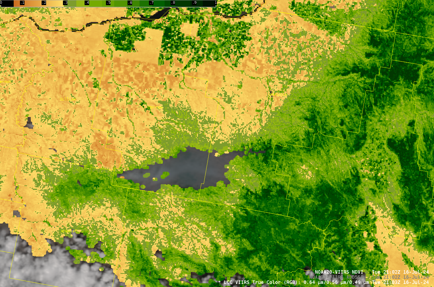
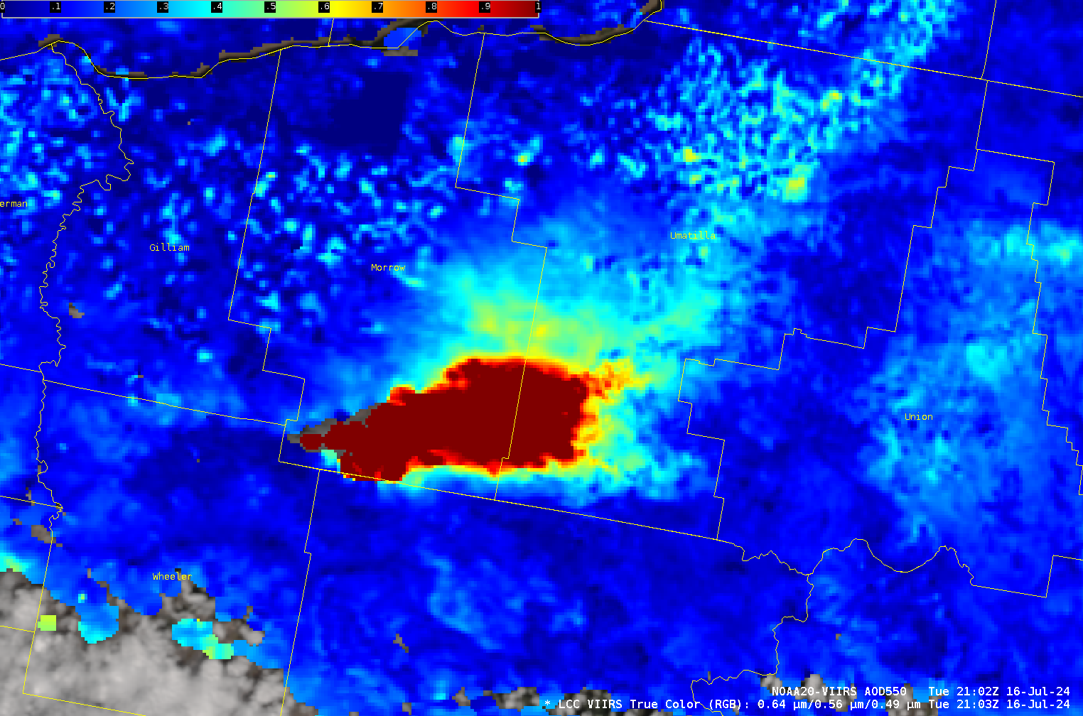
The Community Satellite Processing Package (CSPP) Polar2grid package is being updated and amended. Polar2grid version 3.1 (coming soon to a computer near your desk!) will include the ability to create reprojected images of Aerosol Optical Depth (AOD) and Normalized Difference Vegetation Index (NDVI). The imagery above from AWIPS shows the NOAA-20 AOD... Read More
