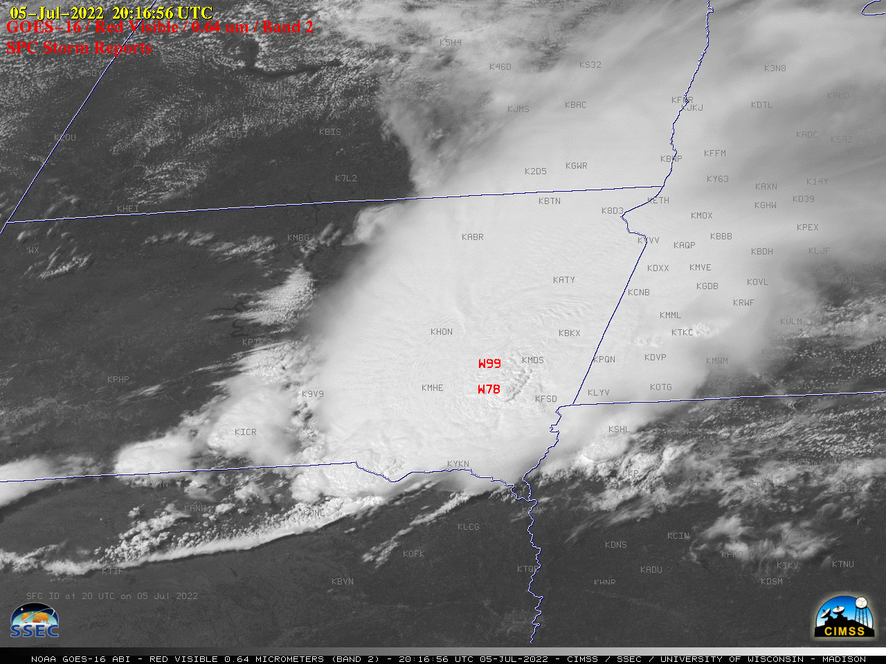
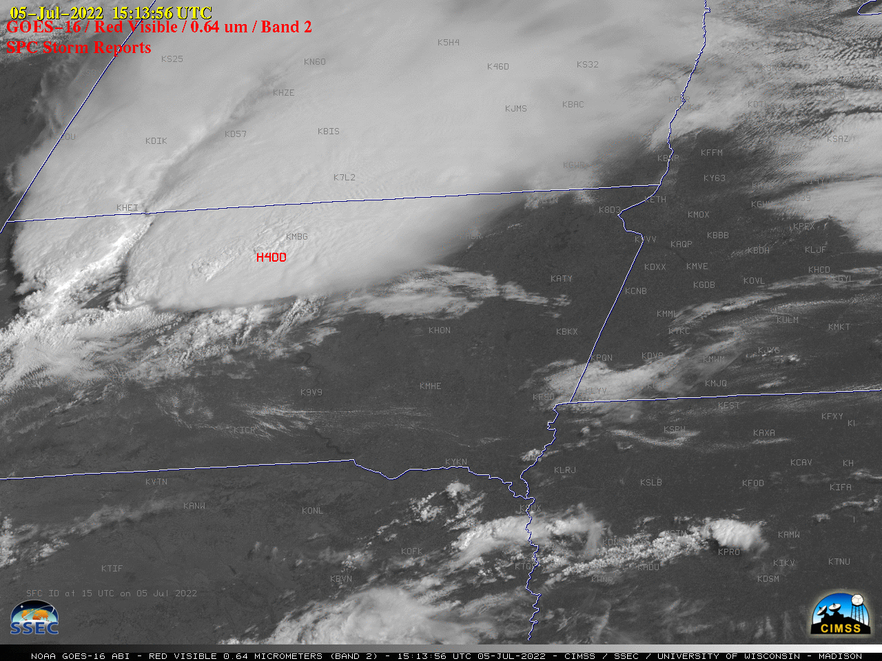
1-minute Mesoscale Domain Sector GOES-16 (GOES-East) “Red” Visible (0.64 µm) images (above) include time-matched SPC Storm Reports — and showed a large Mesoscale Convective System (MCS) that moved southeastward across the Northern Plains on 05 July 2022. This MCS produced damaging straight-line winds as strong as 99 mph and hail as large as 4.00 inches in South Dakota — in fact, with... Read More
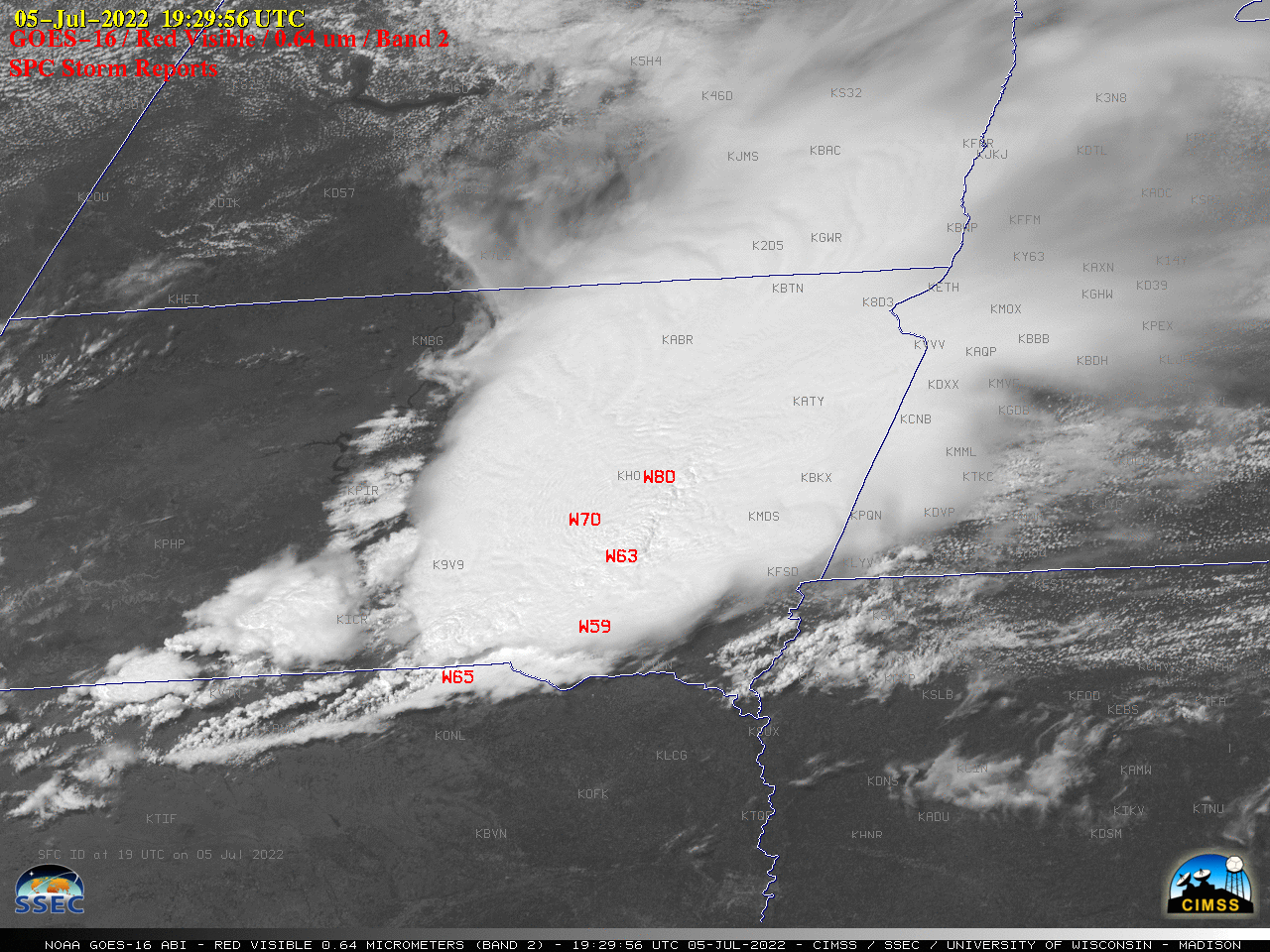
GOES-16 “Red” Visible (0.64 µm) images, with time-matched SPC Storm Reports plotted in red [click to play animated GIF | MP4]
1-minute Mesoscale Domain Sector GOES-16
(GOES-East) “Red” Visible (
0.64 µm) images
(above) include time-matched
SPC Storm Reports — and showed a large Mesoscale Convective System (MCS) that moved southeastward across the Northern Plains on
05 July 2022. This MCS produced damaging straight-line winds as strong as
99 mph and hail as large as
4.00 inches in South Dakota — in fact, with such a long path of strong straight-line winds this event was classified as a
derecho.
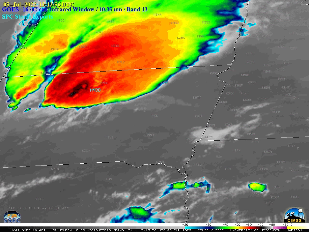
In the corresponding 1-minute GOES-16 “Clean” Infrared Window (10.35 µm) images (below), pulsing overshooting tops exhibited infrared brightness temperatures of -80ºC or colder (purple pixels embedded within interior shades of black-to-white).
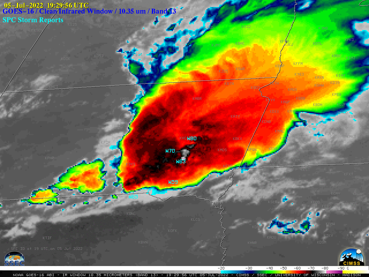
GOES-16 “Clean” Infrared Window (10.35 µm) images, with time-matched SPC Storm Reports plotted in cyan [click to play animated GIF | MP4]
A comparison of Infrared Window images from NOAA-20 (11.45 µm) and GOES-16 (10.35 µm) valid at 2009 UTC — with identical color enhancements
(below) revealed (1) the higher spatial resolution of NOAA-20 VIIRS (~375 m) sensed significantly colder cloud-top infrared brightness temperatures (-88ºC with NOAA-20, vs -78ºC with GOES-16), and (2) a NW displacement of features in the GOES-16 image, associated with
parallax that is an inherent characteristic of geostationary imagery at higher latitudes and/or larger satellite viewing angles.
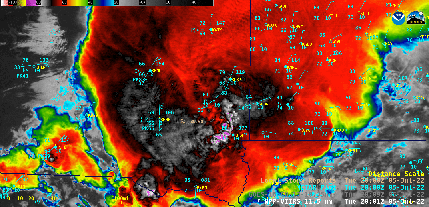
Infrared Window images from NOAA-20 (11.45 µm) and GOES-16 (10.35 µm), valid at 2009 UTC [click to enlarge]
View only this post
Read Less


