This website works best with a newer web browser such as Chrome, Firefox, Safari or Microsoft Edge. Internet Explorer is not supported by this website.

Archive: Jun 2022

GOES-17 IFR, Low IFR, and MVFR Probability fields over South Alaska

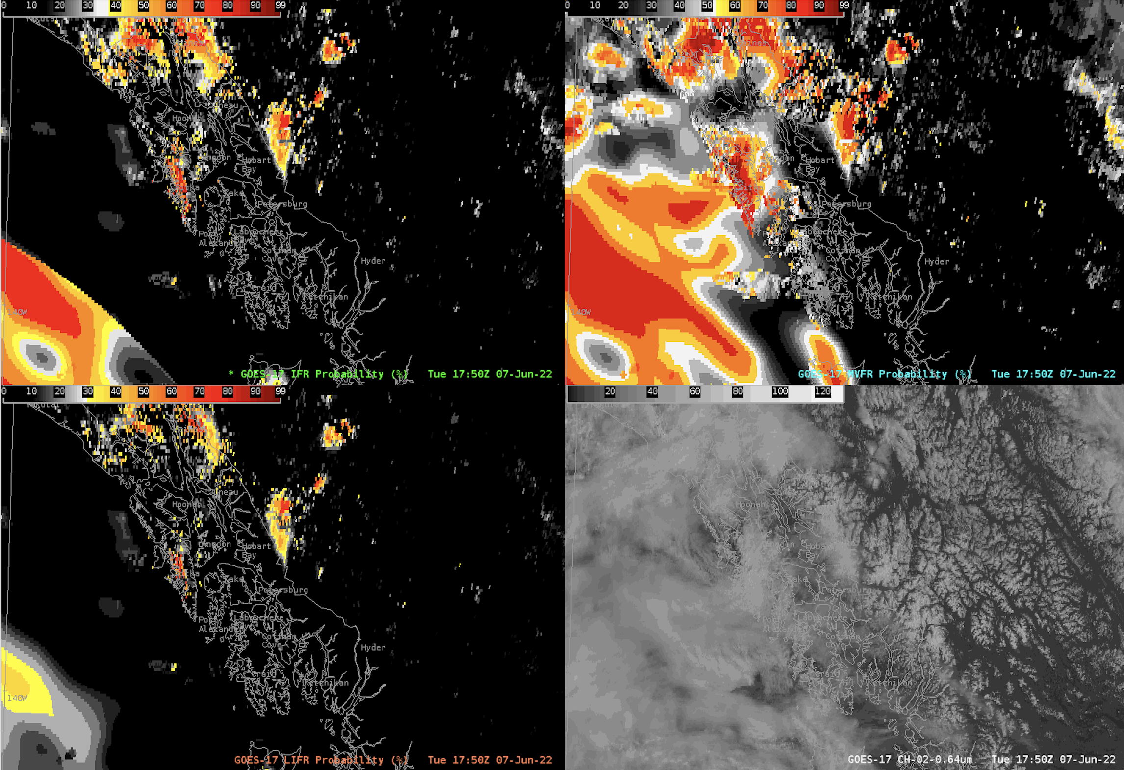
IFR (Instrument Flight Rules) Probability estimates the likelihood that IFR conditions are occurring by fusing GOES-17 satellite data with model output. The satellite-derived products give output of low IFR, (LIFR), IFR, and Marginal Visual Flight Rules (MVFR). In aviation, the difference between these classifications is generally:Low Instrument Flight Rules (LIFR): Ceilings are less than 500 feet above ground... Read More

Tropical Storm Alex

1-minute Mesoscale Domain Sector GOES-16 (GOES-East) “Clean” Infrared Window (10.35 µm) and “Red” Visible (0.64 µm) images (above) showed Tropical Storm Alex after it reached tropical storm intensity at 0900 UTC on 05 June 2022. Overshooting tops within the deep convection exhibited infrared brightness temperatures of -80ºC or colder (shades of violet).GOES-16 Infrared Window (11.2 µm) images... Read More