Tropical Storm Alex

GOES-16 “Clean” Infrared Window (10.35 µm) and “Red” Visible (0.64 µm) images [click to play animated GIF | MP4]
GOES-16 Infrared Window (11.2 µm) images from the CIMSS Tropical Cyclones site (below) include contours of deep-layer wind shear at 17 UTC — which displayed the high shear that was displacing the convection associated with Alex well northeast of the storm center.
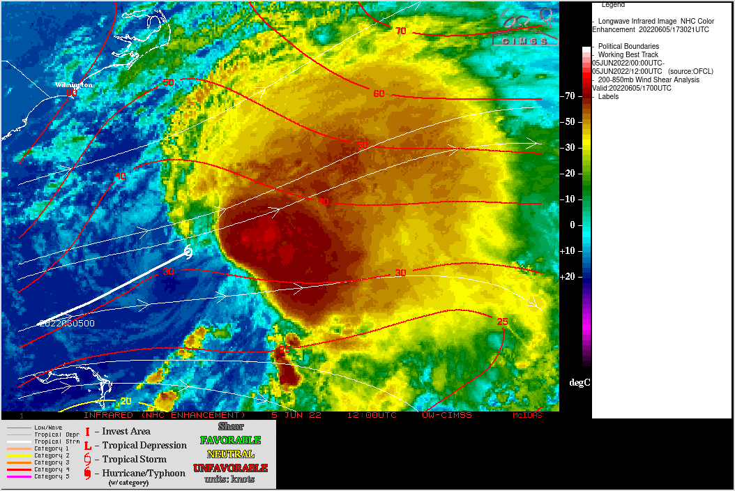
GOES-16 Infrared Window (11.2 µm) images, with contours/streamlines of deep-layer wind shear at 1700 UTC [click to enlarge]
The MIMIC Total Precipitable Water (available at this website) animation below tracks Pacific Hurricane Agatha as it makes landfall, and then the accumulation of moisture that is incorporated into Alex.