This website works best with a newer web browser such as Chrome, Firefox, Safari or Microsoft Edge. Internet Explorer is not supported by this website.

Archive: Jul 2022

McKinney Fire in California produces multiple pyrocumulonimbus clouds

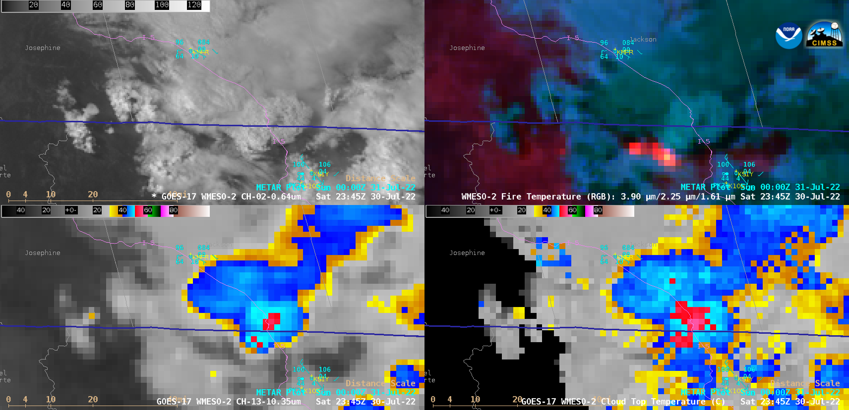
1-minute Mesoscale Domain Sector GOES-17 (GOES-West) “Red” Visible (0.64 µm), Fire Temperature RGB, “Clean” Infrared Window (10.35 µm) and Cloud Top Temperature derived product images (above) showed that the rapidly-growing McKinney Fire in far northern California produced multiple (5 or 6) pulses of pyrocumulonimbus (pyroCb) clouds late in the day on 30 July 2022. The coldest pyroCb cloud-top 10.35... Read More

Heavy rainfall and flooding in eastern Kentucky

GOES-16 (GOES-East) “Clean” Infrared Window (10.35 µm) images (above) showed the development of multiple clusters of thunderstorms that were responsible for producing heavy rainfall and flash flooding across parts of eastern Kentucky during the nighttime hours leading up to sunrise on 28 July 2022. The coldest GOES-16 cloud-top infrared brightness temperature associated with these thunderstorms was -82.7ºC... Read More