This website works best with a newer web browser such as Chrome, Firefox, Safari or Microsoft Edge. Internet Explorer is not supported by this website.

Archive: Nov 2021

Mid-tropospheric vortices over Alaska

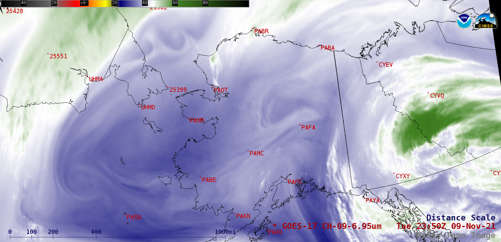
GOES-17 (GOES-West) Mid-level (6.9 µm) Water Vapor images (above) revealed a complex pattern of middle-tropospheric vortices moving slowly west-southwestward over Interior Alaska and the Chukchi / Bering Seas on 09 November 2021. Note that the cold (brighter white) peaks of a few of the higher mountain ranges — including Denali — could... Read More

Hole punch clouds over the Upper Midwest

On the morning of Sunday, November 7th, numerous elongated hole punch clouds were visible over the Upper Midwest, including parts of Wisconsin, Illinois, Iowa, and Minnesota. Also called fall streak clouds, these are a relatively rare phenomenon that form because of the unusual properties of cloud droplets.While most people know... Read More

Radiation fog across the Lower Mississippi Valley and Gulf Coast

The suite of nighttime GOES-16 (GOES-East) Fog / Low Stratus products — Marginal Visual Flight Rules (MVFR) Probability, Instrument Flight Rules (IFR) Probability, Low Instrument Flight Rules (LIFR) Probability, and Cloud Thickness — along with the subsequent daytime “Red” Visible (0.64 µm) images (above) showed the increasing areal coverage of vertically shallow (Cloud Thickness... Read More