Mid-tropospheric vortices over Alaska
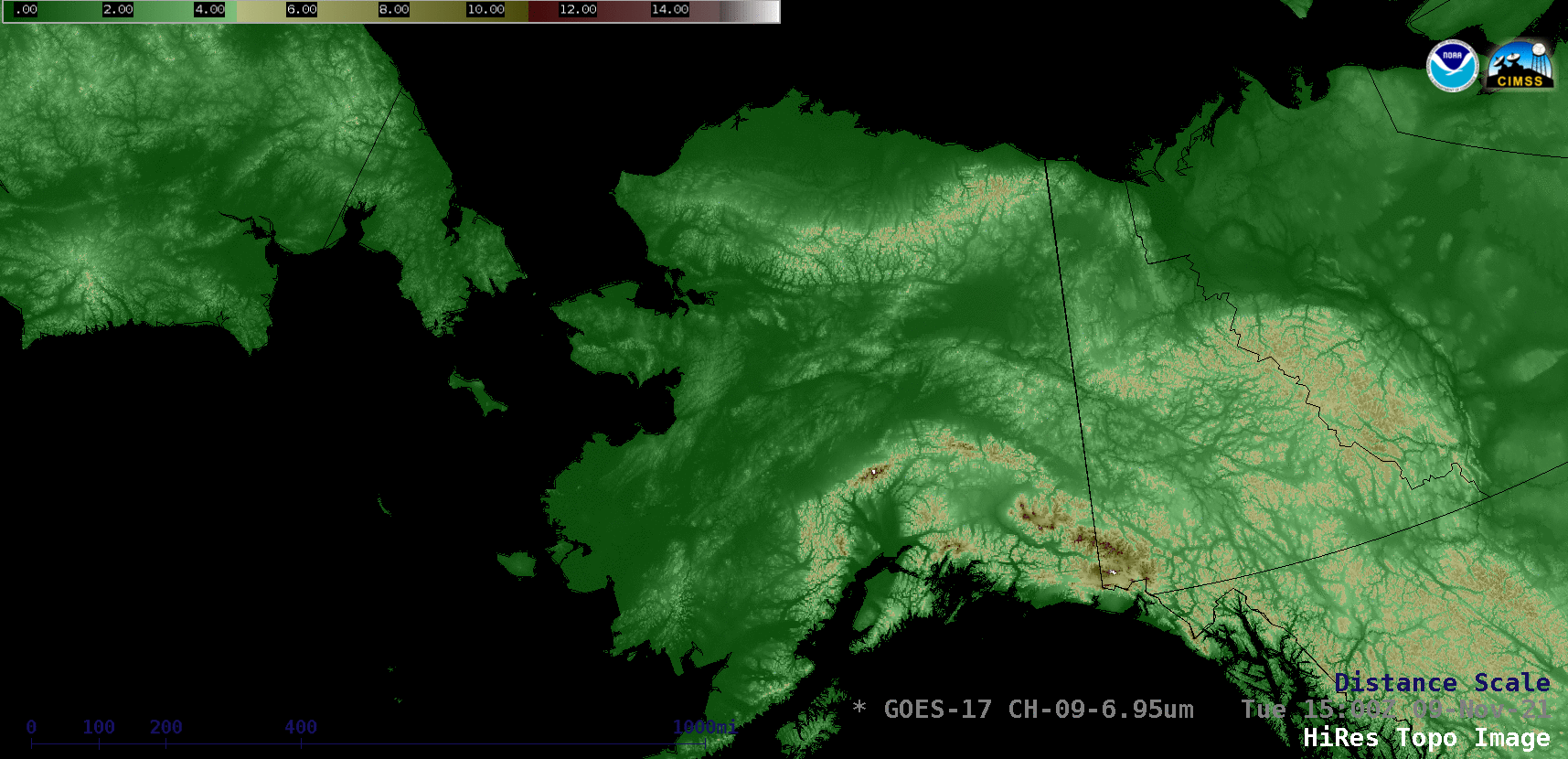
GOES-17 Mid-level Water Vapor (6.9 µm) images [click to play animated GIF | MP4]
The presence of a relatively dry air mass across those areas allowed the signature of higher terrain to be evident in Water Vapor images — since a dry air mass has the effect of shifting the peaks of Water Vapor weighting functions to lower altitudes. The weighting function of the 6.9 µm spectral band (calculated from rawinsonde data at 12 UTC on 09 November and 00 UTC on 10 November) is plotted in blue for Fairbanks and Anchorage (below).
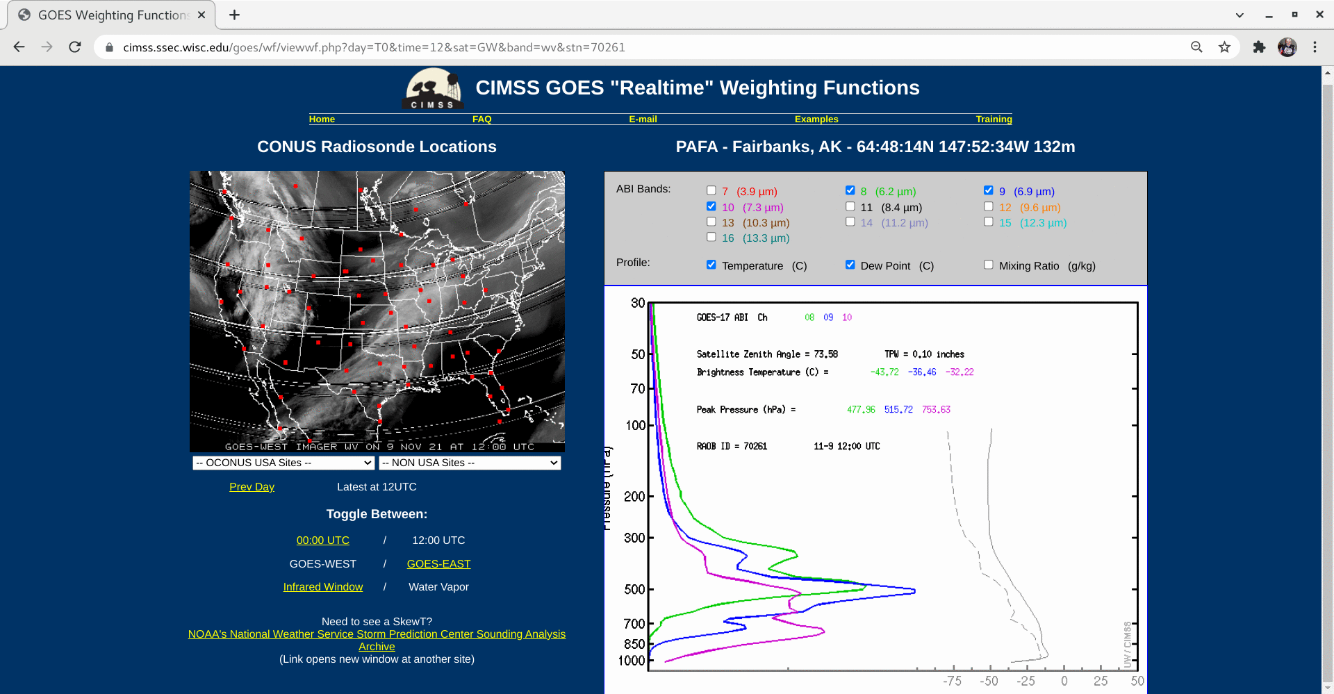 GOES-17 water vapor weighting functions for Fairbanks, Alaska [click to enlarge]
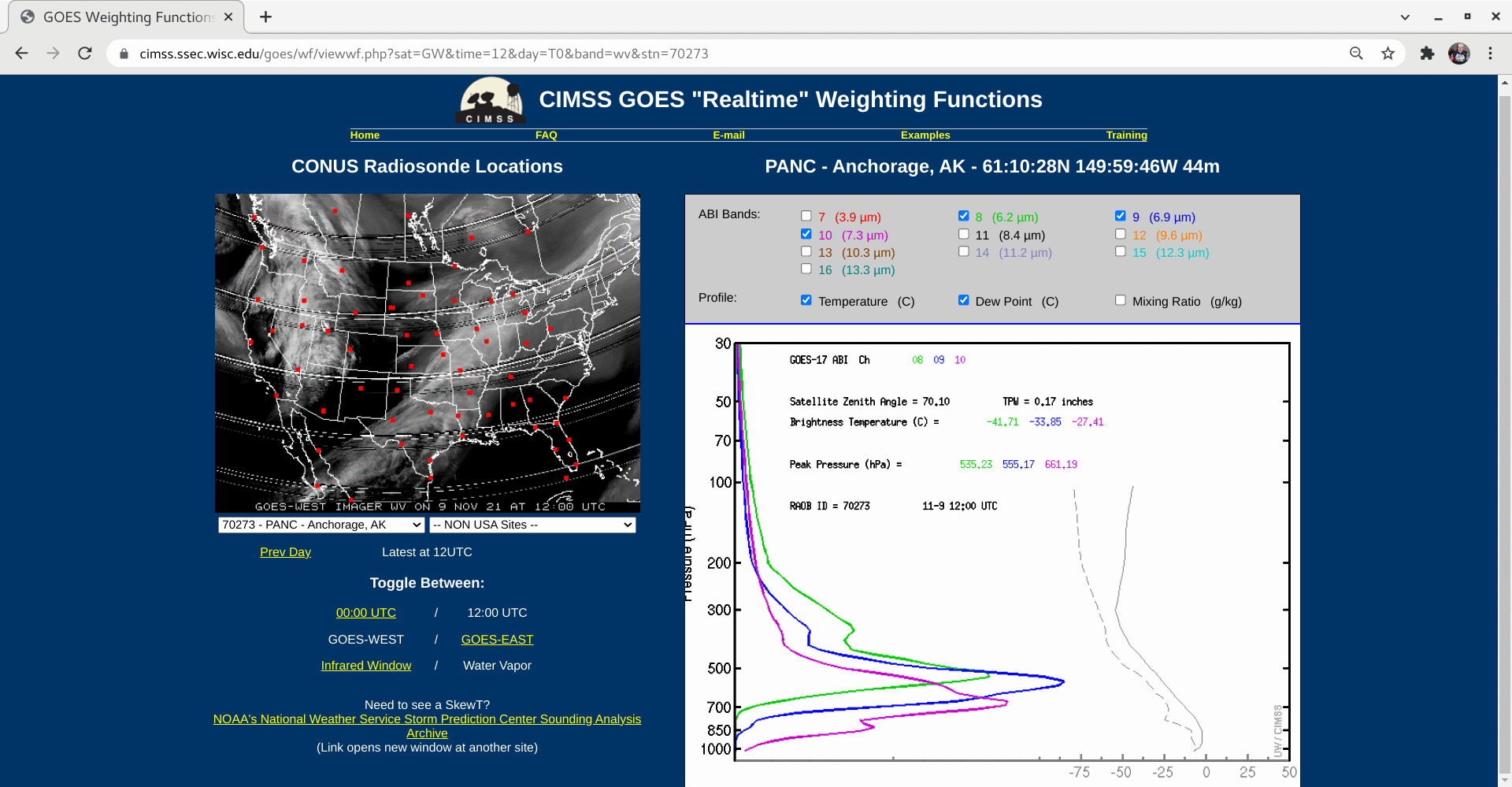
GOES-17 water vapor weighting functions for Anchorage, Alaska [click to enlarge]

Plots of GOES-17 parallax direction (green arrows) and parallax magnitude (km, red) for objects at altitudes of 15,000 and 30,000 feet (4.5 and 9.1 km) [click to enlarge]