Heavy rainfall and flash flooding in South Florida
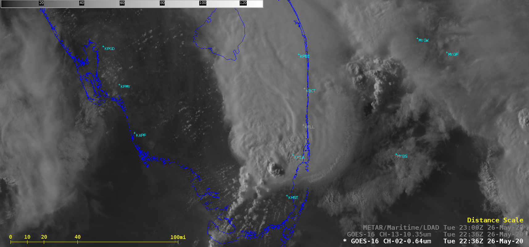
1-minute Mesoscale Domain Sector GOES-16 (GOES-East) “Red” Visible (0.64 µm) and “Clean” Infrared Window (10.35 µm) images (above) showed training and back-building thunderstorms that produced very heavy rainfall and flash flooding across parts of South Florida — particularly in the Miami (KMIA) area — on 26 May 2020. Pulsing overshooting tops were evident, with cloud-top infrared brightness temperatures... Read More
