Using NUCAPS to help nowcast Midwest convection

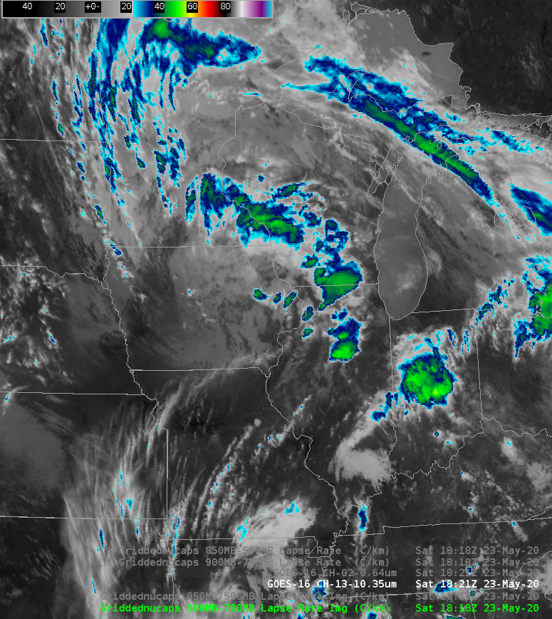
GOES-16 ABI Band 2 (0.64 µm) visible imagery at 1821 UTC 23 May 2020 (Click to enlarge)
The NOAA Storm Prediction Center’s Convective Outlook (graphic) from 1630 UTC 23 May 2020 shows an enhanced risk of Severe Thunderstorms in northern Illinois with a sharp cutoff in probabilities to the north in southern Wisconsin. The imagery above shows the GOES-16 ABI Band 2 (0.64 µm) visible imagery (click here for Band 13 (10.3 µm) Infrared Imagery), and it shows convection over northern Illinois/southern Wisconsin ahead of an obvious vorticity center in Iowa. How far north will the convection build?
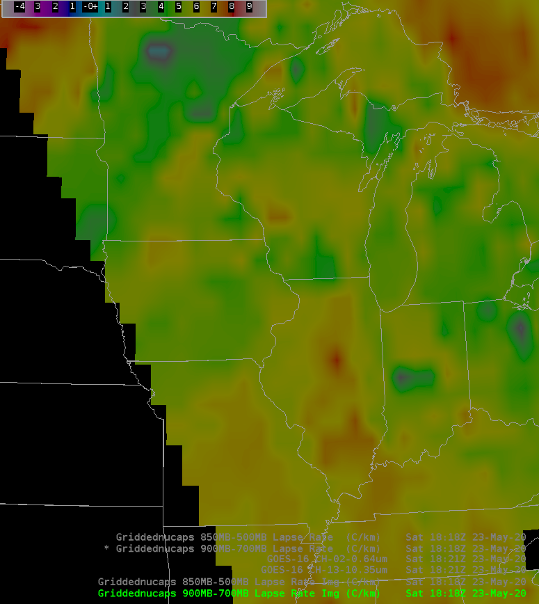
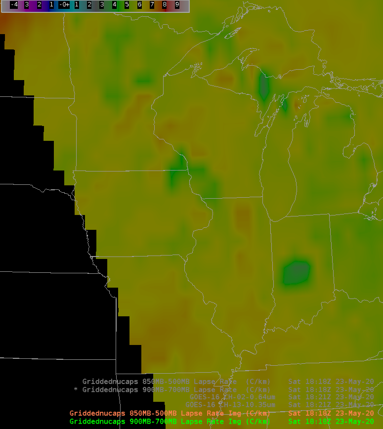
This question can be answered by considering lower-tropospheric (900-700) and mid-tropospheric (850-500) lapse rates diagnosed from the NUCAPS Profiles produced from the NOAA-20 pass over the Upper Midwest at ~1818 UTC (NOAA-20 orbit for this day shown here); these data were available within AWIPS by 1915 UTC!
The toggle below shows ABI Bands 2 and 13 (0.64 µm and 10.3 µm, respectively) as well as the lapse rates. The Lower Tropospheric lapse rates show a north-south gradient in stability, with air that is more stable over Wisconsin; convection over Illinois should weaken as it moves north. Mid-tropospheric lapse rates show a similar gradient in stability albeit less pronounced. (Click here to view the lower-tropospheric lapse rates overlain with NUCAPS sounding availability points from AWIPS, color-coded to show whether or not Infrared and/or microwave retrievals converged. Over southwest Wisconsin/northwest Illinois, perhaps you can argue that the gradient is influenced by soundings that did not converge; that argument would be harder to make over northcentral/northeast Illinois and southcentral/southeast Wisconsin).

GOES-16 ABI Bands 2 (0.64) and 13 (10.3) at 1821 UTC and Lower- and Mid-Tropospheric Layer Lapse Rates (900-700 and 850-500 mb, respectively) at nominal times of 1818 UTC over the upper Midwest (Click to enlarge)
This post is to remind you that satellite-derived retrieval data (independent of model data) is available in AWIPS in a timely manner to help you diagnose the thermodynamic state of the atmosphere. (Added: Storm reports for this event are here. Severe weather did cross into Wisconsin but was very close to the Illinois border).