This website works best with a newer web browser such as Chrome, Firefox, Safari or Microsoft Edge. Internet Explorer is not supported by this website.

Archive: Thu May 2022

Satellite-derived instability ahead of widespread severe winds over South Dakota and Minnesota

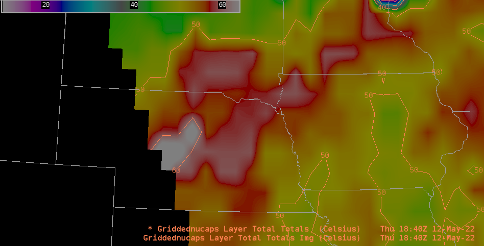
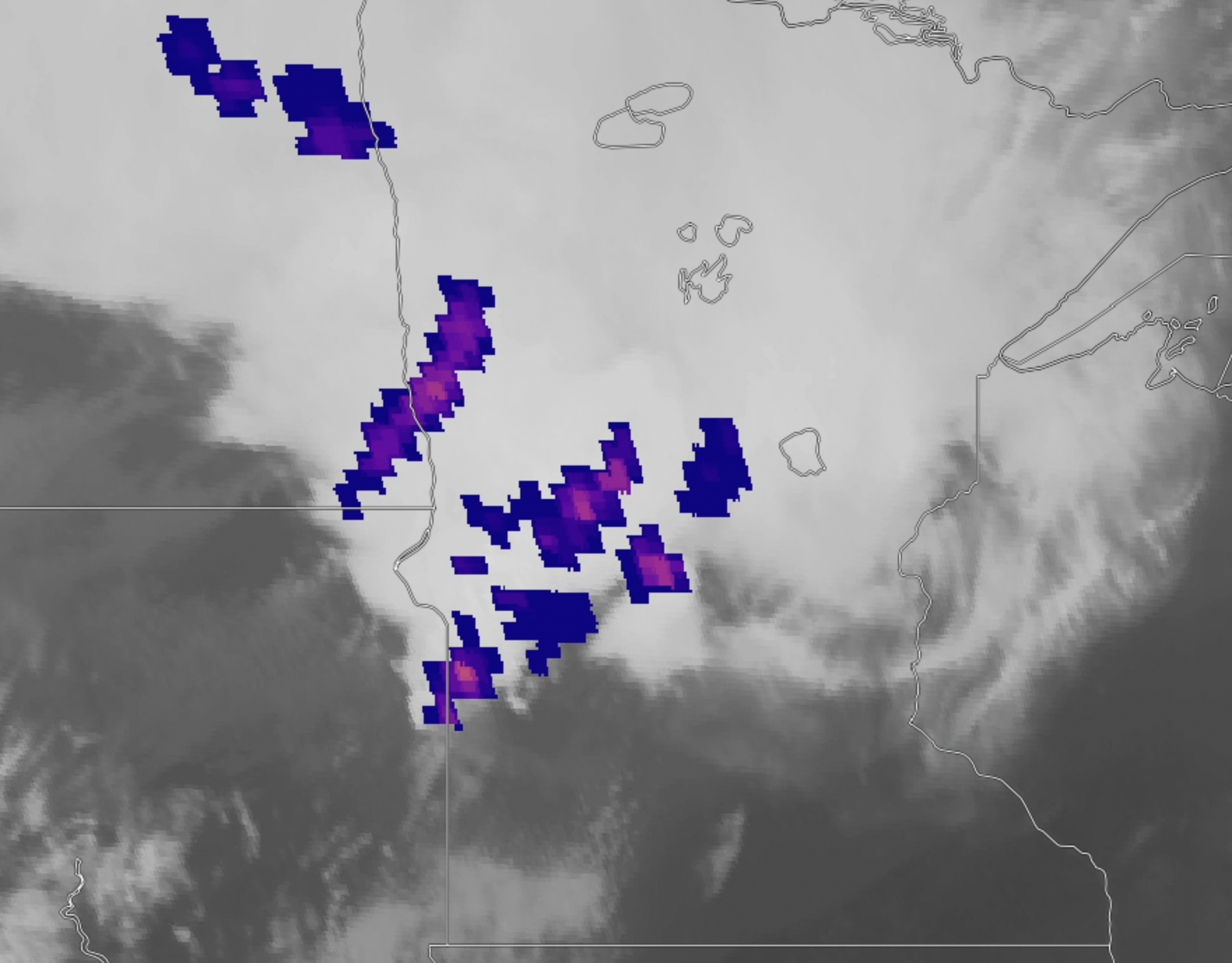
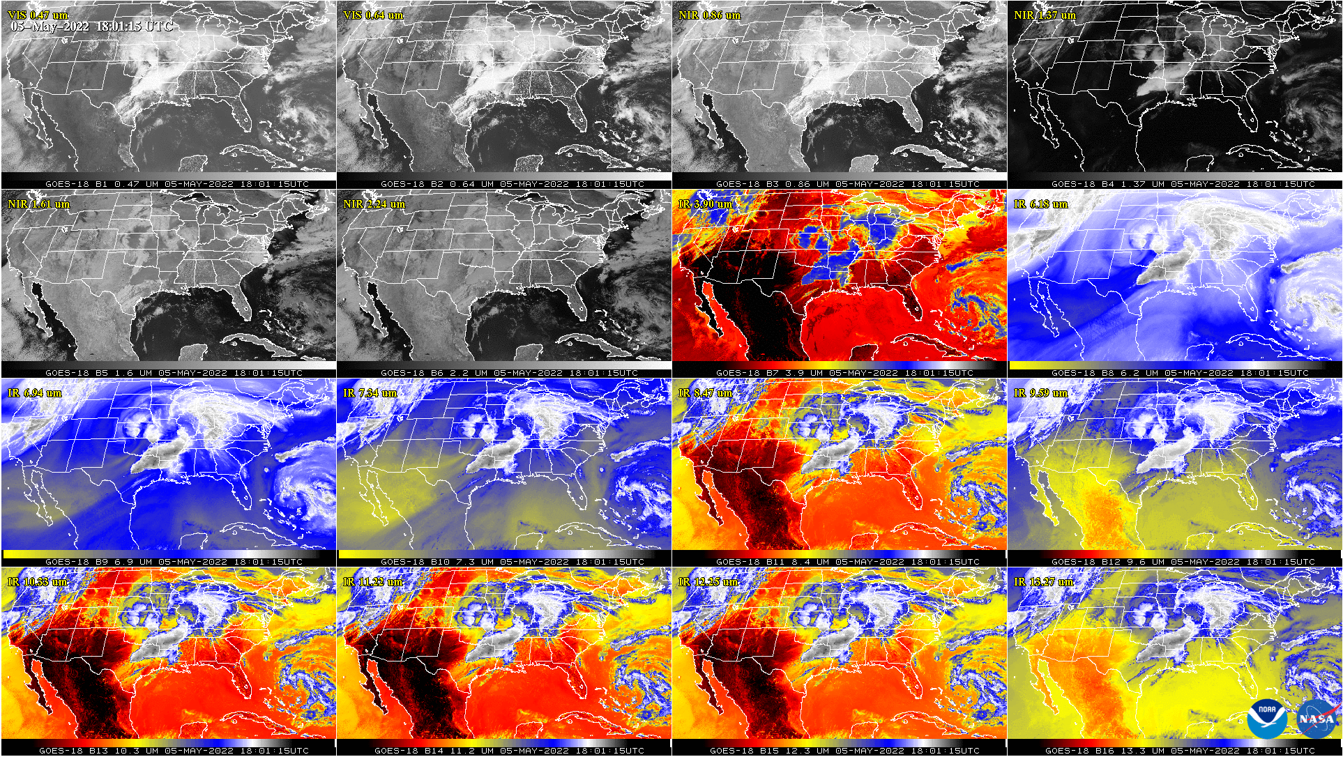
Storm Reports from SPC for 12 May 2022, (also shown below), show an extraordinary number of severe wind reports over eastern South Dakota and western Minnesota. Visible imagery from the CSPP Geosphere site, above, shows the convective system responsible for the widespread winds lifting northeastward out of Nebraska and moving over the Missouri River Valley.The animation below shows... Read More

Haboob over Nebraska on 05-12-22 seen by GOES-16

GOES-16 provided a view of a haboob over Nebraska on 05-12-2022. A haboob is an intense dust storm or “wall of dust” that occurs in dry conditions in high winds, which were recorded in Nebraska up to 80 mph. Haboobs can bring low visibility and even no-visibility blackouts that cause... Read More

GOES-16 GLM Lightning detection over Minnesota

Wednesday, 05-11-2022, brought storm damage and copious amounts of lightning over Minnesota and parts of South Dakota, Iowa, and Wisconsin. The GOES-16 Geostationary Lightning Mapper (GLM) detected the flash extent density over these areas. A NEXRAD radar composite shows a large bow echo signature around 05-12-2022 01:25Z that spanned the... Read More