Satellite-derived instability ahead of widespread severe winds over South Dakota and Minnesota
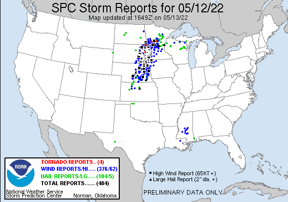
Storm Reports from SPC for 12 May 2022, (also shown below), show an extraordinary number of severe wind reports over eastern South Dakota and western Minnesota. Visible imagery from the CSPP Geosphere site, above, shows the convective system responsible for the widespread winds lifting northeastward out of Nebraska and moving over the Missouri River Valley.
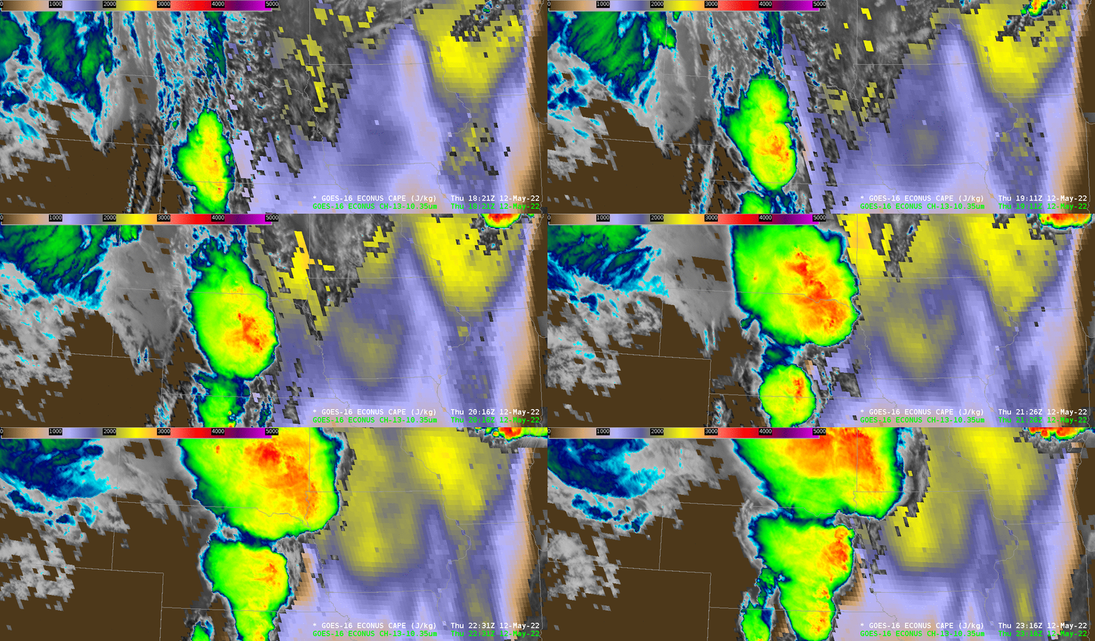
The animation below shows Clean Window infrared imagery (10.3 µm) overlain on top of Clear-sky only GOES-16 Derived Convective Available Potential Energy (CAPE). CAPE values increase into the mid-2000s (J/Kg) as the convection lifts toward the South Dakota/Minnesota border: abundant instability is present.
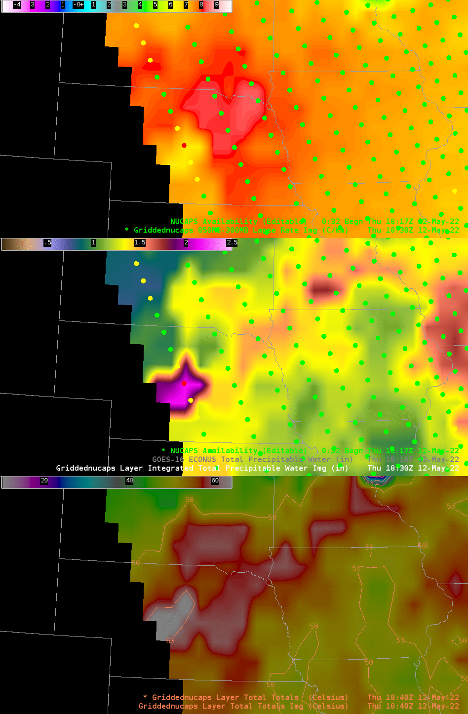
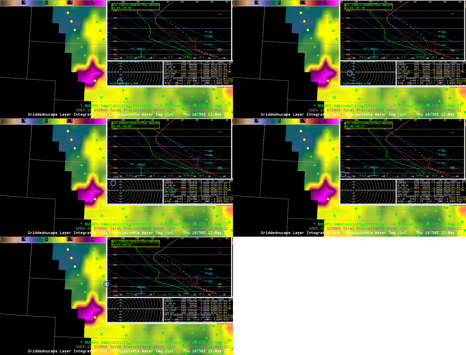
NOAA-20 overflew this area just after 1800 UTC, and the NUCAPS profiles derived from CrIS and ATMS on board that satellite tell a similar story of instability. Gridded fields of the 850-500 mb Lapse Rate, of Total Precipitable Water (TPW) and of the Total Totals Index, below, show a corridor of instability and moisture over extreme southeast South Dakota. Lapse rates are between 8 and 9o C/km, TPW values are near 1.5″, and Total Total Index values exceed 55! Convection moving towards this region and along this axis of instability would not be inhibited by the environment. NUCAPS Sounding Availability points shown in the image below are mostly green: the infrared retrievals converged to a solution.
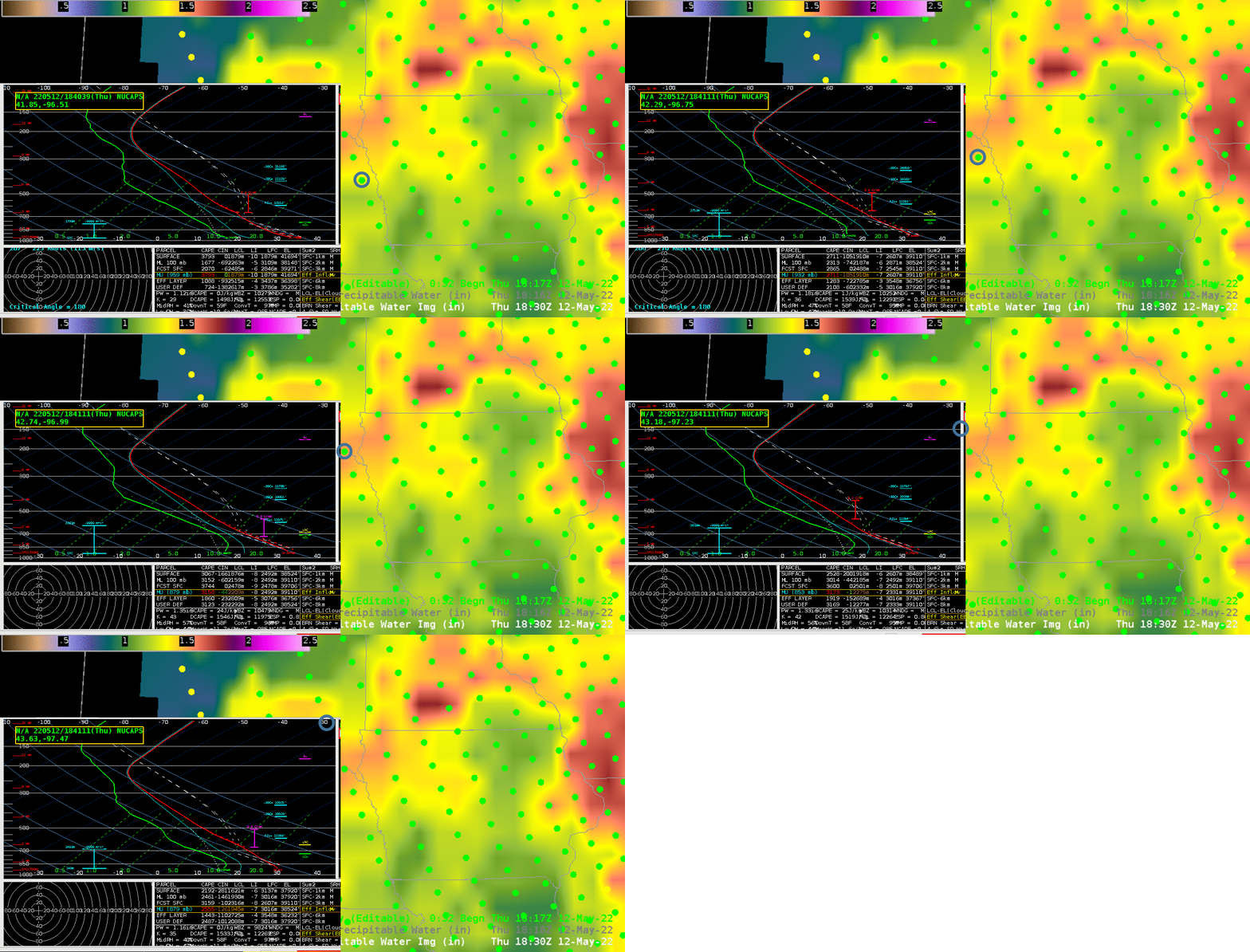
What do the individual NUCAPS Profiles look like? Two lines of profiles over eastern Nebraska are shown below. Sounding readout values from NSharp in AWIPS show large MUCAPS values, and a very well-mixed atmosphere.
AWIPS imagery in this post was created using the NOAA/TOWR-S AWIPS Cloud Instance.
________________________________________________________________________________
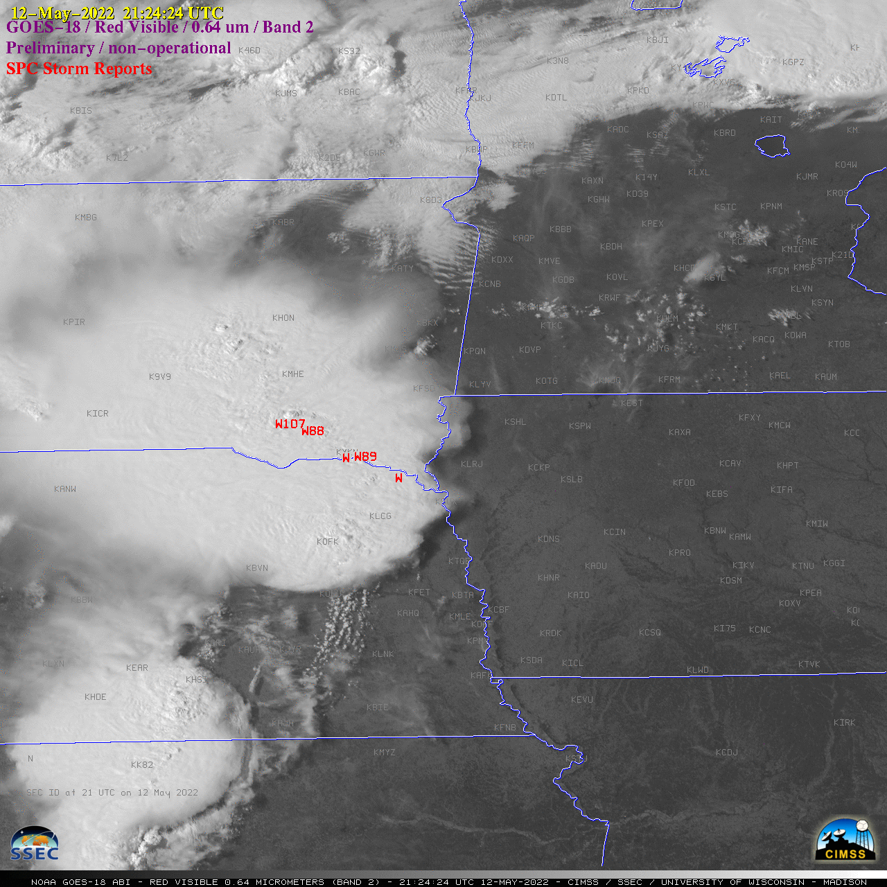
GOES-18 “Red” Visible (0.64 µm) images, with time-matched SPC Storm Reports plotted in red [click to play animated GIF | MP4]
1-minute Mesoscale Domain Sector GOES-18 “Red” Visible (0.64 µm) images with time-matched plots of SPC Storm Reports (above) showed the northeastward propagation of the derecho — along with a second Mesoscale Convective System in its wake — as it produced wind gusts as high as 107 mph in South Dakota (at 2125 UTC), hail as large as 2.50 inches in diameter in Nebraska (at 0007 UTC) and several tornadoes. Note that this early GOES-18 imagery is preliminary and non-operational.
The corresponding 1-minute GOES-18 “Clean” Infrared Window (10.35 µm) images (below) extend a bit past sunset — and revealed pulsing overshooting tops as cold as -70 to -75ºC (white pixels embedded within areas of black).
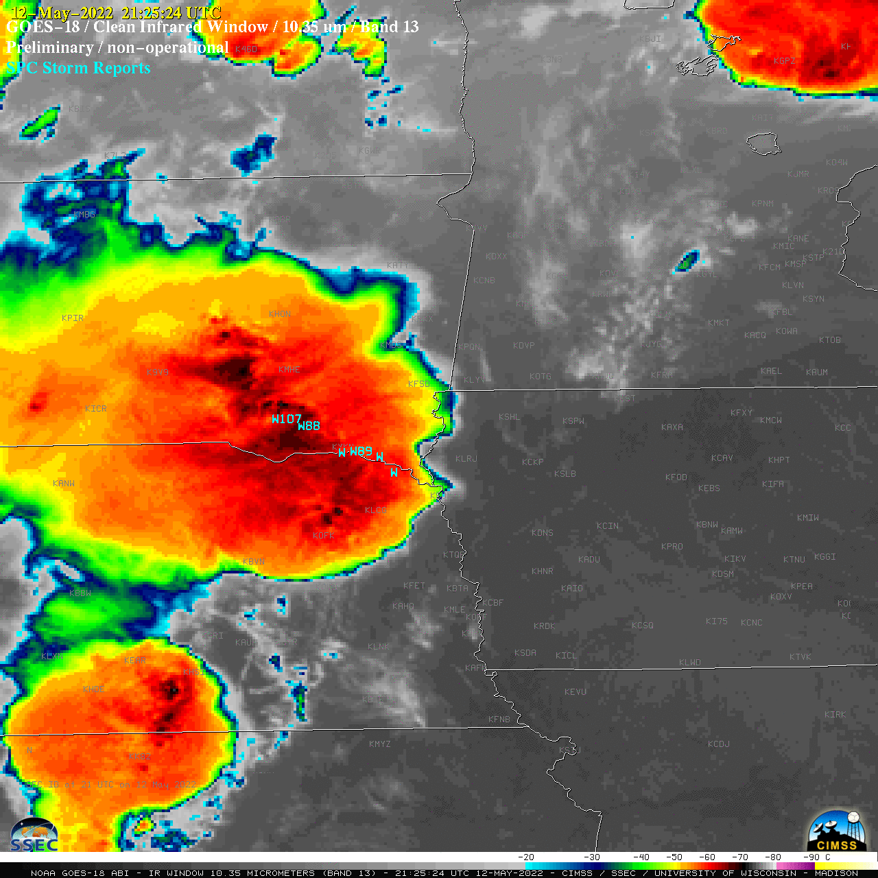
GOES-18 “Clean” Infrared Window (10.35 µm) images, with time-matched SPC Storm Reports plotted in cyan [click to play animated GIF | MP4]

