Archive: Thu May 2022
SAR data over Hawai’i
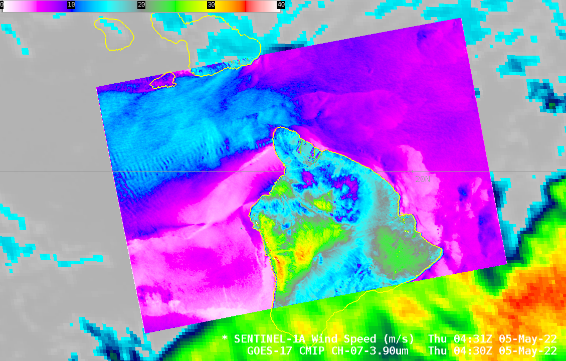
This NOAA/OSPO website shows regions where SAR data are available each day. SAR data can also be imported into AWIPS, as shown in the animation above, which animation has the SAR data overlain on top of GOES-17 Band 7 (Shortwave IR, 3.9 µm) data. Note that SAR winds are not valid... Read More
SAR Observations of Red River of the North Flooding
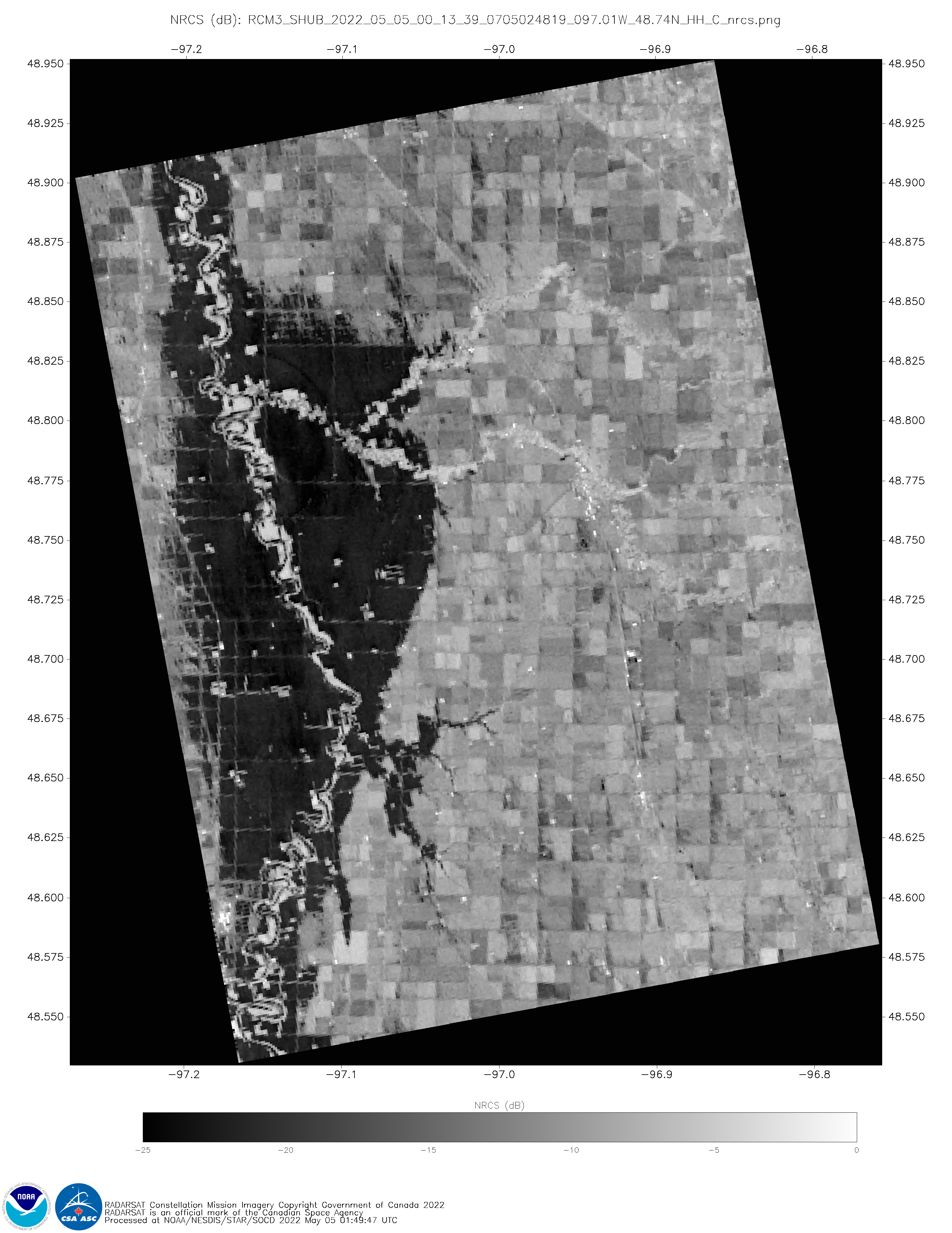
Data on this website (if you click through to 5 May 2022) shows regions where the RCM constellation has produced data. There are very small footprint scenes (shown below) over the Red River of the North, where flooding is ongoing (blog post 1; blog post 2). The Normalized Radar Cross Section (NRCS) imagery within those small footprints... Read More
