This website works best with a newer web browser such as Chrome, Firefox, Safari or Microsoft Edge. Internet Explorer is not supported by this website.

Archive: Aug 2021

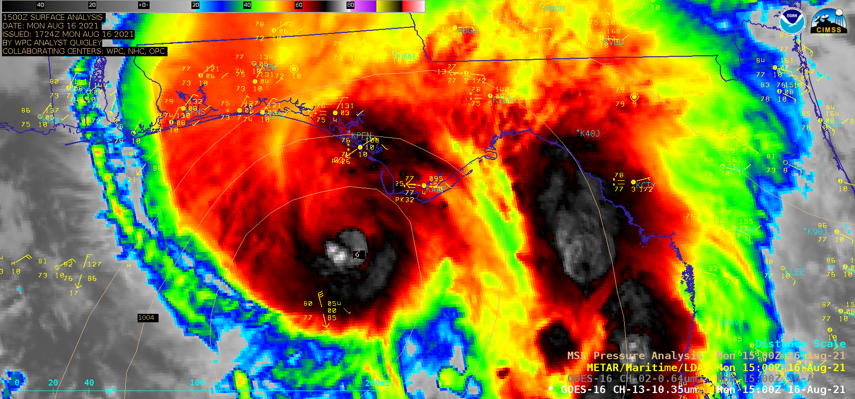
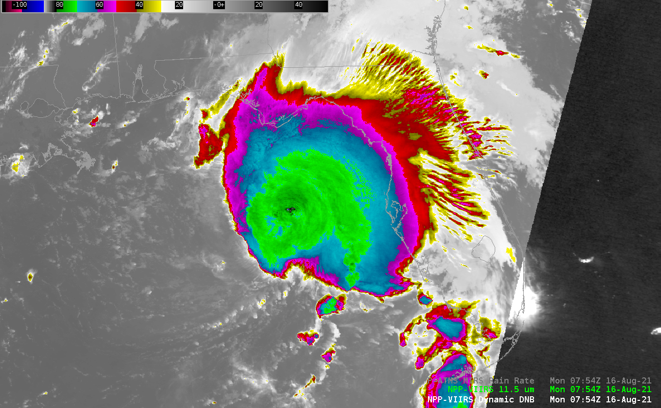
Tropical Storm Henri near Bermuda

GOES-16 “Cirrus” channel (1.38 µm) imagery, above, and visible (0.64 µm ), below, shows Tropical Storm Henri to the southeast of the island of Bermuda (at 32.3º N, 64.7º W) shortly after sunrise on 17 August 2021. The cirrus channel shows a compact region of convection and an expanding cirrus... Read More

Tropical Storm Fred makes landfall in Florida

1–minute Mesoscale Domain Sector GOES-16 (GOES-East) “Red” Visible (0.64 µm) and “Clean” Infrared Window (10.35 µm) images (above) showed Tropical Storm Fred during the 8-hour period leading up to it making landfall along the panhandle of Florida around 1915 UTC on 16 August 2021. Multiple convective bursts developed near the storm center, with some exhibiting cloud-top infrared brightness temperatures of -80ºC or colder (violet pixels).... Read More