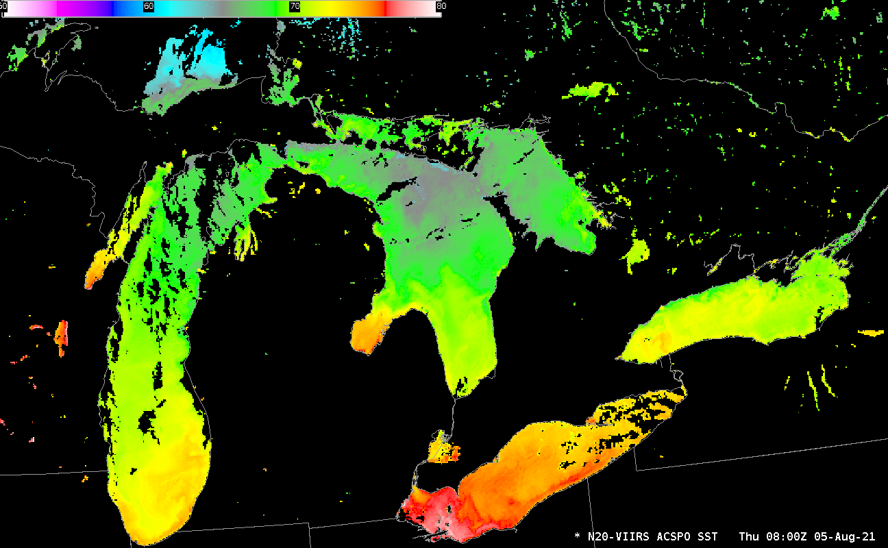
Comparing SAR data over Lake Superior to radar
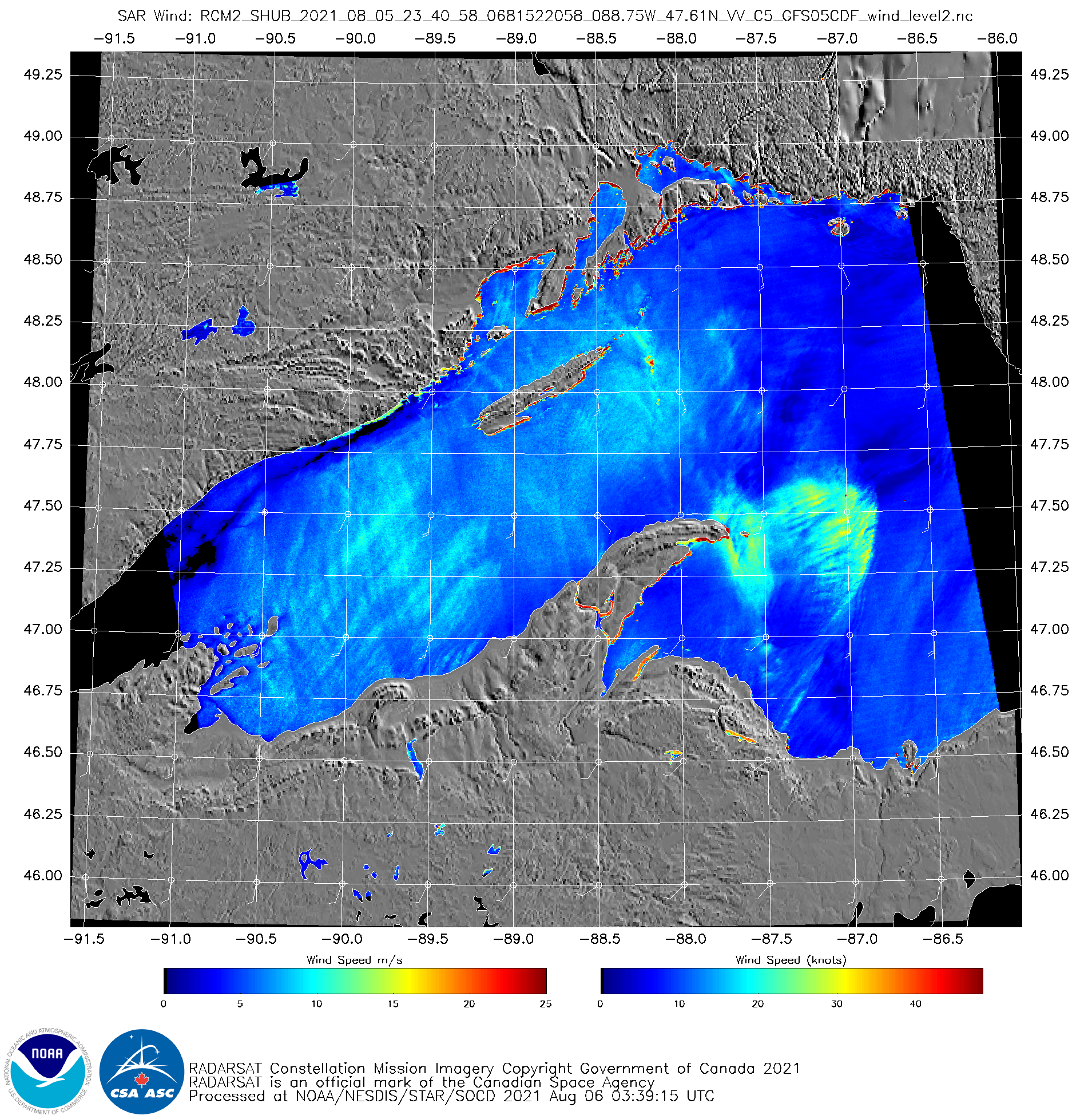
Synthetic Aperture Radar (SAR) winds are derived from a microwave signal pinged from a satellite; backscatter is converted into winds (given a background field that is typically from a numerical model). The wind structure here is suggestive of a bowing feature to a convective downdraft. How does it compare to... Read More