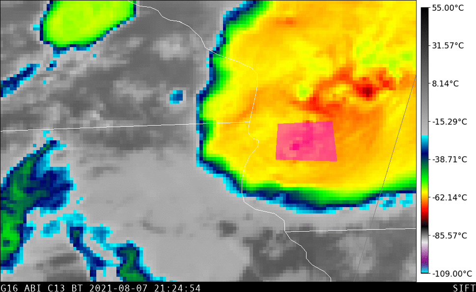
Day 32 of the Dixie Fire in California, as viewed from 5 satellites
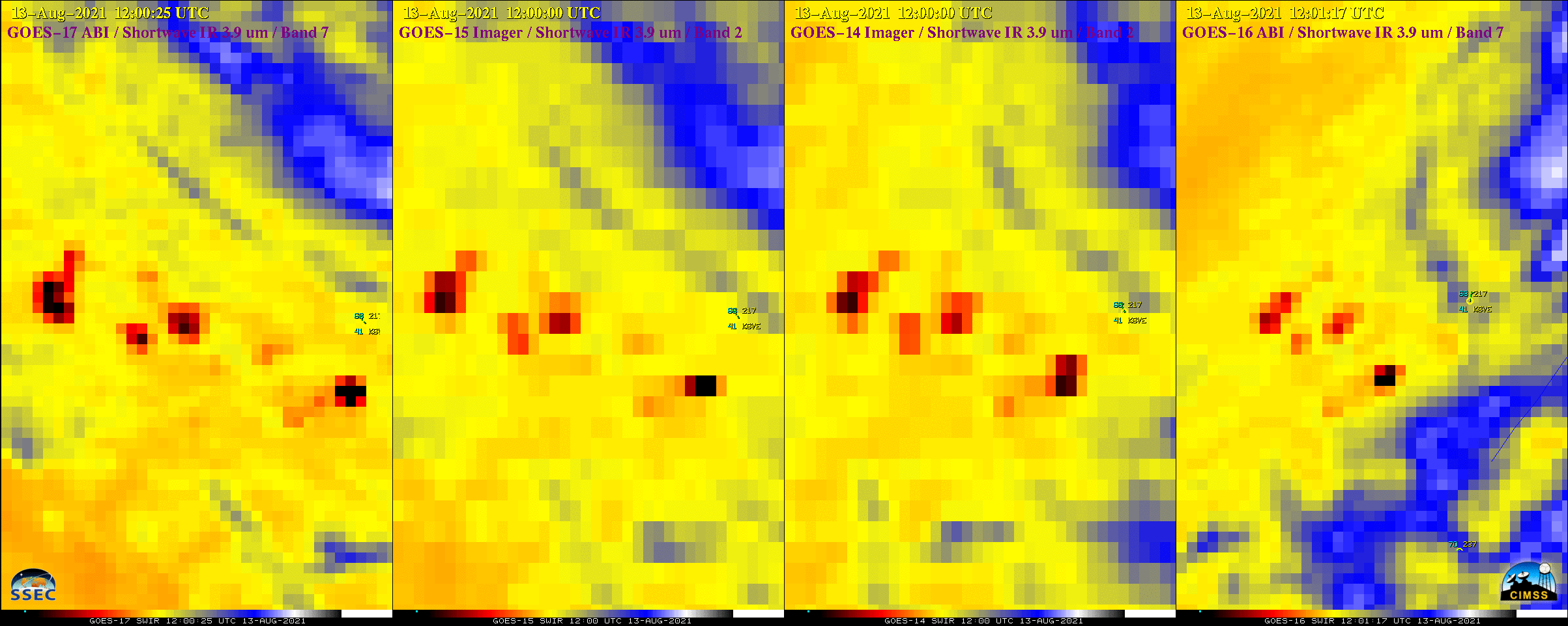
The Dixie Fire (which had grown to become the largest on record for the state of California) began burning on 13 July 2021 — and on 13 August 2021, Shortwave Infrared (3.9 µm) images from 1-minute GOES-17, 15 to 30-minute GOES-15, 15-to 30-minute GOES-14 and 5-minute GOES-16 (above) showed the thermal... Read More