This website works best with a newer web browser such as Chrome, Firefox, Safari or Microsoft Edge. Internet Explorer is not supported by this website.

Archive: Aug 2021

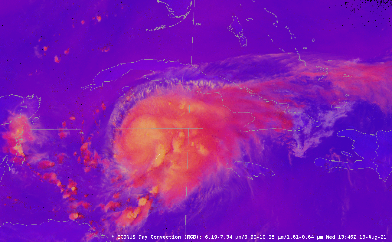
Tropical Storm Henri just north of the Bahamas

GOES-16 Visible Imagery, above, shows Tropical Storm Henri east of Florida and to the north of the Bahamas. Cirrus outflow is well-developed to the east and south, but the storm is sheared; the surface circulation is near the northwestern edge of the ongoing deep convection. Persistent northerly shear, as shown... Read More

Hurricane Grace in the Caribbean

Grace (then a tropical storm) is shown in AWIPS above, in between Jamaica and the Caymans, in Day Night Band Visible imagery, along with VIIRS I05 Infrared imagery, from 0626 UTC, using data from the Direct Broadcast site at CIMSS. The coldest cloud tops with the most vigorous convection, shown... Read More

Enhancing Smoke Detection with Red Visible imagery

Detection of smoke is a challenge in regions with clouds. The bright reflectance from clouds can make the subtler (and usually not so bright) smoke features difficult to view. This blog post briefly shows how visible imagery can be manipulated to facilitate smoke detection. The animation above shows visible imagery... Read More

Calfor Fire in California

The Caldor Fire (east of Sacramento, California) exhibited unprecedented growth on 17 August 2021 — increasing from 3600 acres burned in the morning to 30,000 acres that evening, with 0% containment — and Shortwave Infrared (3.9 µm) images from 1-minute GOES-17, 15 to 30-minute GOES-15, 15 to 30-minute GOES-14 and 5-minute GOES-16 (above)... Read More