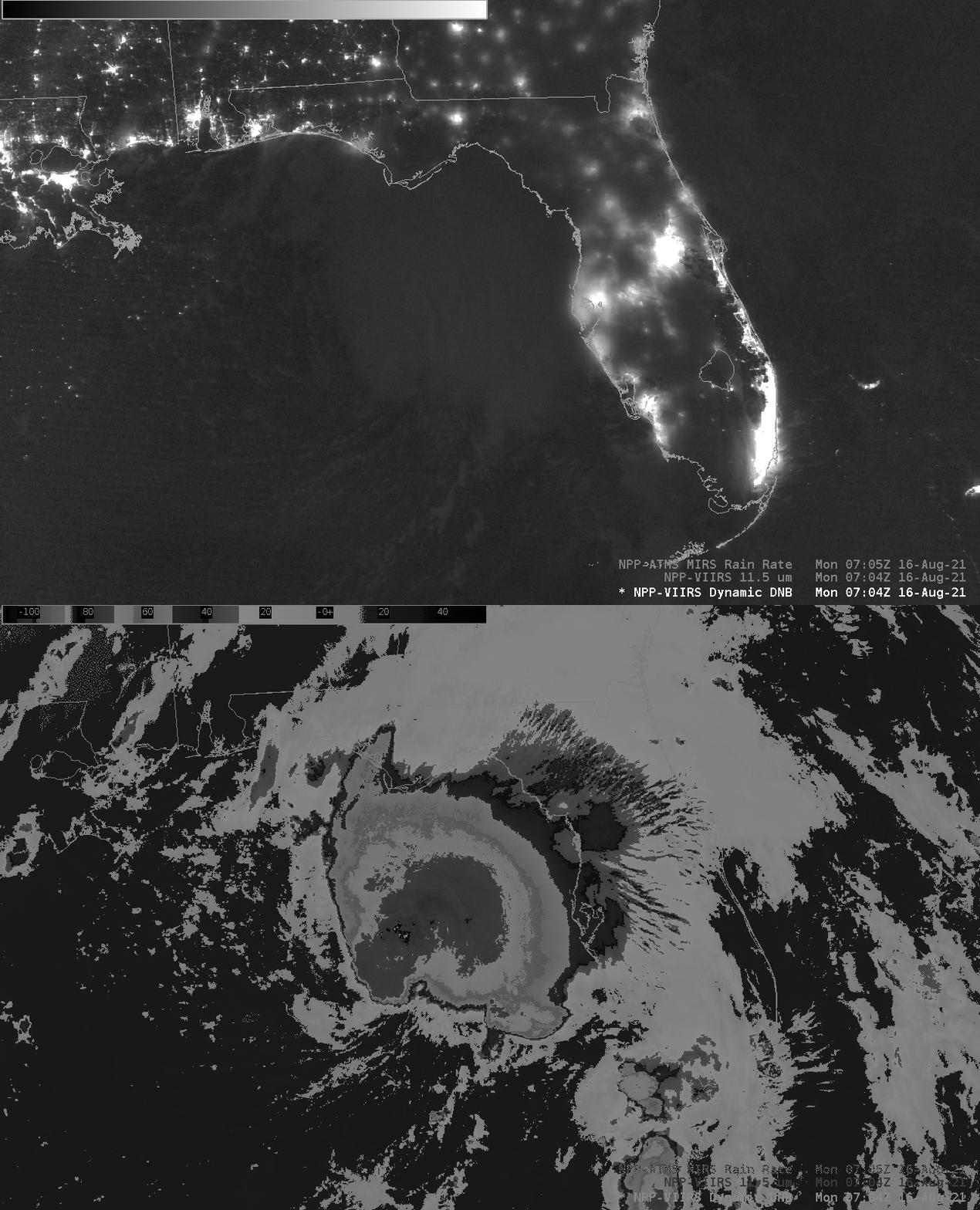
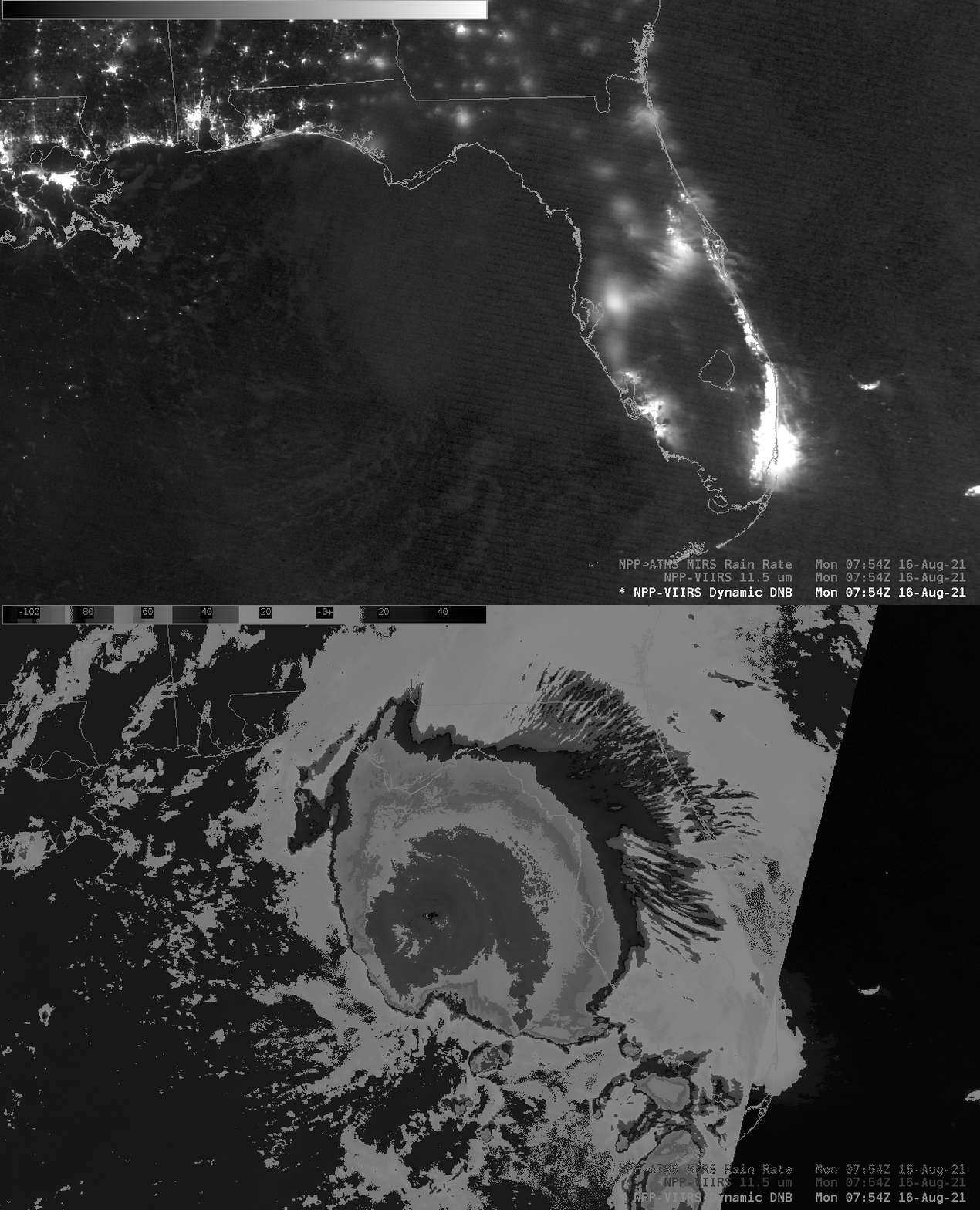
Overnight views of Tropical Storm Fred from NOAA-20 and Suomi-NPP

VIIRS Imagery from Suomi-NPP (the Day Night Band, at 0.7 µm and I05, at 11.5 µm, above, at 0704 UTC) and from NOAA-20 (the Day Night Band, at 0.7 µm and I05, at 11.5 µm, below, at 0754 UTC), show polar orbiting perspectives of Tropical Storm Fred. The Day Night Band shows little detail in the cloud-tops, given the lack of lunar illumination (the moon — about half-illuminated — was below the horizon during these overpasses). The region of coldest cloud tops seems to have decreased from the NPP to the NOAA-20 overpass. The NHC discussion at 0300 UTC suggested that the low-level circulation had emerged from underneath the cirrus canopy, and perhaps that’s detectable in the toggles above and below. The storm does exist under southwesterly shear (morning analysis from the CIMSS Tropical Website).

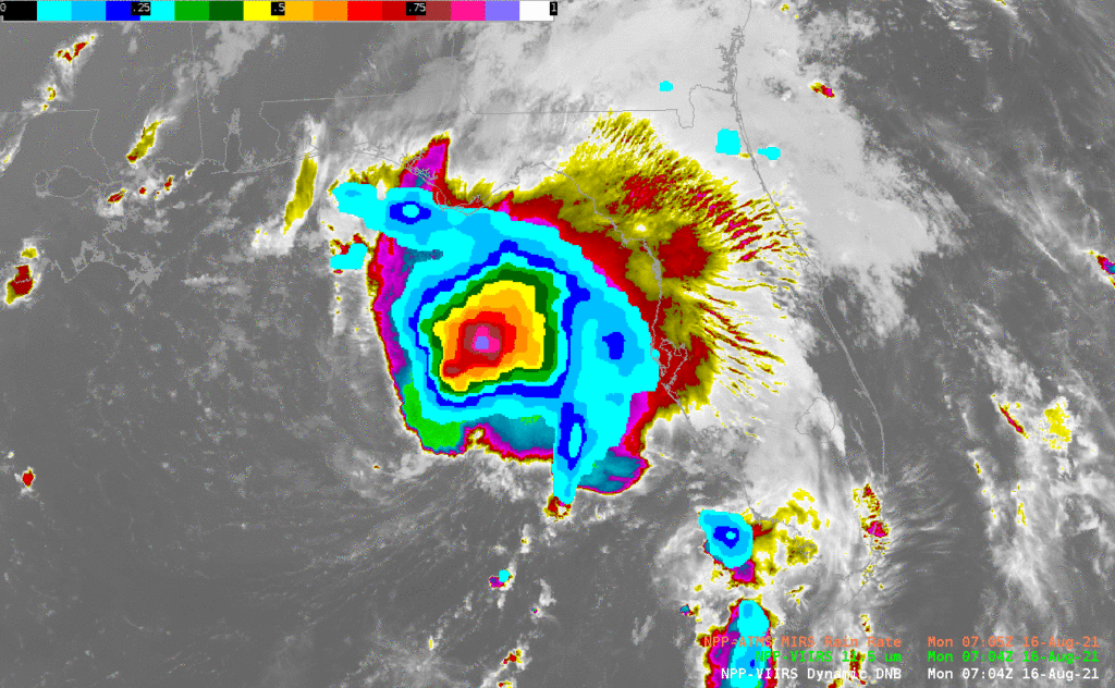
Microwave data from the Advanced Technology Microwave Sounder (ATMS) on board both Suomi-NPP and NOAA-20 can be used to compute a rain rate, as shown below. The Rain Rate snapshots show a decrease in intensity between 0704 (a maximum of about 0.9″/hour) and 0754 UTC (a maximum of 0.5″/hour). That information, combined with the lack of observed lightning in the Day Night Band, might help guide an analyst in their description of the storm strength. Consider, however, that NPP had a near-nadir view whereas NOAA-20 was an edge view.

VIIRS imagery and the ATMS Rain Rate is available in AWIPS-ready tiles via the CIMSS ldm feed. Imagery from Polar Orbiters over Fred (and Grace, and TD #8 (now Henri) in the Atlantic) is also available from the AOML Direct Broadcast link here.
For more information on Tropical Storm Fred, refer to the National Hurricane Center. Fred is forecast to make landfall on the Florida panhandle on 16 August.

