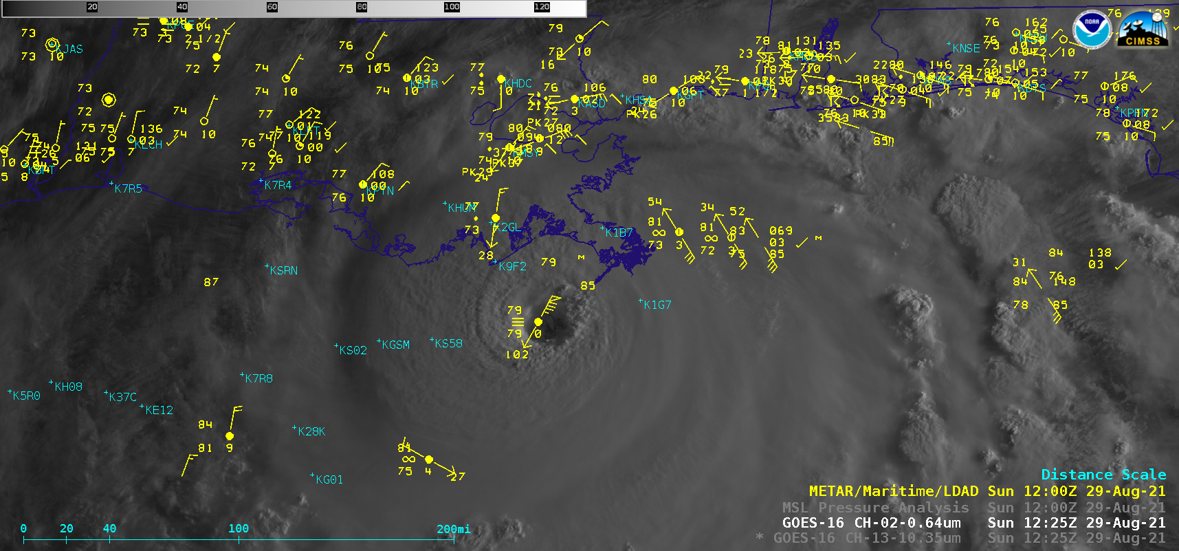
Hurricane Ida develops an eye over the Gulf of Mexico, as intensification continues until landfall

1-–minute Mesoscale Domain Sector GOES-16 (GOES-East) “Red” Visible (0.64 µm) and “Clean” Infrared Window (10.35 µm) images (above) showed that Hurricane Ida gradually developed an eye, as the Category 1 storm intensified to Category 2 by 1800 UTC on 28 August 2021.Microwave (85 GHz) images from DMSP-17 (above) and DMSP-16 (below) — from the CIMSS Tropical Cyclones site — provided 2 views of the eye... Read More


