Tropical Storm Henri just north of the Bahamas
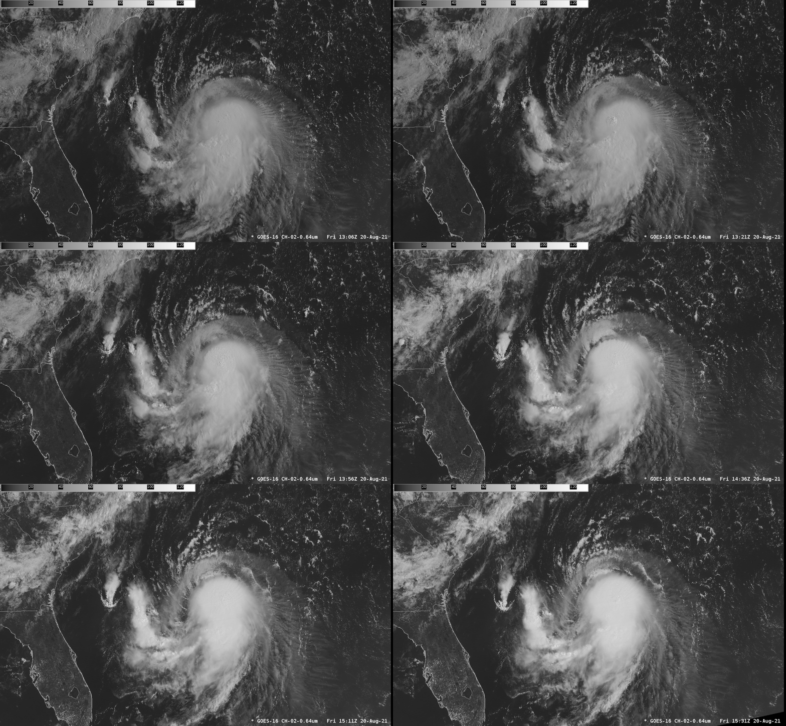
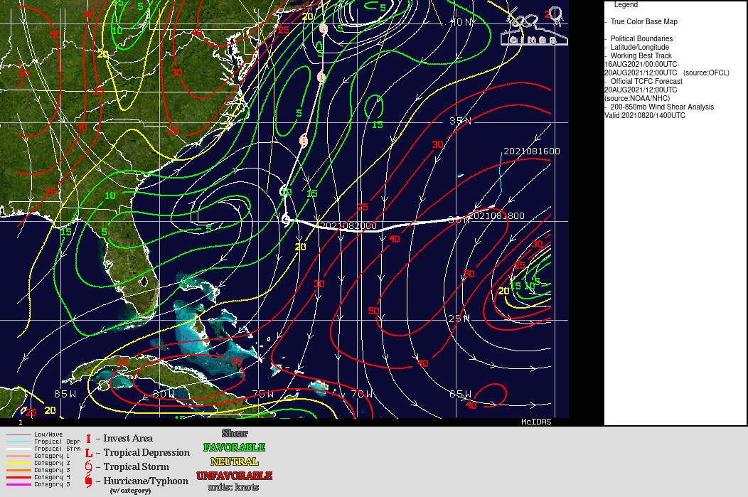
GOES-16 Visible Imagery, above, shows Tropical Storm Henri east of Florida and to the north of the Bahamas. Cirrus outflow is well-developed to the east and south, but the storm is sheared; the surface circulation is near the northwestern edge of the ongoing deep convection. Persistent northerly shear, as shown below in a figure taken from the CIMSS Tropical Website, shows Henri moving from a region of relatively high shear towards a region of relatively smaller shear.
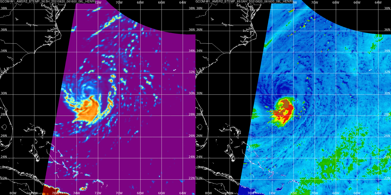
GCOM-W1 overflew Henri at 0616 UTC on 20 August. Microwave imagery, below, (retrieved from the AOML Direct Broadcast site) confirm the sheared nature of the storm at that time. Both frequencies show that deep convection is displaced to the south of the storm center.
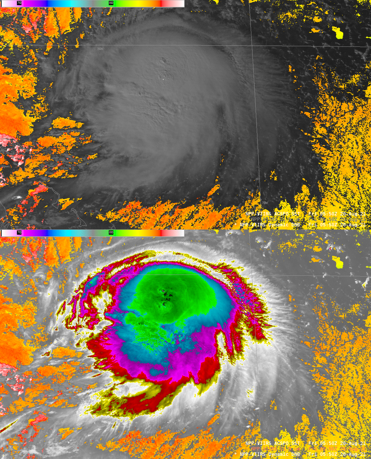
Suomi NPP overflew the storm at around 0600 UTC, and the toggle below shows the Day Night band visible (0.7 µm) imagery and the I05 infrared (11.5 µm) imagery; included in the toggle are Advanced Clear Sky Processor for Oceans (ACSPO) SST values in clear regions. Atlantic Ocean waters have surface temperatures in the 84-85º F range. Cloud top temperatures are as cold as -86º F for this overpass. (Suomi NPP VIIRS data were processed at the CIMSS Direct Broadcast site and injected into AWIPS).
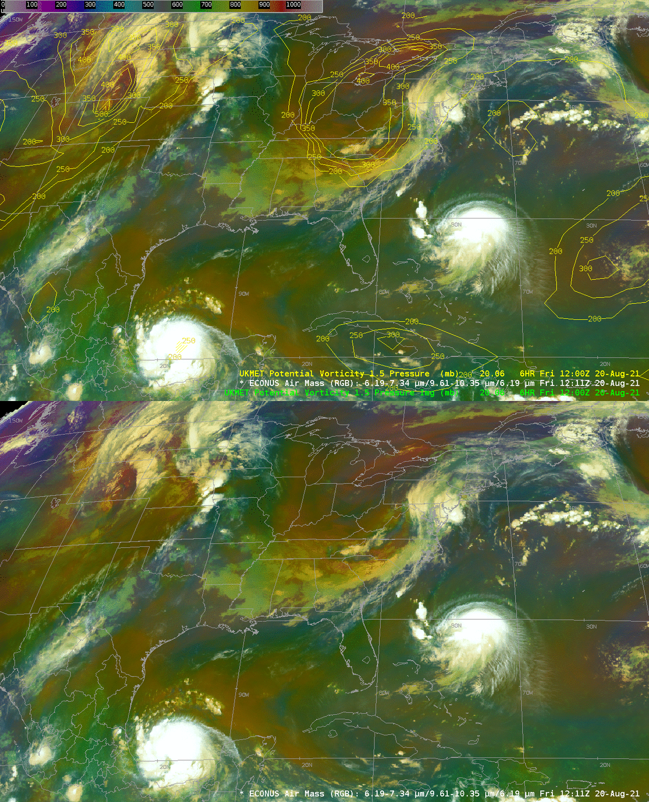
The animation of the Airmass RGB, below, shows a prominent feature over the mid-Atlantic states of the United States that will have a big role in Henri’s future path: a mid-tropospheric potential vorticity maximum highlighted as red/orange in the Airmass RGB. The toggle at bottom compares the 1211 UTC Airmass RGB with contours of pressure (mb) on the 1.5 PVU surface.
For the latest on Henri, refer to the National Hurricane Center Website. Residents of southern New England and Long Island and New Jersey in particular should pay close attention to this storm.

