Hurricane Grace in the Caribbean
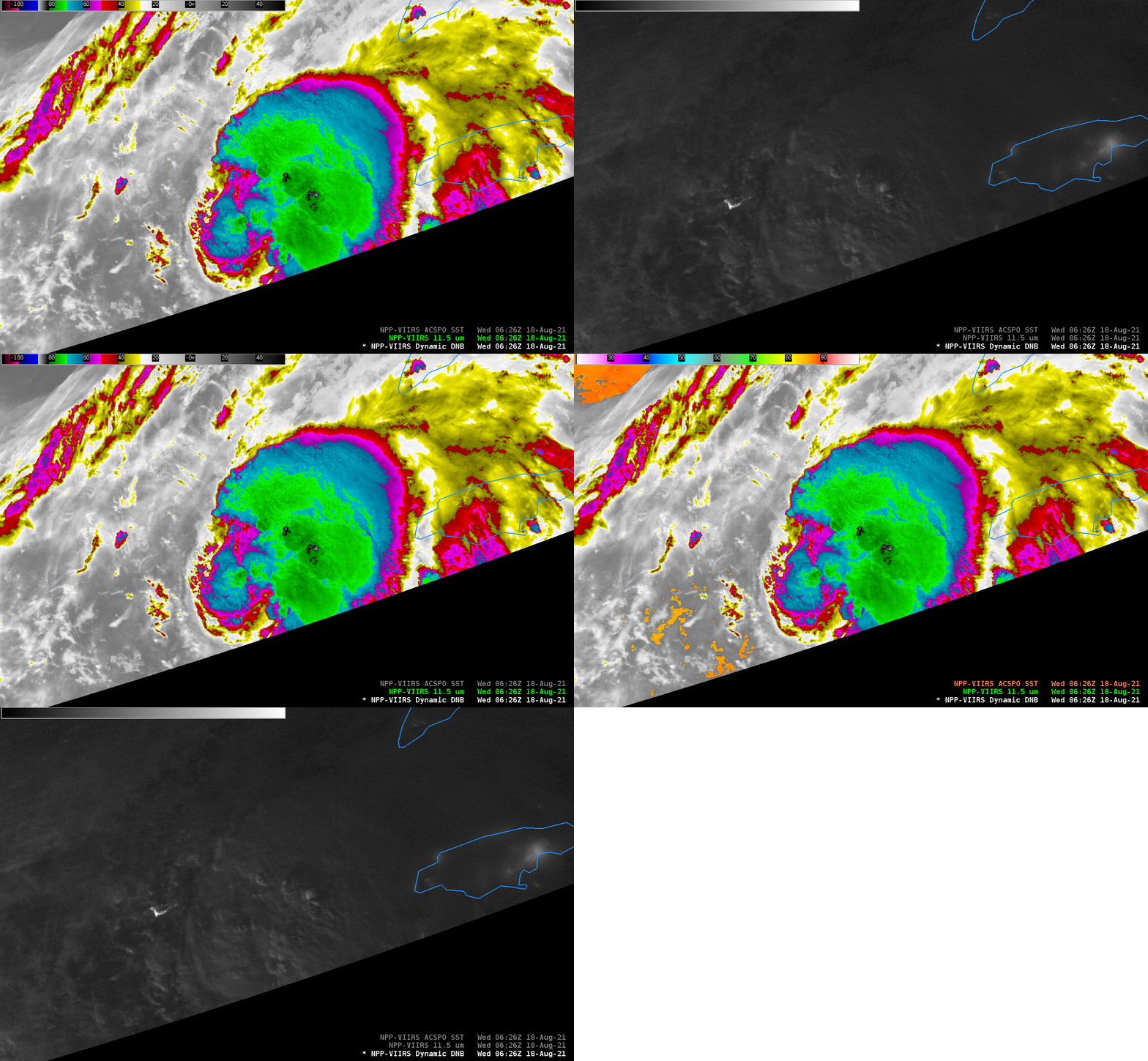
Grace (then a tropical storm) is shown in AWIPS above, in between Jamaica and the Caymans, in Day Night Band Visible imagery, along with VIIRS I05 Infrared imagery, from 0626 UTC, using data from the Direct Broadcast site at CIMSS. The coldest cloud tops with the most vigorous convection, shown as white/blue in the color enhancement, are near -89º C. The visible imagery has sufficient lunar illumination (more than on Monday 16 August with Fred!) that the tallest cloud tops are casting shadows. The few cloud-free pixels that are present allow ACSPO sea-surface temperatures to be computed: 30º C or 86º F.
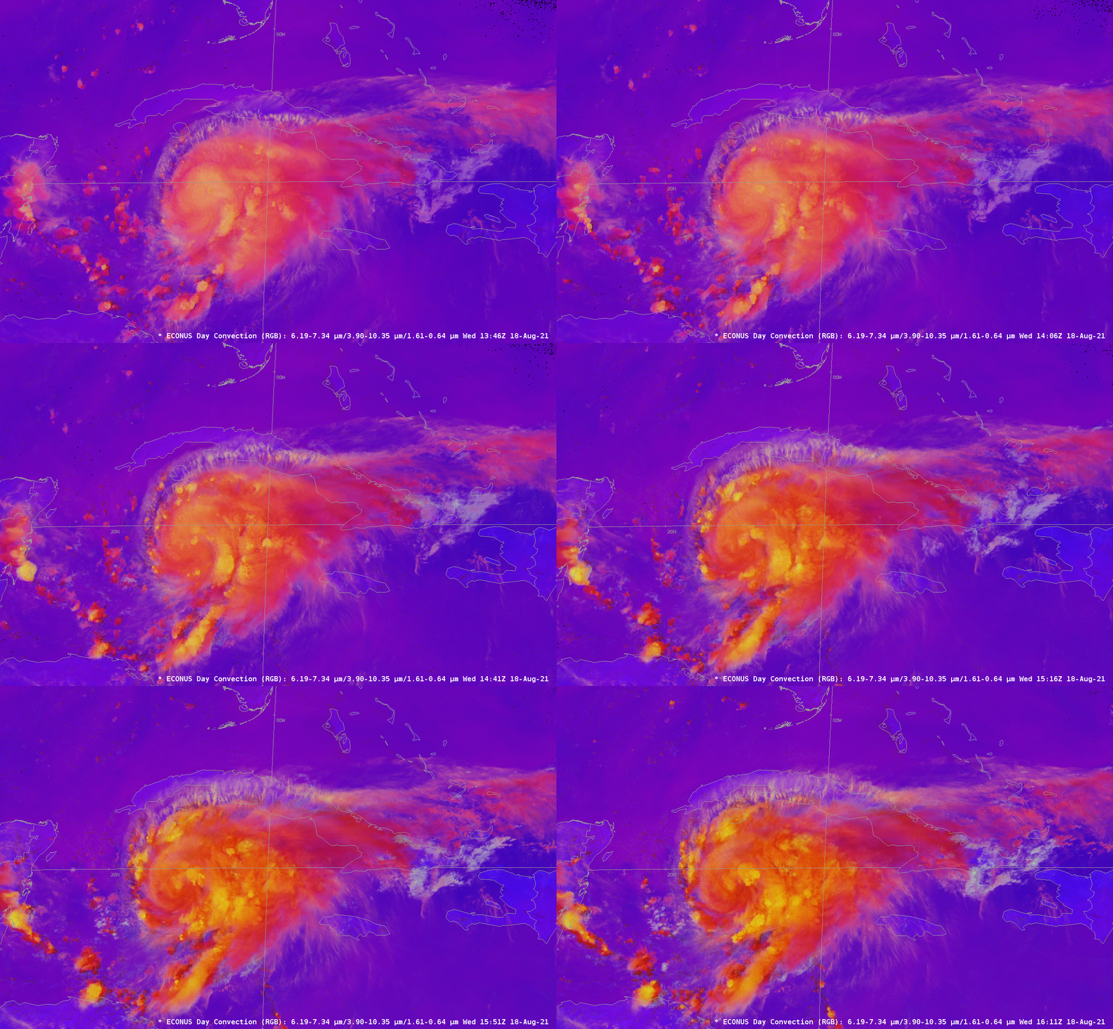
NOAA-20 and Suomi-NPP give infrequent views of the storm. GOES-16 is the better choice for storm monitoring. The animation below shows the Convection RGB over the storm. The Convection RGB is useful because it can highlight regions of vigorous convection (in orange/yellow). The RGB highlights convective banding near the center of the storm and also on the periphery of the storm.
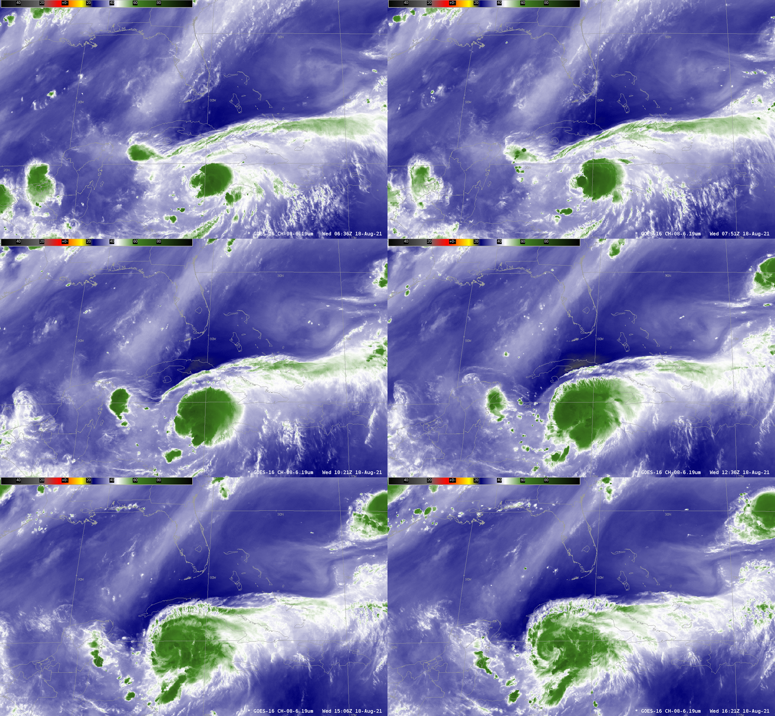
GOES-16 Water Vapor imagery, below, shows the environment in which the storm is forming. The upper-level water vapor imagery, 6.19 , below, begins near the time of the Suomi-NPP overpass (imagery shown above)and continues until about 1600 UTC. It shows a rapid organization to the storm — certainly the satellite presentation changes over the 10 hours of this animation! There does seem to be dry air to the north of Grace, just north of Cuba. How that affects the storm in the future is to be determined.
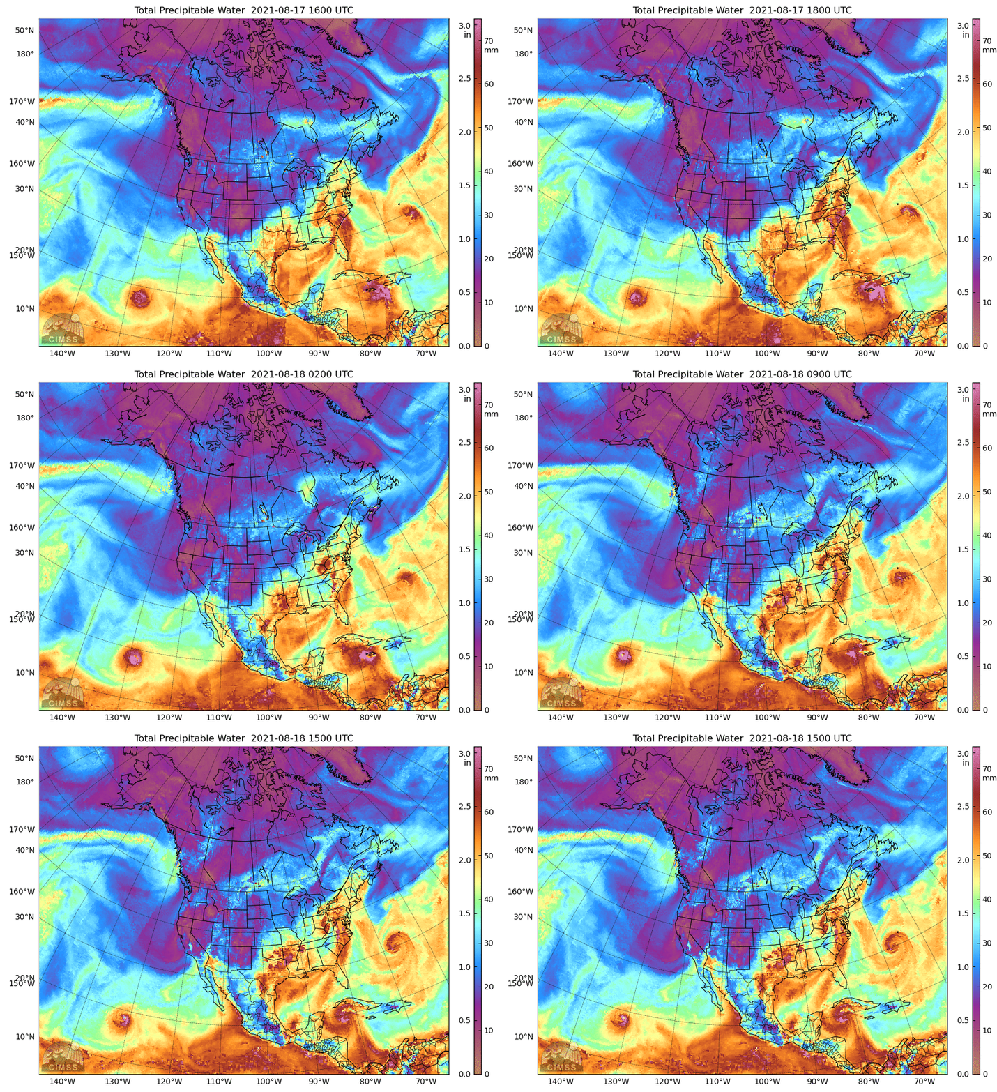
Total Precipitable Water fields, below, for the 24 hours endings at 1500 UTC on 18 August, also show some dry air near the storm. However, Grace has access to plenty of moisture in the near term. Tropical storm Henri, Pacific Hurricane Linda, and the remains of Fred are also apparent in the imagery.
Grace is in an environment of low shear, and is over very warm water, as shown in this image, a 1500 UTC 200-850 mb shear and SST analysis taken from the CIMSS Tropical Website.
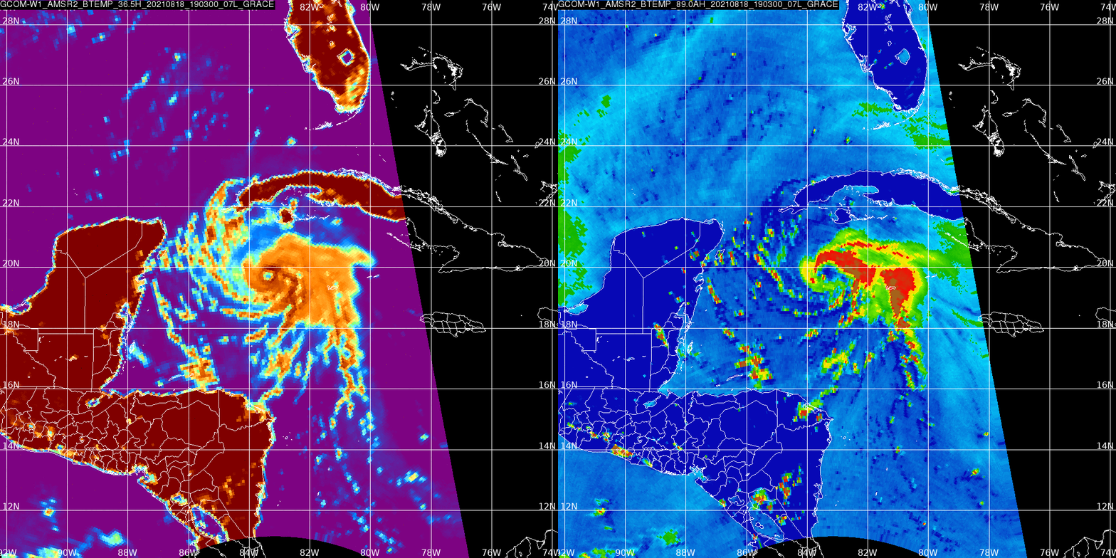
JAXA‘s GCOM-W1 satellite, carrying the AMSR-2 instrument, overflew Grace near 1900 UTC on 18 August, and imagery (taken from the AOML Direct Broadcast website) from 36.5 and 89.0 GHz is shown above (note that 89.0 GHz imagery is used in MIMIC-TC imagery available at the CIMSS Tropical Website). Both microwave representations show a distinct eye in the storm, most especially at lower levels.
True-Color imagery from CSPP Geosphere, below, shows convection persistently developing around the storm center as it moves through the northwest Caribbean towards the Yucatán Peninsula.
More information on Grace is available at the National Hurricane Center.

