This website works best with a newer web browser such as Chrome, Firefox, Safari or Microsoft Edge. Internet Explorer is not supported by this website.

Archive: Jul 2021

Pyrocumulonimbus clouds with lightning produced by the Dixie Fire in California

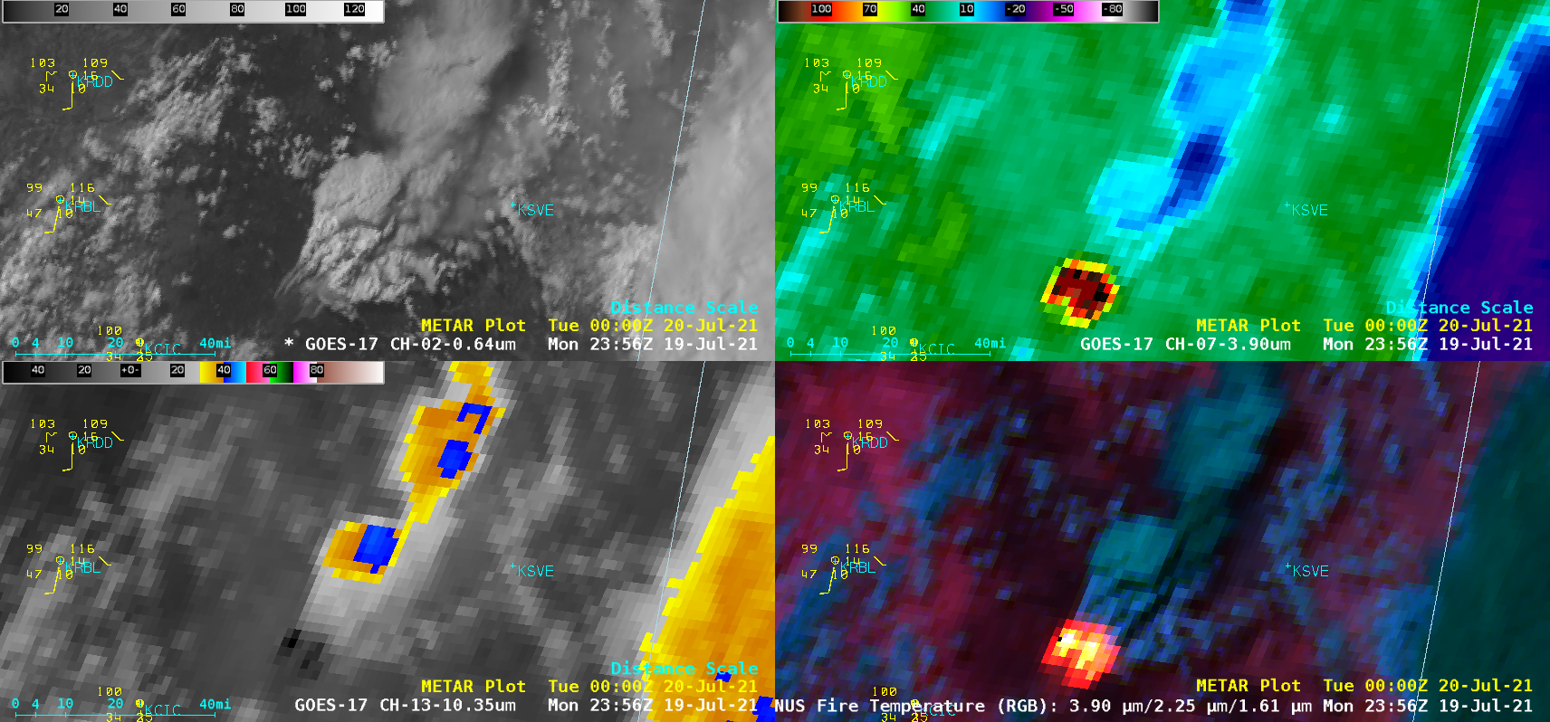
5-minute GOES-17 (GOES-West) “Red” Visible (0.64 µm), Shortwave Infrared (3.9 µm), “Clean” Infrared Window (10.35 µm) and Fire Temperature RGB images (above) revealed that the Dixie Fire in northern California produced a pair of pyrocumulonimbus (pyroCb) clouds — denoted by cloud-top 10.35 µm infrared brightness temperatures of -40ºC or colder (shades of blue pixels) — late in the day on 19 July 2021.... Read More

Forecasting lightning

Lightning safety is important for aircraft, mariners, and many outdoor activities. CIMSS is working to evaluate a model that nowcasts lightning. This model was trained using GOES-16 ABI visible, near-infrared, and long-wave infrared channels, as well as GOES-16 Geostationary Lightning Mapper (GLM) observations. It predicts the probability of lightning (IC... Read More

Pyrocumulonimbus cloud produced by the Bootleg Fire in Oregon

1-minute Mesoscale Domain Sector GOES-17 (GOES-West) “Red” Visible (0.64 µm), Shortwave Infrared (3.9 µm), “Clean” Infrared Window (10.35 µm) and Fire Temperature RGB images (above) revealed that the Bootleg Fire in far southern Oregon produced a pyrocumulonimbus (pyroCb) cloud — denoted by cloud-top 10.35 µm infrared brightness temperatures of -40ºC and colder (darker blue pixels) — late in the day... Read More