This website works best with a newer web browser such as Chrome, Firefox, Safari or Microsoft Edge. Internet Explorer is not supported by this website.

Archive: Jun 2021

Pyrocumulonimbus clouds over British Columbia and California

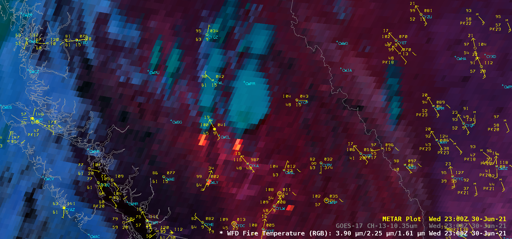
GOES-17 (GOES-West) “Red” Visible (0.64 µm), Shortwave Infrared (3.9 µm) and “Clean” Infrared Window (10.35 µm) images (above) showed the explosive formation of large pyrocumulonimbus (pyroCb) clouds that were spawned by large wildfires in British Columbia, Canada on 30 June 2021. The 10.35 µm cloud-top infrared brightness temperatures rapidly cooled to the -50 to -60ºC range,... Read More

Subtropical storm Raoni off the coast of South America

GOES-16 (GOES-East) “Red” Visible (0.64 µm) images (above) showed the circulation of Subtropical Storm Raoni (discussion issued by MARINHA) off the coast of Argentina/Uruguay on 28 June 2021.In the corresponding GOES-16 “Clean” Infrared Window (10.35 µm) images (below), the coldest cloud tops exhibited infrared brightness temperatures around -50ºC (shades of yellow).===== 29 June Update =====GOES-16 Visible... Read More

Tropical Depression Four off the South Carolina coast

Update: Tropical Depression 4 strengthened to become Tropical Storm Danny at 1905 UTC on 28 June (link).GOES-16 visible imagery (0.64 µm), above, from the morning of 28 June 2021, shows a compact low-level circulation east of South Carolina, steadily moving towards the coast. Deep convection with this system is offset... Read More