The 1996 Oakfield, Wisconsin F5 tornado
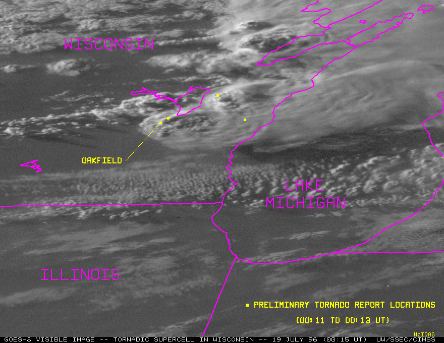
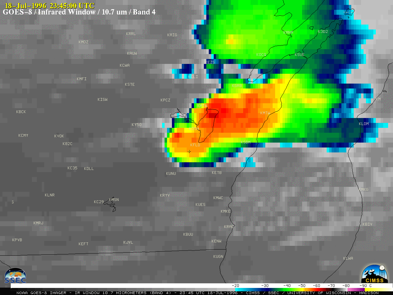
An F5 tornado struck the village of Oakfield, Wisconsin late in the day on 18 July 1996 (NWS Milwaukee story). An animation of GOES-8 (GOES-East) Visible images (below) showed the development of supercell thunderstorms as they moved east-southeastward across the area. Oakfield is located just southwest of Fond du Lac (KFLD), and is denoted by the yellow ‘+’ symbol on the images. Overshooting tops were evident on these thunderstorms.
![GOES-8 Visible images [click to play animation | MP4]](https://cimss.ssec.wisc.edu/satellite-blog/images/2021/07/960718_goes8_visible_Oakfield_WI_tornado_anim.gif)
GOES-8 Visible images [click to play animation | MP4]
![GOES-8 Infrared images [click to play animation | MP4]](https://cimss.ssec.wisc.edu/satellite-blog/images/2021/07/960718_goes8_infraredWindow_Oakfield_WI_tornado_anim.gif)
GOES-8 Infrared images [click to play animation | MP4]
![GOES-8 Water Vapor images [click to play animation | MP4]](https://cimss.ssec.wisc.edu/satellite-blog/images/2021/07/960718_goes8_waterVapor_Oakfield_WI_tornado_anim.gif)
GOES-8 Water Vapor images [click to play animation | MP4]