This website works best with a newer web browser such as Chrome, Firefox, Safari or Microsoft Edge. Internet Explorer is not supported by this website.

Archive: Mon Jul 2021

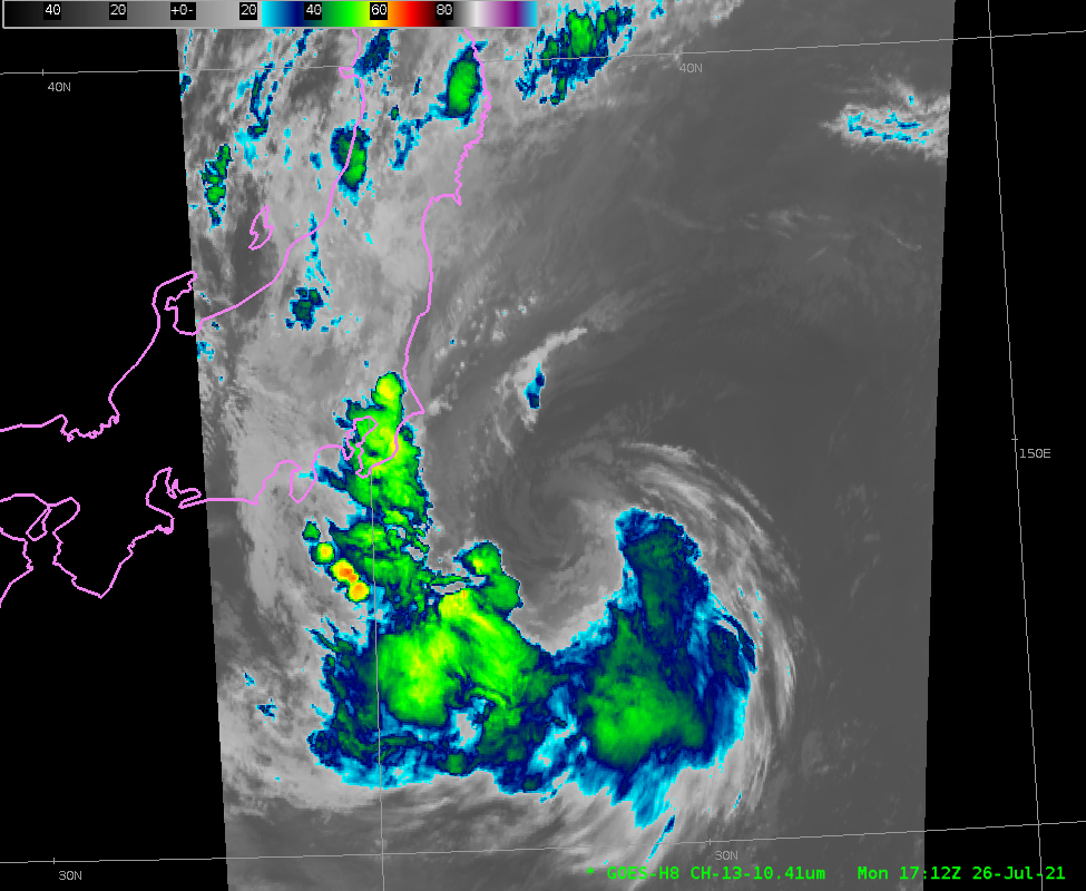
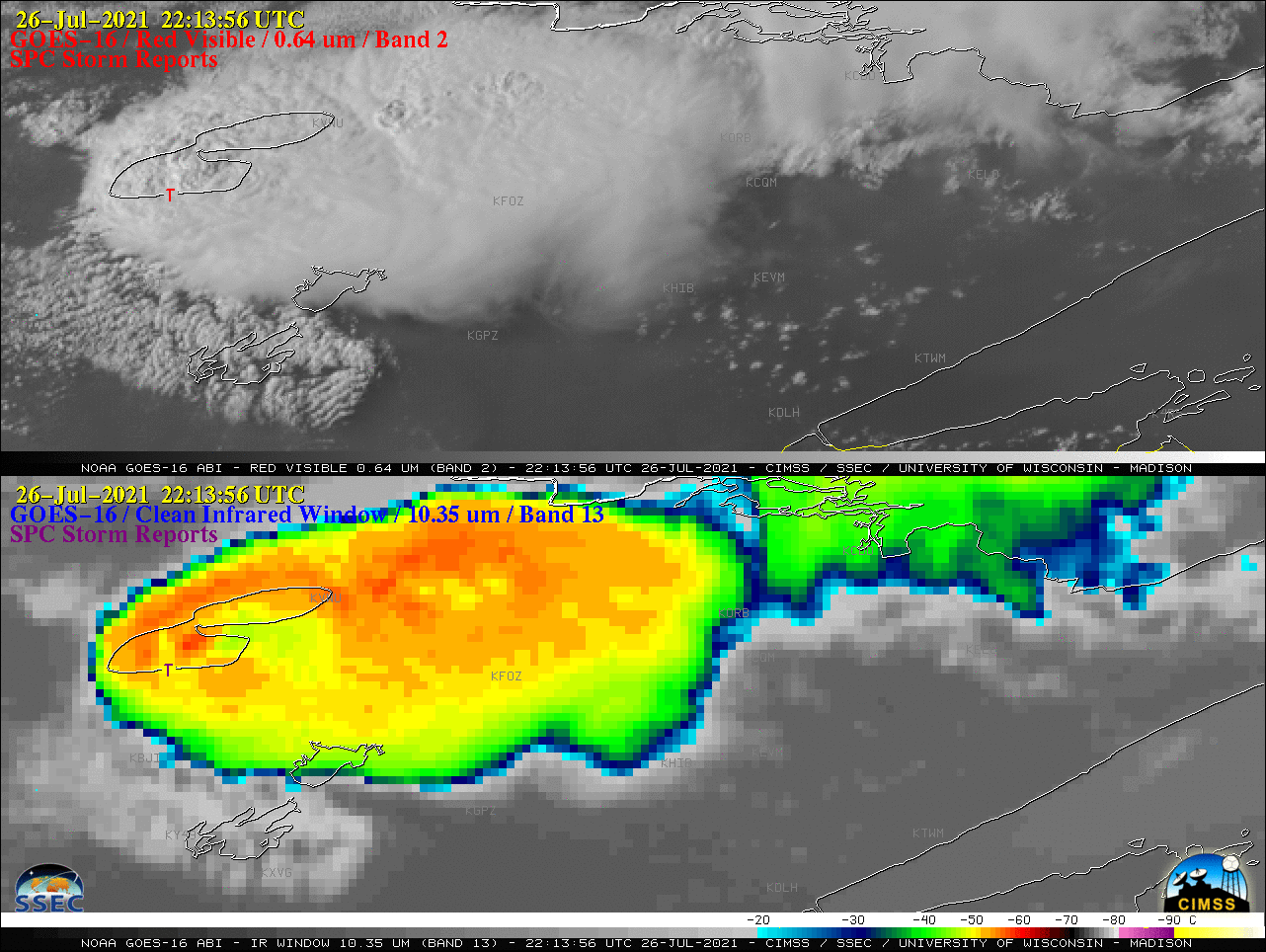
Severe thunderstorms in northern Minnesota

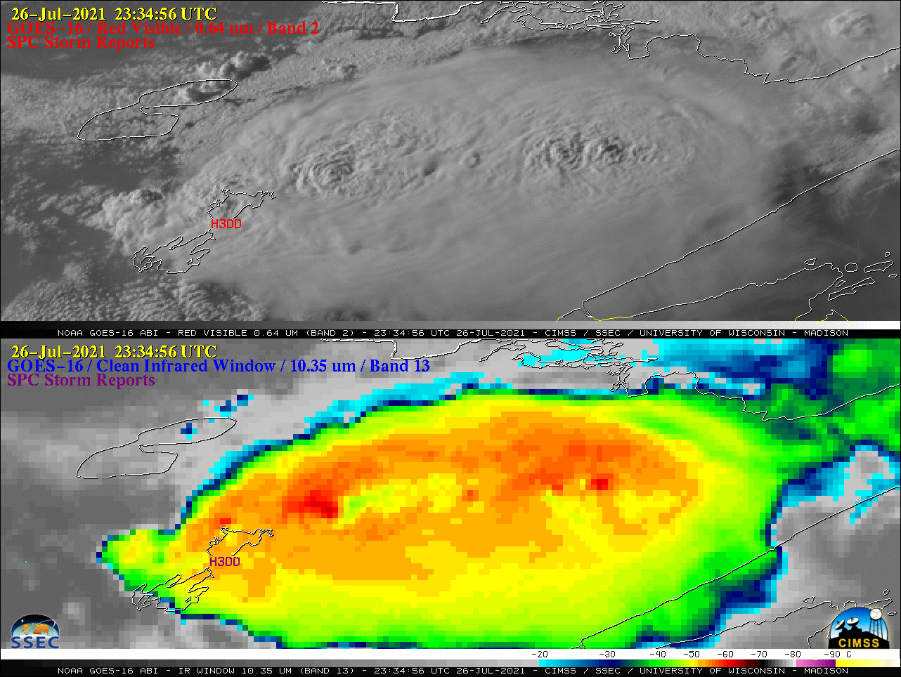
1–minute Mesoscale Domain Sector GOES-16 (GOES-East) “Red” Visible (0.64 µm) images and “Clean” Infrared Window (10.35 µm) images (above) include time-matched plots of SPC Storm Reports produced by supercell thunderstorms that moved east-southeastward across northern Minnesota during the afternoon and early evening hours on 26 July 2021. Severe reports included a tornado at 2213 UTC and hail as large as to 3.0 inches in diameter... Read More

Tropical Storm Nepartak approaches Japan

As the games of the 2021 Olympics progress, a weakening Tropical Storm Nepartak is moving over coastal waters to the east of Honshu, the main island of Japan. The Total Precipitable Water imagery, above, from MIMIC TPW, shows a plume of moisture wrapped around the circulation center. Himawari-8 Clean Window... Read More