This website works best with a newer web browser such as Chrome, Firefox, Safari or Microsoft Edge. Internet Explorer is not supported by this website.

Archive: Mar 2021

Severe weather and blowing dust across the southern High Plains

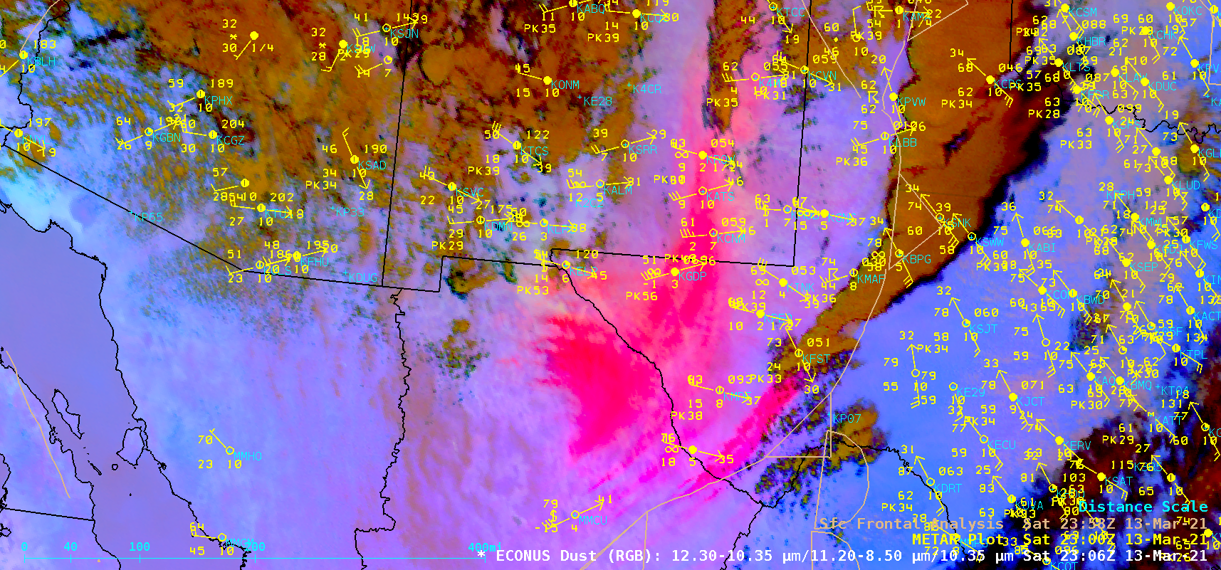
As an anomalously-deep middle-tropospheric low migrated eastward over the Southwest US, severe thunderstorms developed ahead of a surface low and its associated cold front (surface analyses) as they moved from New Mexico into Texas on 13 March 2021 — as shown in 1-minute Mesoscale Domain Sector GOES-16 (GOES-East) “Red” Visible (0.64 µm) (above) and “Clean” Infrared Window (10.35 um) images (below). According... Read More

The moving shadow of Denali

Clear skies over much of Alaska on 12 March meant that GOES-17 had a clear view of Denali.  The animation above, of GOES-17 CIMSS True Color imagery, shows the shadow of Denali (near the center of the imagery, due north of Cook Inlet) moving during the day.A higher-resolution animation, below,... Read More

Cyclone Habana in the South Indian Ocean

US Space Force EWS-G1 Infrared Window (10.7 µm) images (above) displayed the well-defined eye and eyewall structure of Cyclone Habana in the South Indian Ocean on 10 March 2021. This was the second period of Category 4 intensity (ADT | SATCON) during the life cycle of Habana.Meteosat-8 Infrared images with... Read More