This website works best with a newer web browser such as Chrome, Firefox, Safari or Microsoft Edge. Internet Explorer is not supported by this website.

Archive: Mar 2021

Satellite-based detection of rain amounts

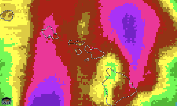
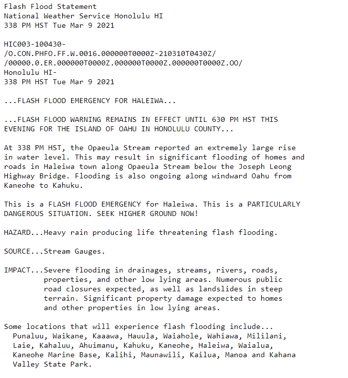
The system that produced the high-impact flooding event on Maui (discussed here) also  caused flooding rains on Oahu on the 9th.   (A Flash Flood Emergency was declared at 348 HST on 9 March:  Link)  How well did quantitative satellite estimates of this event perform?  Hydroestimator values, above, from the 24... Read More

Heavy rainfall in Hawai’i

GOES-17 (GOES-West) “Red” Visible (0.64 µm) and “Clean” Infrared Window (10.35 µm) images (above) revealed 2 bursts of back-building thunderstorms that produced heavy rainfall (as much as 19.21 inches) and flooding along the northern coast of the Hawaiian island of Maui on 08 March 2021. This heavy rain caused rockslides that closed some... Read More

Prescribed burns in Oklahoma, Arkansas ad Missouri

1-minute Mesoscale Domain Sector GOES-16 (GOES-East) “Red” Visible (0.64 µm) and Shortwave Infrared (3.9 µm) images (above) depicted smoke plumes and thermal anomalies (clusters of hot pixels) associated with widespread prescribed burns across parts of Oklahoma, Arkansas and Missouri on 07 March 2021.For one of the largest fires in far southern Oklahoma (located about 15 miles north-northwest... Read More