Strong winds over Lake Michigan
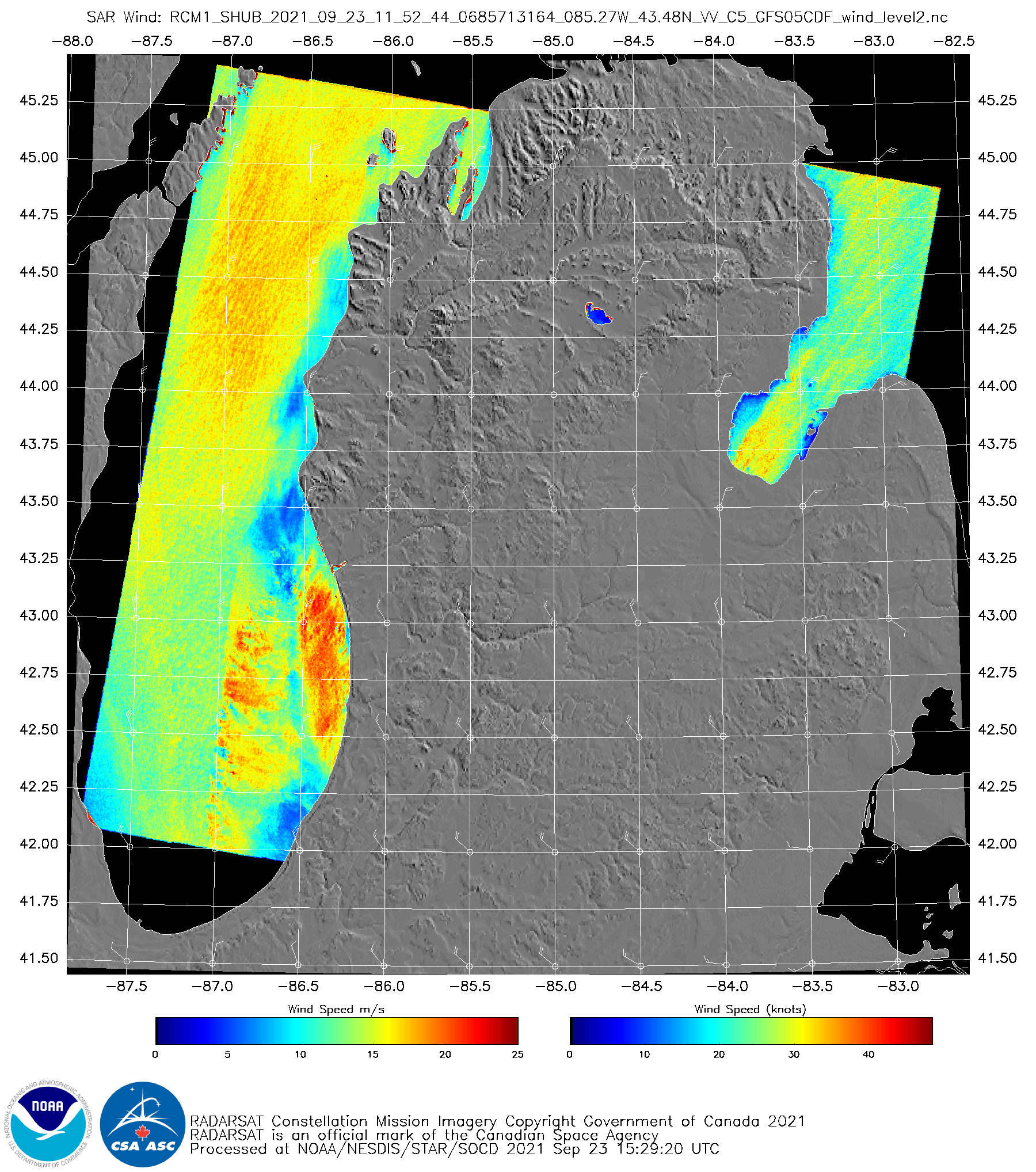
GOES-16 “Veggie Band” near-infrared imagery (Band 3, 0.86 µm), above, (from the CSPP Geosphere website, click here for a link to the animation at that website) shows an early-season Fall cyclone over lower Michigan. During the animation, RADARSAT Constellation Mission Satellite 1 (RCM-1) was in a descending pass down Lake Michigan. Synthetic... Read More
