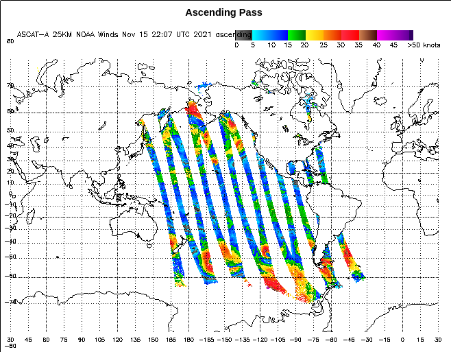
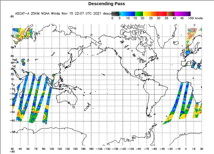
This website works best with a newer web browser such as Chrome, Firefox, Safari or Microsoft Edge. Internet Explorer is not supported by this website.

Category: Satellite winds

Ice Motion in Lake Superior

GOES-16 visible animations from the morning of 8 February show ice motion along the south shore of Lake Superior, moving northeastward away from Duluth Harbor, and also east and northeastward to the south of Madeline Island. Winds at this time were from the west or southwest at 15-20 knots as... Read More

A leeside cold frontal gravity wave in the Plains, and a strong polar jet stream over the Rockies

GOES-16 (GOES-East) Upper-level Water Vapor (6.2 µm) images (above) displayed the signature of a leeside cold frontal gravity wave (reference) as it moved rapidly southward across the Plains (surface analyses) on 14 January 2021. Post-frontal wind gusts in the 50-70 knot range were seen, with a peak gust to 91 knots (105 mph) in eastern Wyoming.In... Read More

Cold air advection in the Bering Sea

GOES-17 (GOES-West) “Red” Visible (0.64 µm) images (above) displayed cloud streets across the Bering Sea — cloud features that frequently occur in areas with a strong flow of cold air over warmer water. This northerly flow of cold air across the Bering Sea was due to a strong pressure gradient between... Read More