This website works best with a newer web browser such as Chrome, Firefox, Safari or Microsoft Edge. Internet Explorer is not supported by this website.

Category: Satellite winds

SAR Winds over the Pacific Ocean

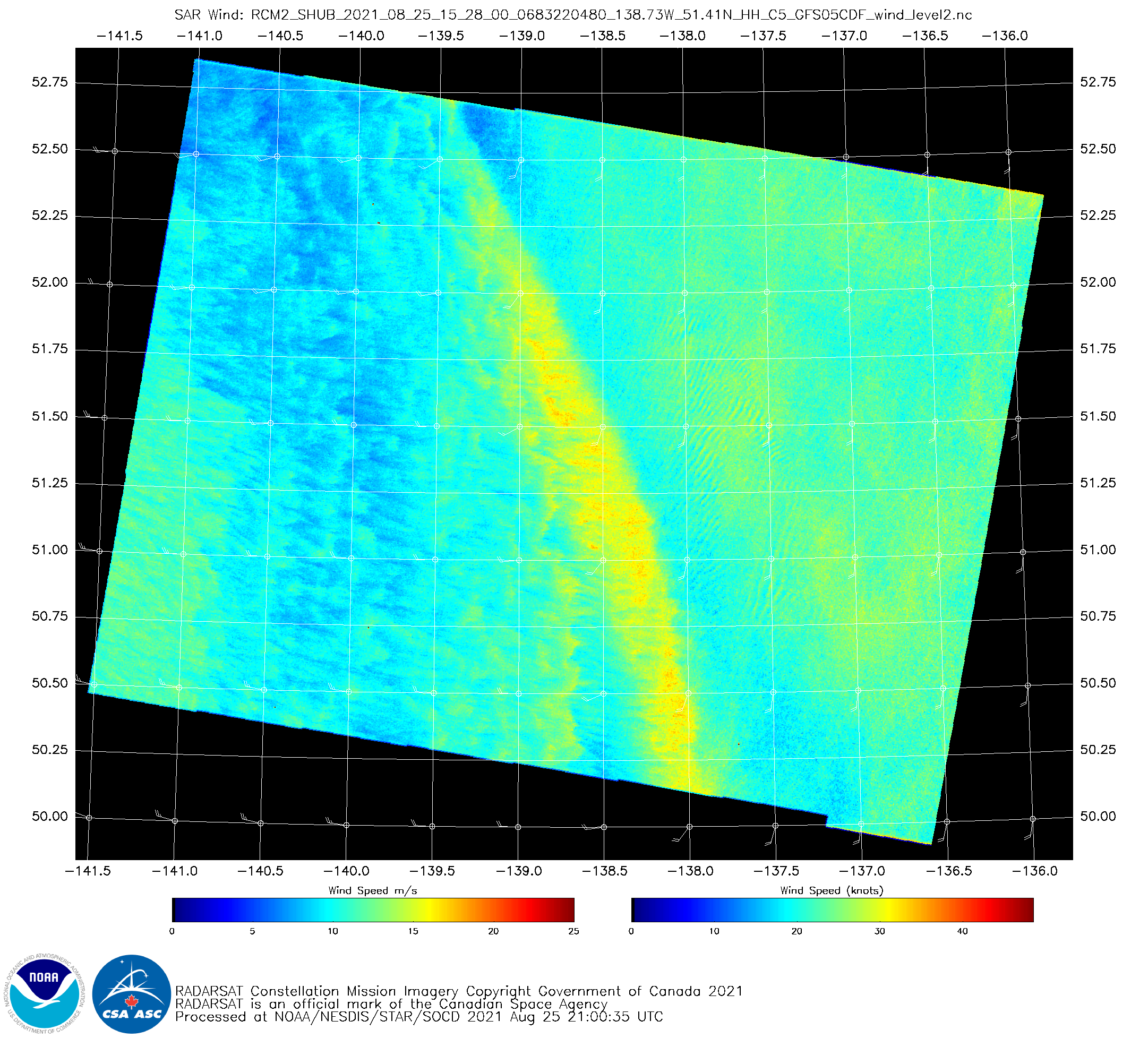
Synthetic Aperture Radar (SAR) winds over the northwest Pacific, above, derived from Radar Constellation Mission (RCM) Satellite #2, shows a narrow ribbon of strong winds (>30 knots) stretching from 50 N, 138 W towards 53 N, 140 W. What kind of cloud imagery is associated with this wind feature?Near-sunrise visible... Read More

Tropical Storm Fred in the Caribbean Sea

Potential Tropical Cyclone 6 was upgraded to Tropical Storm Fred at 03 UTC on 11 August 2021, just south of Puerto Rico — and 1–minute Mesoscale Domain Sector GOES-16 (GOES-East) “Red” Visible (0.64 µm) and “Clean” Infrared Window (10.35 µm) images (above) showed Fred as it made landfall along the southern coast of the Dominican Republic around 18 UTC.Fred was moving through an environment... Read More

SAR winds over Tropical Storm Mirinae

Tropical Storm Mirinae, shown above, to the east of Japan (click here to see the same image with latitude/longitude lines), was overflown on 8 August by Radar Constellation Mission Satellite one (RCM-1) at 2013 UTC. The Synthetic Aperture Radar (SAR) imagery (from this site) is shown below, with both polarities. The two... Read More

Comparing SAR data over Lake Superior to radar

Synthetic Aperture Radar (SAR) winds are derived from a microwave signal pinged from a satellite; backscatter is converted into winds (given a background field that is typically from a numerical model). The wind structure here is suggestive of a bowing feature to a convective downdraft. How does it compare to... Read More