SAR winds and Lake-Effect cloud bands
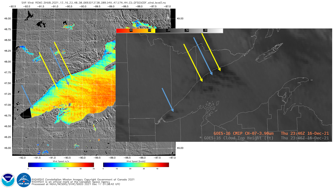
Synthetic Aperture Radar (SAR) winds in select small domains are routinely available (with good latency, i.e., within 2 or 2-1/2 hours) at this website. Coverage over the Great Lakes typically occurs within an hour of 0000 UTC and 1200 UTC on each day. The image above (direct link) shows derived SAR winds... Read More
