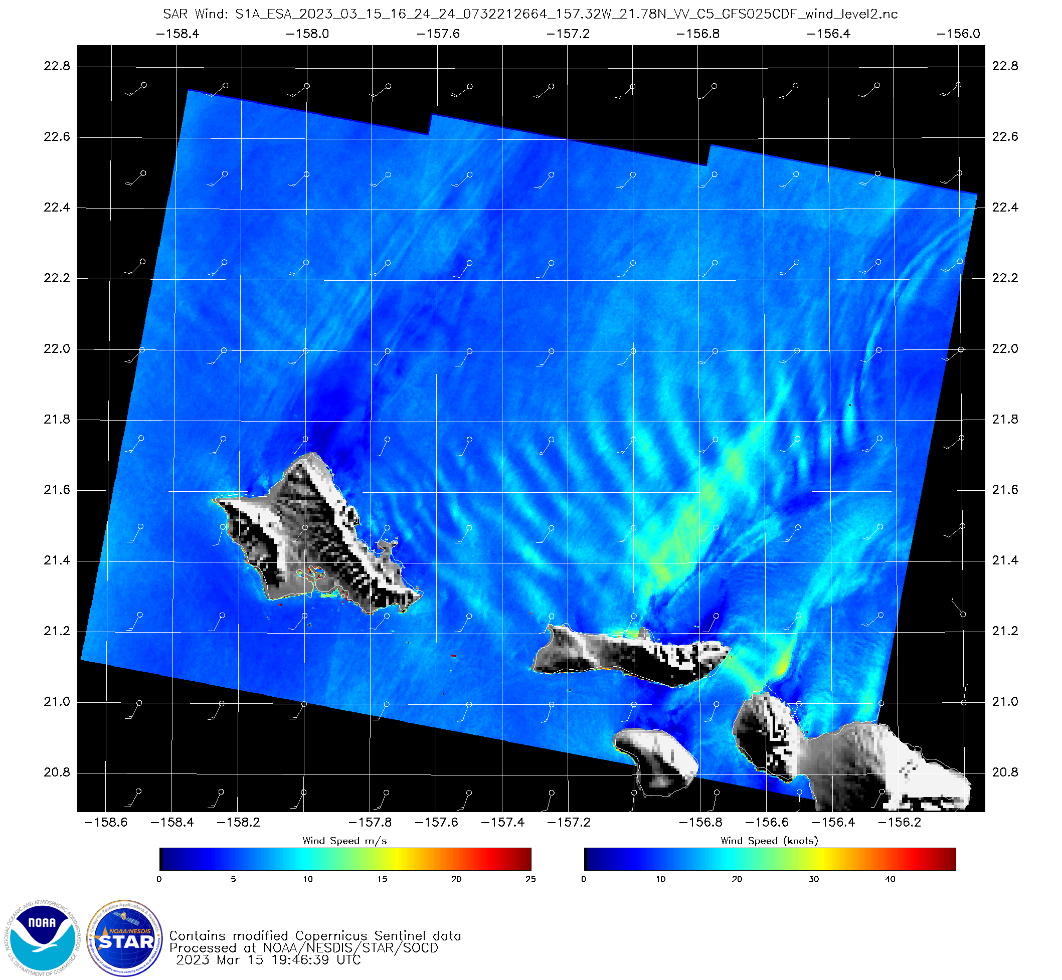
Standing waves downwind of Oahu
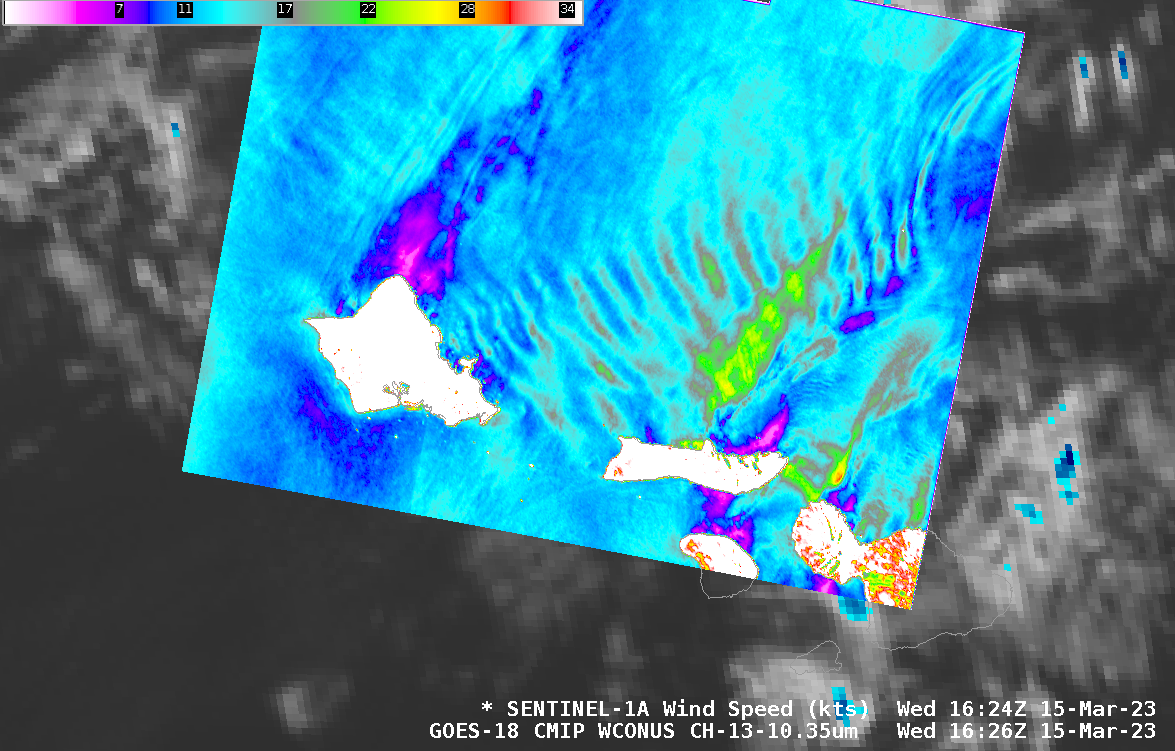
Sentinel-1A overflew the Hawai’ian islands shortly before sunrise on 15 March and the derived winds from this descending pass are shown above (they are also available here, through this website). Southwesterly flow and the topography of Oahu has excited gravity waves that are observable downstream from the island in the SAR... Read More
