SAR Observations over American Samoa (part IV)

RADARSAT-2 passed over Samoan waters again on 9 February 2023, just after sunset (above) and near sunrise (at bottom). The imagery above compares the SAR winds to GOES-18 visible (with a changed enhancement to account for low light conditions, with reflectance values ranging from 0 to 6.3 only vs. the maximum default of 130) and infrared imagery at the same time. Several features of note deserve comment: both the strong convection just west/southwest of Savai’i, Samoa, and the cold cloud tops at the southern edge of the domain, have very little signal in the surface wind field.
A feature of interest to me is the slight change in windspeeds highlighted in the toggle below, extending north from the Samoan Islands. Is this slight change in SAR-derived winds, from 6 knots (bright purple, to the west) to 8 knots (darker purple, to the east) related to any obvious linear feature in the visible and infrared imagery? At first blush, a disappointing no is the answer!

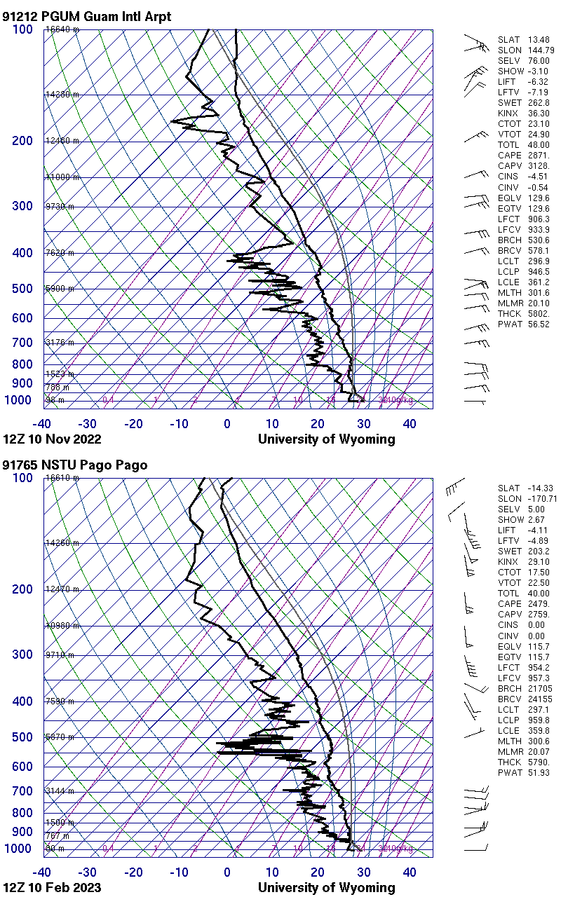
An image below shows RADARSAT-2 SAR winds at 0552 and 1655 UTC (Note: the color enhancement of the winds has been changed to have a maximum of 25 kts, vs. 40 knots in the imagery above). When SAR observations occurred over Guam in November 2022, the effect of the Marianas island chain on winds extended a significant distance downwind of the island, as shown in this image from 0840 UTC on 10 November from this blog post. Why might the effects of the Samoan Islands not extend as far downstream; that is, why is the effect of the island not trapped? The toggle below shows the Guam SkewT from 1200 UTC on 10 November 2022 and the SkewT from Pago Pago at 1200 UTC on 9 February 2023; (both SkewTs are from the University Of Wyoming sounding site). One thing the Guam sounding features that is missing from the Pago Pago sounding is a stable layer from 850 to 750 hPa; that stable layer might affect how the Island Effect persists downwind.


The toggle below compares SAR winds with GOES-18 clean window imagery. At 1655 UTC, the coldest cloud tops are related to perturbations in the wind field, especially in the southern part of the domain.


