Standing waves downwind of Oahu
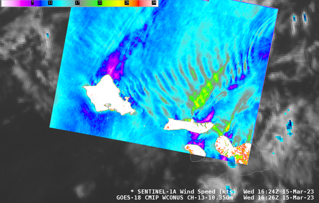
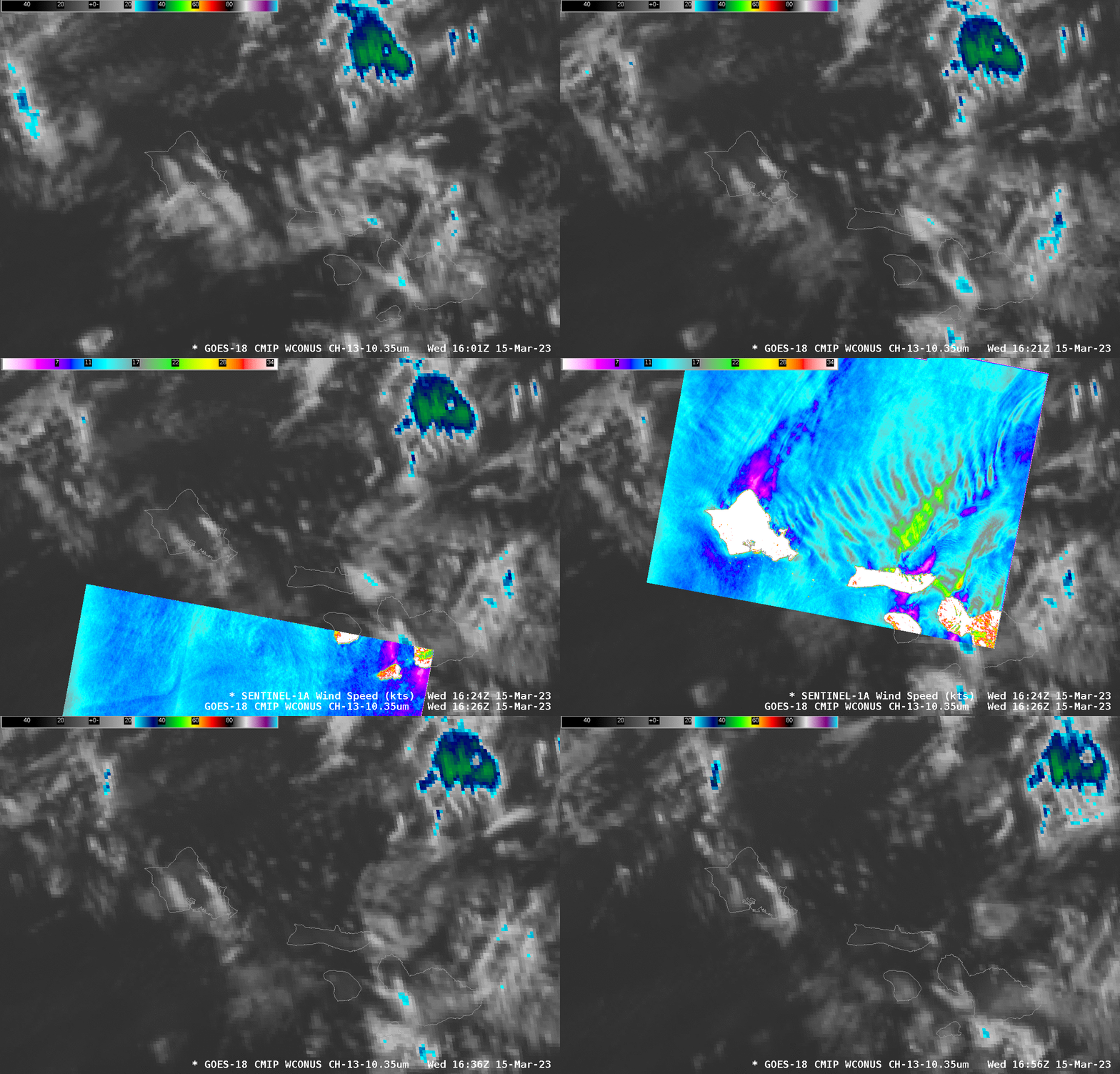
Sentinel-1A overflew the Hawai’ian islands shortly before sunrise on 15 March and the derived winds from this descending pass are shown above (they are also available here, through this website). Southwesterly flow and the topography of Oahu has excited gravity waves that are observable downstream from the island in the SAR analysis. GOES-18 Band 13 (“Clean window”, 10.3 µm) imagery, below (that includes the Sentinel-1A SAR winds), also shows suggestions of mostly stationary clouds oriented parallel to the wind features. (This toggle showing 1624 UTC SAR winds and brightened visible imagery and 1646 UTC shows clouds aligned with the wind features as well).
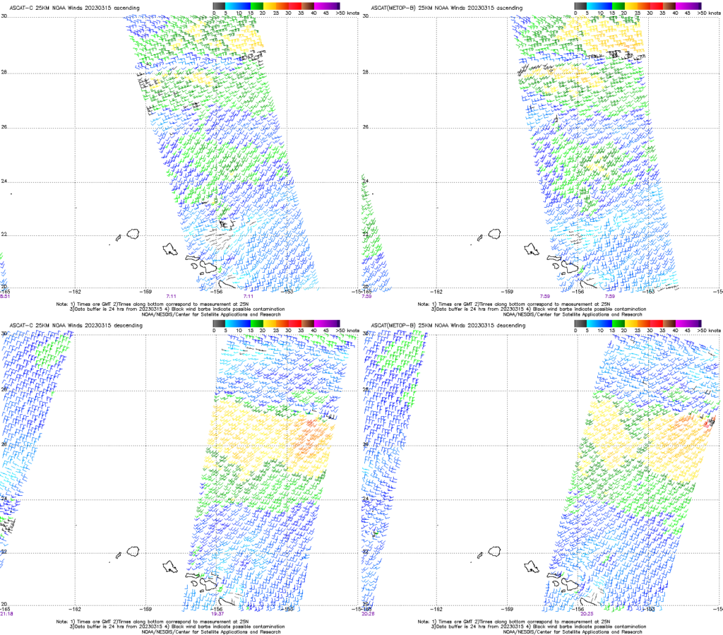
Advanced Scatterometer (ASCAT) winds from the manati site, below, show the southwesterly winds to the northeast of Oahu from both ascending passes between 0700 and 0800 UTC, and from descending passes between 1900 an 2100 UTC.
Trapping the energy in the lower part of the troposphere requires the presence of an inversion. SkewT/LogP charts from Lihue to the west of Oahu, and from Hilo to the east (from the University of Wyoming Sounding Site) both show low-level stable air.
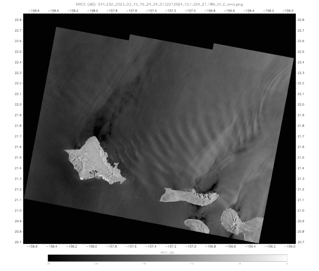
SAR data shows winds of 30 knots just north of Maui above (red in the enhancement). Should you believe those wind speeds? Sometimes (not today, but sometimes) reflection off ice within the clouds results in computed wind speeds that are too high. This typically occurs when feathery structures appear in the Normalized Radar Cross Section fields, shown below. The absence of such structures north of Maui lends credence to the computed wind speed.
The waves also appeared in Water Vapor imagery, most prominently in the low-level (Band 10, 7.34 µm) imagery shown below.
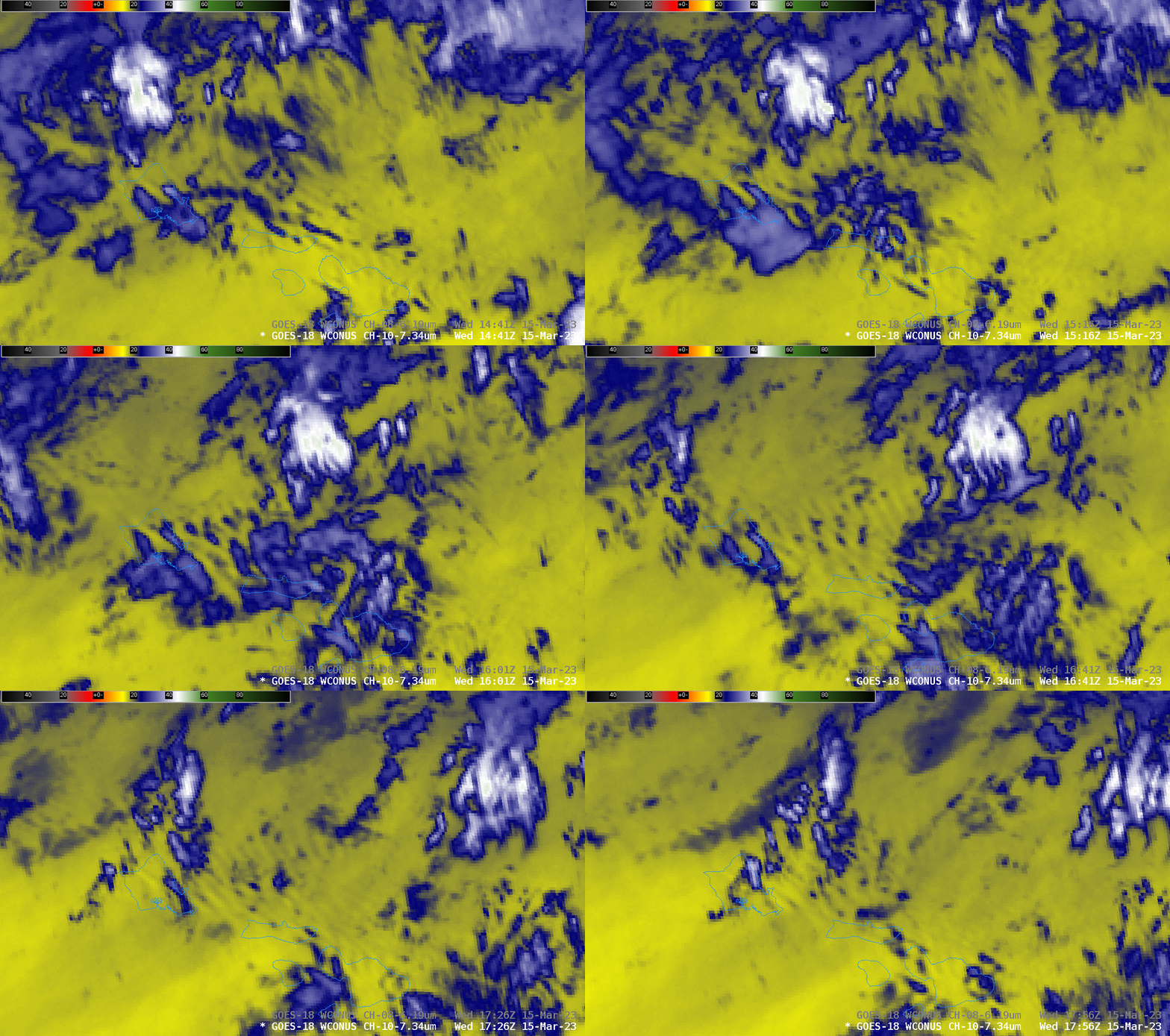
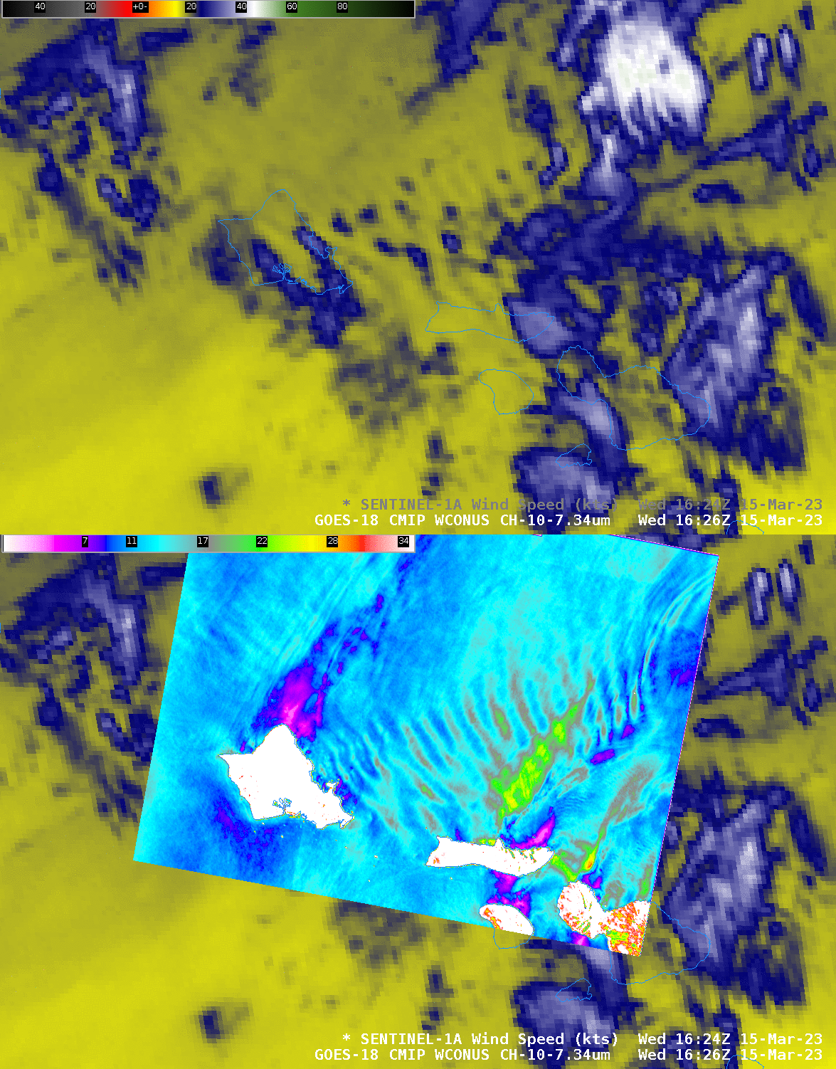
The conclusion from these images: the perturbation induced by the topography on Oahu affects the atmosphere from the sea surface all the way up into the upper troposphere!

